Directions to Drogaria Exata (Quintino Bocaiúva) with public transportation
The following transit lines have routes that pass near Drogaria Exata
 Bus: 353, 363, 383, 685, SVB 685.
- Train: RAMAL DEODORO, RAMAL JAPERI, RAMAL SANTA CRUZ, RAMAL BELFORD ROXO.
How to get to Drogaria Exata by bus?
Click on the bus route to see step by step directions with maps, line arrival times and updated time schedules.
From Cadeg, Benfica
47 minFrom Hospital Municipal Ronaldo Gazolla, Acari
44 minFrom Shopping Metropolitano Barra, Jacarepaguá
47 minFrom Triagem, Benfica
47 minFrom Avenida Athos da Silveira Ramos 149, Cidade Universitária (Fundão)
61 minFrom BRT - Estação Curicica, Curicica
30 minFrom Hospital Municipal Ronaldo Gazolla, Acari
43 minFrom Rua Bom Pastor, Tijuca
50 minFrom Linha 222 - Vila Isabel / Candelária, Maracanã
44 minFrom Ilha do Fundão, Cidade Universitária (Fundão)
59 min
How to get to Drogaria Exata by train?
Click on the train route to see step by step directions with maps, line arrival times and updated time schedules.
Bus stops near Drogaria Exata in Quintino Bocaiúva
Train stations near Drogaria Exata in Quintino Bocaiúva
Bus lines to Drogaria Exata in Quintino Bocaiúva
- 353, Gardênia Azul - Terminal Gentileza (Via Praça Seca),VIEW
- SN 353, Gardênia Azul - Terminal Gentileza (Via Praça Seca),VIEW
- 363, Vila Valqueire - Candelária (Brs 5 - Via Dias da Cruz),VIEW
- SN 363, Vila Valqueire - Candelária (Brs 5 - Via Dias da Cruz),VIEW
- SR 363, Vila Valqueire - Candelária (Brs 5 - Expresso - Via Radial Oeste),VIEW
- 383, Realengo - Praça da República (Brs 5),VIEW
- SN 383, Realengo - Praça da República (BRS 5 - Noturno),VIEW
- SV 391, Padre Miguel - Praça da República (Brs 5 - Via Sulacap / Méier),VIEW
- 652, Cascadura - Méier (Via Pilares),VIEW
- 685, LECD140 - Terminal Margaridas - Méier (via Rua dos Diamantes),VIEW
- SN 685, Irajá - Méier (Via Rua dos Diamantes),VIEW
- SVA 685, Irajá - Méier (Via Rua Embaú),VIEW
- SVB 685, Terminal Margaridas - Méier (via Rua Ururaí / Madureira Shopping),VIEW
- 651, Méier,VIEW
- 636, Taquara (Merck),VIEW
- SN 636, Saens Peña,VIEW
- 607, Rio Comprido,VIEW
- 653, Deodoro (Área De Lazer),VIEW
What are the closest stations to Drogaria Exata?
The closest stations to Drogaria Exata are:
- Rua Clarimundo De Melo, 782 is 79 meters away, 2 min walk.
- Rua Clarimundo De Melo, 827 is 165 meters away, 3 min walk.
- FAETEC Quintino is 326 meters away, 5 min walk.
- Rua Bernardo Guimarães, 107 is 720 meters away, 10 min walk.
- Quintino is 824 meters away, 11 min walk.
- Cavalcanti is 3493 meters away, 45 min walk.
Which bus lines stop near Drogaria Exata?
These bus lines stop near Drogaria Exata: 353, 363, 383, 685, SVB 685.
Which train lines stop near Drogaria Exata?
These train lines stop near Drogaria Exata: RAMAL DEODORO, RAMAL JAPERI, RAMAL SANTA CRUZ.
What’s the nearest train station to Drogaria Exata in Quintino Bocaiúva?
The nearest train station to Drogaria Exata in Quintino Bocaiúva is Quintino. It’s a 11 min walk away.
What’s the nearest bus station to Drogaria Exata in Quintino Bocaiúva?
The nearest bus station to Drogaria Exata in Quintino Bocaiúva is Rua Clarimundo De Melo, 782. It’s a 2 min walk away.
What time is the first train to Drogaria Exata in Quintino Bocaiúva?
The RAMAL DEODORO is the first train that goes to Drogaria Exata in Quintino Bocaiúva. It stops nearby at 4:27 AM.
What time is the last train to Drogaria Exata in Quintino Bocaiúva?
The RAMAL SANTA CRUZ is the last train that goes to Drogaria Exata in Quintino Bocaiúva. It stops nearby at 11:37 PM.
What time is the first bus to Drogaria Exata in Quintino Bocaiúva?
The SN 636 is the first bus that goes to Drogaria Exata in Quintino Bocaiúva. It stops nearby at 3:16 AM.
What time is the last bus to Drogaria Exata in Quintino Bocaiúva?
The SN 685 is the last bus that goes to Drogaria Exata in Quintino Bocaiúva. It stops nearby at 3:25 AM.
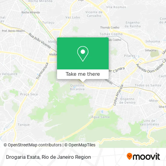
See Drogaria Exata, Quintino Bocaiúva, on the map
Public Transit to Drogaria Exata in Quintino Bocaiúva
Wondering how to get to Drogaria Exata in Quintino Bocaiúva? Moovit helps you find the best way to get to Drogaria Exata with step-by-step directions from the nearest public transit station.
Moovit provides free maps and live directions to help you navigate through your city. View schedules, routes, timetables, and find out how long does it take to get to Drogaria Exata in real time.
Looking for the nearest stop or station to Drogaria Exata? Check out this list of stops closest to your destination: Rua Clarimundo De Melo; Rua Clarimundo De Melo; FAETEC Quintino; Rua Bernardo Guimarães; Quintino; Cavalcanti.
Bus: 353, 363, 383, 685, SVB 685, SN 353, SN 363, SR 363, 651, 636, SN 636, 607, 653.Train: RAMAL DEODORO, RAMAL JAPERI, RAMAL SANTA CRUZ, RAMAL BELFORD ROXO.
Want to see if there’s another route that gets you there at an earlier time? Moovit helps you find alternative routes or times. Get directions from and directions to Drogaria Exata easily from the Moovit App or Website.
We make riding to Drogaria Exata easy, which is why over 1.5 million users, including users in Quintino Bocaiúva, trust Moovit as the best app for public transit. You don’t need to download an individual bus app or train app, Moovit is your all-in-one transit app that helps you find the best bus time or train time available.
For information on prices of bus and train, costs and ride fares to Drogaria Exata, please check the Moovit app.
Use the app to navigate to popular places including to the airport, hospital, stadium, grocery store, mall, coffee shop, school, college, and university.
Drogaria Exata Address: Rua Clarimundo de Melo, 796 Quintino Bocaiúva Rio de Janeiro-RJ 20740-323 street in Quintino Bocaiúva
- Rua Clarimundo de Melo 815/817,
- Ete de Saúde Herbert José de Souza,
- Rua Clarimundo de Melo / Rua Lemos Brito,
- Quintino Bocaiuva,
- Querubim de Quintino,
- Posto Querubim,
- Rua João Barbalho,
- Ceda Clinica Especializada Em Dermatologia E Alergia,
- Ile Iya Omin,
- Igreja Batista Missionária Em Quinhtino,
- Ponto Elétrico del Castilho,
- CEFE Quintino,
- Paróquia São Jorge,
- Igreja de São Jorge,
- Escola Municipal Oswaldo Teixeira,
- Rua Clarimundo de Melo 763,
- Yakisoba le Chef,
- Big Lanches e Pizzas,
- Rua Balbina, 146,
- Escola Estadual de Ensino Fundamental República-FAETEC
Places Near Drogaria Exata (Quintino Bocaiúva)
- Shopping RioSul, Botafogo,
- Avenida Rio Branco, Centro,
- Niterói, Niterói,
- Hospital Municipal Ronaldo Gazolla, Acari,
- Feira Livre da Gloria, Glória,
- Hospital Federal Cardoso Fontes, Jacarepaguá,
- Praia do Arpoador, Ipanema,
- Shopping Downtown, Barra Da Tijuca,
- Shopping Rio Sul, Botafogo,
- Hospital Federal Do Andaraí, Andaraí,
- Norte Shopping, Cachambi,
- Rua Licínio Cardoso, São Francisco Xavier,
- Feirão De Malhas, Duque De Caxias,
- Rua Ulysses Guimarães 16, Cidade Nova,
- Rodoviária Novo Rio (Rodoviária do Rio de Janeiro), Santo Cristo,
- Shopping Nova América, Del Castilho,
- Avenida Venezuela 134, Saúde,
- Hospital Pedro Ernesto, Vila Isabel,
- Rio De Janeiro,
- Museu Do Amanhã, Centro
How to get to popular places in Rio de Janeiro Region with public transit
Get around Quintino Bocaiúva by public transit!
Traveling around Quintino Bocaiúva has never been so easy. See step by step directions as you travel to any attraction, street or major public transit station. View bus and train schedules, arrival times, service alerts and detailed routes on a map, so you know exactly how to get to anywhere in Quintino Bocaiúva.
When traveling to any destination around Quintino Bocaiúva use Moovit's Live Directions with Get Off Notifications to know exactly where and how far to walk, how long to wait for your line, and how many stops are left. Moovit will alert you when it's time to get off — no need to constantly re-check whether yours is the next stop.
Wondering how to use public transit in Quintino Bocaiúva or how to pay for public transit in Quintino Bocaiúva? Moovit public transit app can help you navigate your way with public transit easily, and at minimum cost. It includes public transit fees, ticket prices, and costs. Looking for a map of Quintino Bocaiúva public transit lines? Moovit public transit app shows all public transit maps in Quintino Bocaiúva with all Bus, Train, Metro, Light Rail, Ferry, Cable Car, Gondola and Funicular routes and stops on an interactive map.
Rio de Janeiro Region has 8 transit type(s), including: Bus, Train, Metro, Light Rail, Ferry, Cable Car, Gondola and Funicular, operated by several transit agencies, including TrensRJ, Metrô Rio, VLT Carioca, Barcas Rio, BRT MOBI-Rio, Auto Viação Alpha, Auto Viação Tijuca, Gire Transportes, Transurb, Viação Nossa Senhora das Graças, Consórcio INTERSUL, Braso Lisboa (Municipal), Caprichosa Auto Ônibus, Auto Viação Três Amigos and Rodoviária Âncora Matias
Public transit lines with stations closest to Drogaria Exata in Quintino Bocaiúva
Train lines with stations closest to Drogaria Exata in Quintino Bocaiúva
Bus lines with stations closest to Drogaria Exata in Quintino Bocaiúva
Rua Clarimundo De Melo, 782
- 353Gardênia Azul - Terminal Gentileza (Via Praça Seca)
- SN 353Gardênia Azul - Terminal Gentileza (Via Praça Seca)
- 363Vila Valqueire - Candelária (Brs 5 - Via Dias da Cruz)
- SN 363Vila Valqueire - Candelária (Brs 5 - Via Dias da Cruz)
- SR 363Vila Valqueire - Candelária (Brs 5 - Expresso - Via Radial Oeste)