How to get to Drogarias Pacheco by bus?
Click on the bus route to see step by step directions with maps, line arrival times and updated time schedules.
From MetrôRio - Estação Coelho Neto, Coelho Neto
52 minFrom Bienal Do Livro, Jacarepaguá
36 minFrom parque madureira - portão 6 - rocha miranda, Rocha Miranda
36 minFrom Coelho Neto, Coelho Neto
56 minFrom Avenida Ministro Edgard Romero, Madureira
21 minFrom Vila Da Penha, Vila Da Penha
44 minFrom Vila Militar (Estação Vila Militar), Vila Militar
45 minFrom BRT - Estação Riomar, Barra Da Tijuca
56 minFrom Avenida Ayrton Senna 2541, Barra Da Tijuca
28 minFrom Centro Universitário Celso Lisboa (UCL), Engenho Novo
37 min
Bus stops near Drogarias Pacheco in Tanque
Funicular station near Drogarias Pacheco in Tanque
- José Roiz De Aragão, 51 min walk,VIEW
Bus lines to Drogarias Pacheco in Tanque
- 338, Candelária,VIEW
- 341, Taquara,VIEW
- 565, Tanque ↔ Barra Da Tijuca,VIEW
- SN 565, Gávea (Feira Livre),VIEW
- 601, Taquara (Capela),VIEW
- SP 601, Hospital Cardoso Fontes,VIEW
- 766, Madureira Shopping,VIEW
- 878, Tanque,VIEW
- SN 878, Tanque (Via Floresta / Via Light) (Desvio Temporário),VIEW
- SV 878, Tanque,VIEW
- 932, Tanque,VIEW
- 2112, Boiúna → Castelo (via Serra),VIEW
- SP 766, Madureira Shopping,VIEW
- 987, Gardênia Azul ↔ Pechincha,VIEW
- 859, Geremário,VIEW
- 306, Praça Seca,VIEW
- 353, Terminal Gentileza (Rodoviária),VIEW
- SN 353, Terminal Gentileza,VIEW
- 546L, Nova Iguaçu (Via Paraquedista),VIEW
- 561, Caxias,VIEW
What are the closest stations to Drogarias Pacheco?
The closest stations to Drogarias Pacheco are:
- Av. Geremário Dantas | Supermarket is 86 meters away, 2 min walk.
- Av. Geremário Dantas | Posto De Saúde Do Tanque is 91 meters away, 2 min walk.
- Rua Alexandre Ramos, 285 is 288 meters away, 4 min walk.
- Ponto Final - 859 is 309 meters away, 5 min walk.
- Av. Nelson Cardoso | Rua Lívio Barreto is 708 meters away, 10 min walk.
- José Roiz De Aragão is 3924 meters away, 51 min walk.
Which bus lines stop near Drogarias Pacheco?
These bus lines stop near Drogarias Pacheco: 40, 41, 43, 565, 601, 766, 878.
What’s the nearest bus station to Drogarias Pacheco in Tanque?
The nearest bus stations to Drogarias Pacheco in Tanque are Av. Geremário Dantas | Supermarket and Av. Geremário Dantas | Posto De Saúde Do Tanque. The closest one is a 2 min walk away.
What time is the first bus to Drogarias Pacheco in Tanque?
The SN 878 is the first bus that goes to Drogarias Pacheco in Tanque. It stops nearby at 3:00 AM.
What time is the last bus to Drogarias Pacheco in Tanque?
The SN 878 is the last bus that goes to Drogarias Pacheco in Tanque. It stops nearby at 3:36 AM.
What time is the first funicular to Drogarias Pacheco in Tanque?
The IGREJA DA PENNA is the first funicular that goes to Drogarias Pacheco in Tanque. It stops nearby at 8:00 AM.
What time is the last funicular to Drogarias Pacheco in Tanque?
The IGREJA DA PENNA is the last funicular that goes to Drogarias Pacheco in Tanque. It stops nearby at 5:00 PM.
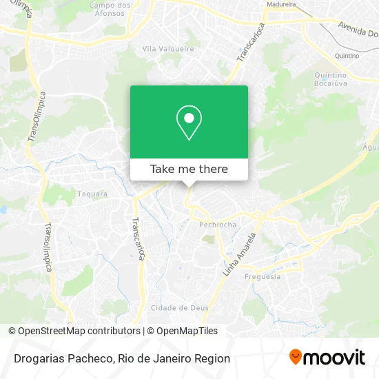
See Drogarias Pacheco, Tanque, on the map
Public Transit to Drogarias Pacheco in Tanque
Wondering how to get to Drogarias Pacheco in Tanque? Moovit helps you find the best way to get to Drogarias Pacheco with step-by-step directions from the nearest public transit station.
Moovit provides free maps and live directions to help you navigate through your city. View schedules, routes, timetables, and find out how long does it take to get to Drogarias Pacheco in real time.
Looking for the nearest stop or station to Drogarias Pacheco? Check out this list of stops closest to your destination: Av. Geremário Dantas | Supermarket; Av. Geremário Dantas | Posto De Saúde Do Tanque; Rua Alexandre Ramos; Ponto Final - 859; Av. Nelson Cardoso | Rua Lívio Barreto; José Roiz De Aragão.
Bus: 40, 41, 43, 565, 601, 766, 878, 338, 341, SN 565, SP 766, 987, 859, 306, 353, SN 353, 546L, 561.Funicular: IGREJA DA PENNA.
Want to see if there’s another route that gets you there at an earlier time? Moovit helps you find alternative routes or times. Get directions from and directions to Drogarias Pacheco easily from the Moovit App or Website.
We make riding to Drogarias Pacheco easy, which is why over 1.5 million users, including users in Tanque, trust Moovit as the best app for public transit. You don’t need to download an individual bus app or train app, Moovit is your all-in-one transit app that helps you find the best bus time or train time available.
For information on prices of bus, metro and train, costs and ride fares to Drogarias Pacheco, please check the Moovit app.
Use the app to navigate to popular places including to the airport, hospital, stadium, grocery store, mall, coffee shop, school, college, and university.
Drogarias Pacheco Address: Avenida Geremário Dantas, 210 Tanque Rio de Janeiro-RJ 22735-015 Brasil street in Tanque
- Rua Alexandre Ramos 2-20,
- Rua Pouso Alto, 68,
- Rede Supermarket,
- Supermarket,
- Two Brothers Oficina,
- Rua Piatã, 34,
- Rua Belo Vale, 85,
- Avenida Geremário Dantas / Rua Henriqueta,
- Detran-RJ,
- Pestana Auto Peças,
- Posto de Saude do Tanque,
- Esquina Gourmet Do Tanque Bar E Lanchonete,
- Posto de Saúde Jorge Saldanha (Jacarepaguá),
- 12º Cartório de Registro Civil das Pessoas Naturais,
- 6° Registro Civil de Pessoas Naturais da Capital,
- Avenida Geremário Dantas 142,
- Daniel Saboya Dance Studio,
- CMS Jorge Saldanha Bandeira de Mello,
- 12a Circunscrição do Registro Civil Jacarepaguá,
- Praça Padre Ambrósio
Places Near Drogarias Pacheco (Tanque)
- Shopping Nova América, Del Castilho,
- Niterói, Niterói,
- Hospital Municipal Ronaldo Gazolla, Acari,
- Shopping RioSul, Botafogo,
- Rua Ulysses Guimarães 16, Cidade Nova,
- Museu Do Amanhã, Centro,
- Hospital Federal Do Andaraí, Andaraí,
- Avenida Rio Branco, Centro,
- Hospital Federal Cardoso Fontes, Jacarepaguá,
- Hospital Pedro Ernesto, Vila Isabel,
- Norte Shopping, Cachambi,
- Praia do Arpoador, Ipanema,
- Feira Livre da Gloria, Glória,
- Shopping Rio Sul, Botafogo,
- Rio De Janeiro,
- Avenida Venezuela 134, Saúde,
- Feirão De Malhas, Duque De Caxias,
- Rua Licínio Cardoso, São Francisco Xavier,
- Shopping Downtown, Barra Da Tijuca,
- Rodoviária Novo Rio (Rodoviária do Rio de Janeiro), Santo Cristo
How to get to popular places in Rio de Janeiro Region with public transit
Get around Tanque by public transit!
Traveling around Tanque has never been so easy. See step by step directions as you travel to any attraction, street or major public transit station. View bus and train schedules, arrival times, service alerts and detailed routes on a map, so you know exactly how to get to anywhere in Tanque.
When traveling to any destination around Tanque use Moovit's Live Directions with Get Off Notifications to know exactly where and how far to walk, how long to wait for your line, and how many stops are left. Moovit will alert you when it's time to get off — no need to constantly re-check whether yours is the next stop.
Wondering how to use public transit in Tanque or how to pay for public transit in Tanque? Moovit public transit app can help you navigate your way with public transit easily, and at minimum cost. It includes public transit fees, ticket prices, and costs. Looking for a map of Tanque public transit lines? Moovit public transit app shows all public transit maps in Tanque with all Bus, Train, Metro, Light Rail, Ferry, Cable Car, Gondola and Funicular routes and stops on an interactive map.
Rio de Janeiro Region has 8 transit type(s), including: Bus, Train, Metro, Light Rail, Ferry, Cable Car, Gondola and Funicular, operated by several transit agencies, including TrensRJ, Metrô Rio, VLT Carioca, Barcas Rio, BRT MOBI-Rio, Auto Viação Alpha, Auto Viação Tijuca, Gire Transportes, Transurb, Viação Nossa Senhora das Graças, Consórcio INTERSUL, Braso Lisboa (Municipal), Caprichosa Auto Ônibus, Auto Viação Três Amigos and Rodoviária Âncora Matias