Directions to Duboce Park (Western Addition, Sf) with public transportation
The following transit lines have routes that pass near Duboce Park
How to get to Duboce Park by bus?
Click on the bus route to see step by step directions with maps, line arrival times and updated time schedules.
How to get to Duboce Park by train?
Click on the train route to see step by step directions with maps, line arrival times and updated time schedules.
How to get to Duboce Park by BART?
Click on the BART route to see step by step directions with maps, line arrival times and updated time schedules.
Bus stations near Duboce Park in Western Addition, Sf
- Duboce Ave & Noe St, 1 min walk,
- Haight St & Pierce St, 4 min walk,
- 14th St & Noe St, 4 min walk,
- Castro St & Duboce Ave, 4 min walk,
- Hermann St & Fillmore St, 5 min walk,
- Duboce Ave & Church St, 5 min walk,
Light Rail stations near Duboce Park in Western Addition, Sf
- 17th St & Noe St, 7 min walk,
- Church Street, 20 min walk,
- Church St & 16th St, 22 min walk,
Bus lines to Duboce Park in Western Addition, Sf
- N BUS, Ocean Beach,
- N OWL, Owl Judah,
- 6, Haight - Parnassus,
- 7, Haight - Noriega,
- 37, Masonic + Haight,
- 24, Jackson + Fillmore,
- 22, UCSF Mission Bay,
- N, Caltrain/Ballpark,
What are the closest stations to Duboce Park?
The closest stations to Duboce Park are:
- Duboce Ave & Noe St is 73 yards away, 1 min walk.
- Haight St & Pierce St is 248 yards away, 4 min walk.
- 14th St & Noe St is 269 yards away, 4 min walk.
- Castro St & Duboce Ave is 297 yards away, 4 min walk.
- Hermann St & Fillmore St is 355 yards away, 5 min walk.
- Duboce Ave & Church St is 397 yards away, 5 min walk.
- 17th St & Noe St is 588 yards away, 7 min walk.
- Church Street is 1616 yards away, 20 min walk.
- Church St & 16th St is 1807 yards away, 22 min walk.
Which bus lines stop near Duboce Park?
These bus lines stop near Duboce Park: 22, 7.
Which train line stops near Duboce Park?
LOCAL
Which BART lines stop near Duboce Park?
These BART lines stop near Duboce Park: GREEN, RED, YELLOW.
Which light rail lines stop near Duboce Park?
These light rail lines stop near Duboce Park: M, N.
What’s the nearest light rail station to Duboce Park in Western Addition, Sf?
The nearest light rail station to Duboce Park in Western Addition, Sf is 17th St & Noe St. It’s a 7 min walk away.
What’s the nearest bus stop to Duboce Park in Western Addition, Sf?
The nearest bus stop to Duboce Park in Western Addition, Sf is Duboce Ave & Noe St. It’s a 1 min walk away.
What time is the first light rail to Duboce Park in Western Addition, Sf?
The J is the first light rail that goes to Duboce Park in Western Addition, Sf. It stops nearby at 4:42 AM.
What time is the last light rail to Duboce Park in Western Addition, Sf?
The N is the last light rail that goes to Duboce Park in Western Addition, Sf. It stops nearby at 1:03 AM.
What time is the first bus to Duboce Park in Western Addition, Sf?
The 24 is the first bus that goes to Duboce Park in Western Addition, Sf. It stops nearby at 3:06 AM.
What time is the last bus to Duboce Park in Western Addition, Sf?
The 22 is the last bus that goes to Duboce Park in Western Addition, Sf. It stops nearby at 3:13 AM.
How much is the BART fare to Duboce Park?
The BART fare to Duboce Park costs about $1.05 - $7.15.
How much is the light rail fare to Duboce Park?
The light rail fare to Duboce Park costs about $2.50.
See Duboce Park, Western Addition, Sf, on the map
Public Transit to Duboce Park in Western Addition, Sf
Wondering how to get to Duboce Park in Western Addition, Sf, United States? Moovit helps you find the best way to get to Duboce Park with step-by-step directions from the nearest public transit station.
Moovit provides free maps and live directions to help you navigate through your city. View schedules, routes, timetables, and find out how long does it take to get to Duboce Park in real time.
Looking for the nearest stop or station to Duboce Park? Check out this list of stops closest to your destination: Duboce Ave & Noe St; Haight St & Pierce St; 14th St & Noe St; Castro St & Duboce Ave; Hermann St & Fillmore St; Duboce Ave & Church St; 17th St & Noe St; Church Street; Church St & 16th St.
Bus: 22, 7, N BUS, N OWL, 6, 37, 24, N.Train: LOCAL.BART: GREEN, RED, YELLOW.Light Rail: M, N.
Want to see if there’s another route that gets you there at an earlier time? Moovit helps you find alternative routes or times. Get directions from and directions to Duboce Park easily from the Moovit App or Website.
We make riding to Duboce Park easy, which is why over 1.5 million users, including users in Western Addition, Sf, trust Moovit as the best app for public transit. You don’t need to download an individual bus app or train app, Moovit is your all-in-one transit app that helps you find the best bus time or train time available.
For information on prices of bus, light rail, BART and train, costs and ride fares to Duboce Park, please check the Moovit app.
Use the app to navigate to popular places including to the airport, hospital, stadium, grocery store, mall, coffee shop, school, college, and university.
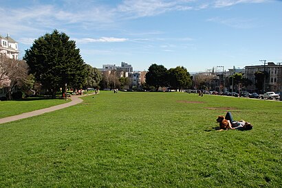
Duboce Park Address: Pierce Street street in Western Addition, Sf
Attractions near Duboce Park
Duboce Park,Duboce Park,MUNI Metro Stop - Duboce & Noe,Sunset Tunnel East Portal,Terry Regan, Ma,John Crawford Films,Duboce Avenue & Noe Street,Duboce Avenue & Noe Street,Noam Smooha, CMT,Thriving Life Wellness Center,Revive Acupuncture and,Strong Body Love,Fritts Family Chiropractic,Somamancy,Psychesom Therapy,Humanurture,Showing on, L.Ac., MS,United Projects,Scott Street Labyrinth,CPMC Davies 3 NORTHHow to get to popular attractions in Western Addition, Sf with public transit
Sunnyvale, CA, Sunnyvale,Stonestown Galleria Mall, Lakeshore, Sf,Culinary Institute of America at Greystone, St Helena,Workday, Pleasanton,City College Of San Francisco, San Francisco,Intel, Santa Clara,De Anza College, Cupertino,City of San José, San Jose,City of Newark, Newark,Apple Valley Fair, San Jose,Googleplex,Genentech Inc, South San Francisco,Lake Elizabeth, Fremont,Japantown (日本町), San Jose,Googleplex - Charlie's Cafe,Emery Go-Round MacArthur BART Bus Stop, Oakland,Nordstrom Stoneridge Mall in Pleasanton, Pleasanton,Sfo, Sfo,Costco Wholesale, San Jose,Best Buy, MilpitasGet around San Francisco - San Jose, CA by public transit!
Traveling around San Francisco - San Jose, CA has never been so easy. See step by step directions as you travel to any attraction, street or major public transit station. View bus and train schedules, arrival times, service alerts and detailed routes on a map, so you know exactly how to get to anywhere in San Francisco - San Jose, CA.
When traveling to any destination around San Francisco - San Jose, CA use Moovit's Live Directions with Get Off Notifications to know exactly where and how far to walk, how long to wait for your line, and how many stops are left. Moovit will alert you when it's time to get off — no need to constantly re-check whether yours is the next stop.
Wondering how to use public transit in San Francisco - San Jose, CA or how to pay for public transit in San Francisco - San Jose, CA? Moovit public transit app can help you navigate your way with public transit easily, and at minimum cost. It includes public transit fees, ticket prices, and costs. Looking for a map of San Francisco - San Jose, CA public transit lines? Moovit public transit app shows all public transit maps in San Francisco - San Jose, CA with all Bus, Train, BART, Light Rail, Ferry and Cable Car routes and stops on an interactive map.
San Francisco - San Jose, CA has 6 transit type(s), including: Bus, Train, BART, Light Rail, Ferry and Cable Car, operated by several transit agencies, including BART, Bay Area Rapid Transit, Muni Metro, Caltrain, VTA, Capitol Corridor, Sonoma Marin Area Rail Transit, MUNI, SF Cable Car, AC Transit, Dumbarton Express, Golden Gate Transit, County Connection, SamTrans, SamTrans / City of Menlo Park