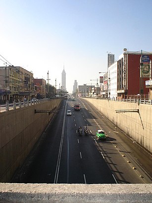
Directions to EJE CENTRAL LÁZARO CÁRDENAS (Azcapotzalco) with public transportation
The following transit lines have routes that pass near EJE CENTRAL LÁZARO CÁRDENAS
How to get to EJE CENTRAL LÁZARO CÁRDENAS by bus?
Click on the bus route to see step by step directions with maps, line arrival times and updated time schedules.
How to get to EJE CENTRAL LÁZARO CÁRDENAS by metro?
Click on the metro route to see step by step directions with maps, line arrival times and updated time schedules.
Bus stations near EJE CENTRAL LÁZARO CÁRDENAS in Azcapotzalco
- López Rayón Morelos Ciudad De México Cuauhtémoc Cdmx 06200 México, 7 min walk,
- Calle Ignacio Allende Guerrero Ciudad De México Cuauhtémoc Cdmx 06300 México, 7 min walk,
- Monumento A Cuitláhuac Glorieta Cuitláhuac Morelos Ciudad De México Cuauhtémoc Cdmx 06200 México, 14 min walk,
- Eje 1 Pte. Guerrero, 16 min walk,
- Paseo De La Reforma X Calle De La Constancia, 17 min walk,
Metro stations near EJE CENTRAL LÁZARO CÁRDENAS in Azcapotzalco
- Bellas Artes, 10 min walk,
Bus lines to EJE CENTRAL LÁZARO CÁRDENAS in Azcapotzalco
- 572, Zócalo,
- 169, Portales,
- MICROBÚS, Delegación Azcapotzalco,
- RUTA 1, Metro Revolución,
- RUTA 99, Toreo,
- L5, San Felipe de Jesús,
What are the closest stations to EJE CENTRAL LÁZARO CÁRDENAS?
The closest stations to EJE CENTRAL LÁZARO CÁRDENAS are:
- López Rayón Morelos Ciudad De México Cuauhtémoc Cdmx 06200 México is 474 meters away, 7 min walk.
- Calle Ignacio Allende Guerrero Ciudad De México Cuauhtémoc Cdmx 06300 México is 506 meters away, 7 min walk.
- Bellas Artes is 762 meters away, 10 min walk.
- Monumento A Cuitláhuac Glorieta Cuitláhuac Morelos Ciudad De México Cuauhtémoc Cdmx 06200 México is 1039 meters away, 14 min walk.
- Eje 1 Pte. Guerrero is 1175 meters away, 16 min walk.
- Paseo De La Reforma X Calle De La Constancia is 1317 meters away, 17 min walk.
Which bus lines stop near EJE CENTRAL LÁZARO CÁRDENAS?
These bus lines stop near EJE CENTRAL LÁZARO CÁRDENAS: 7, COPATTSA, L1, REFORMA-BICENTENARIO.
Which metro lines stop near EJE CENTRAL LÁZARO CÁRDENAS?
These metro lines stop near EJE CENTRAL LÁZARO CÁRDENAS: 2, 3, 8, B.
What’s the nearest metro station to EJE CENTRAL LÁZARO CÁRDENAS in Azcapotzalco?
The nearest metro station to EJE CENTRAL LÁZARO CÁRDENAS in Azcapotzalco is Bellas Artes. It’s a 10 min walk away.
What’s the nearest bus stop to EJE CENTRAL LÁZARO CÁRDENAS in Azcapotzalco?
The nearest bus stops to EJE CENTRAL LÁZARO CÁRDENAS in Azcapotzalco are López Rayón Morelos Ciudad De México Cuauhtémoc Cdmx 06200 México and Calle Ignacio Allende Guerrero Ciudad De México Cuauhtémoc Cdmx 06300 México. The closest one is a 7 min walk away.
See EJE CENTRAL LÁZARO CÁRDENAS, Azcapotzalco, on the map
Public Transit to EJE CENTRAL LÁZARO CÁRDENAS in Azcapotzalco
Wondering how to get to EJE CENTRAL LÁZARO CÁRDENAS in Azcapotzalco, México? Moovit helps you find the best way to get to EJE CENTRAL LÁZARO CÁRDENAS with step-by-step directions from the nearest public transit station.
Moovit provides free maps and live directions to help you navigate through your city. View schedules, routes, timetables, and find out how long does it take to get to EJE CENTRAL LÁZARO CÁRDENAS in real time.
Looking for the nearest stop or station to EJE CENTRAL LÁZARO CÁRDENAS? Check out this list of stops closest to your destination: López Rayón Morelos Ciudad De México Cuauhtémoc Cdmx 06200 México; Calle Ignacio Allende Guerrero Ciudad De México Cuauhtémoc Cdmx 06300 México; Bellas Artes; Monumento A Cuitláhuac Glorieta Cuitláhuac Morelos Ciudad De México Cuauhtémoc Cdmx 06200 México; Eje 1 Pte. Guerrero; Paseo De La Reforma X Calle De La Constancia.
Bus: 7, COPATTSA, L1, REFORMA-BICENTENARIO, 572, 169, MICROBÚS, RUTA 1, RUTA 99, L5.Metro: 2, 3, 8, B.
Want to see if there’s another route that gets you there at an earlier time? Moovit helps you find alternative routes or times. Get directions from and directions to EJE CENTRAL LÁZARO CÁRDENAS easily from the Moovit App or Website.
We make riding to EJE CENTRAL LÁZARO CÁRDENAS easy, which is why over 1.5 million users, including users in Azcapotzalco, trust Moovit as the best app for public transit. You don’t need to download an individual bus app or train app, Moovit is your all-in-one transit app that helps you find the best bus time or train time available.
For information on prices of bus and metro, costs and ride fares to EJE CENTRAL LÁZARO CÁRDENAS, please check the Moovit app.
Use the app to navigate to popular places including to the airport, hospital, stadium, grocery store, mall, coffee shop, school, college, and university.
Location: Azcapotzalco, Ciudad de Mexico
Attractions near EJE CENTRAL LÁZARO CÁRDENAS
Diana Cazadora Garibaldi,Yardas,Club Billares La Victoria,Calle Magnolia 8,Hotel Magnolia,MAGNOLIA 7,El Lucero,Gym Olimpia Garibaldi,Deposito Marconi,Hotel San Martín,Vinos y Licores Fanny,Elite,hotel san martin,Colonia Doctores,Camila's deck,Hotel Emperador,Cafe Nueva Península,Farmacia Salvador,Lilys Nails,Lázaro CárdenasHow to get to popular attractions in Azcapotzalco with public transit
Banamex - Citi, Naucalpan De Juárez,La Cerveceria de Barrio, Tultitlán,Feria De La Nieve, Tláhuac,Starbucks, Naucalpan De Juárez,Agencia (anónimo), Naucalpan De Juárez,Italianni's Pizza, Pasta & Vino, Cuautitlán Izcalli,Perros y Burros, Cuautitlán Izcalli,Food Fingers, Alvaro Obregón,Papa Bill's Saloon, Naucalpan De Juárez,Los Bisquets Bisquets Obregón, Cuajimalpa De Morelos,IHOP, Atizapán De Zaragoza,Universidad Latinoamericana (ULA) Campus Norte, Cuautitlán Izcalli,El Primo Pescados Fritos Y Mariscos, Cuautitlán Izcalli,Forever 21, Naucalpan De Juárez,Corporativo Multiva, Naucalpan De Juárez,Sportium Club, Cuajimalpa De Morelos,54D, Naucalpan De Juárez,Beer Factory, Atizapán De Zaragoza,P.F. Chang's Asian Restaurant, Atizapán De Zaragoza,Starbucks, HuixquilucanGet around Ciudad de Mexico by public transit!
Traveling around Ciudad de Mexico has never been so easy. See step by step directions as you travel to any attraction, street or major public transit station. View bus and train schedules, arrival times, service alerts and detailed routes on a map, so you know exactly how to get to anywhere in Ciudad de Mexico.
When traveling to any destination around Ciudad de Mexico use Moovit's Live Directions with Get Off Notifications to know exactly where and how far to walk, how long to wait for your line, and how many stops are left. Moovit will alert you when it's time to get off — no need to constantly re-check whether yours is the next stop.
Wondering how to use public transit in Ciudad de Mexico or how to pay for public transit in Ciudad de Mexico? Moovit public transit app can help you navigate your way with public transit easily, and at minimum cost. It includes public transit fees, ticket prices, and costs. Looking for a map of Ciudad de Mexico public transit lines? Moovit public transit app shows all public transit maps in Ciudad de Mexico with all Bus, Train, Metro and Gondola routes and stops on an interactive map.
Ciudad de Mexico has 4 transit type(s), including: Bus, Train, Metro and Gondola, operated by several transit agencies, including STC (Metro CDMX), Metrobús, RTP, Trolebús elevado, Trolebús, Tren Ligero, Corredores Concesionados, Ferrocarriles Suburbanos, Mexibus, Mexicable, Cablebús, Puma Bus, Peseros, Autobuses / Combis