See EPIC Residences, Miami, on the map
Directions to EPIC Residences (Miami) with public transportation
The following transit lines have routes that pass near EPIC Residences
 Bus:
Bus: - Subway:
- Light Rail:
How to get to EPIC Residences by bus?
Click on the bus route to see step by step directions with maps, line arrival times and updated time schedules.
How to get to EPIC Residences by subway?
Click on the subway route to see step by step directions with maps, line arrival times and updated time schedules.
Bus stations near EPIC Residences in Miami
- Se 2 Av@Se 4 St,1 min walk,
Light Rail stations near EPIC Residences in Miami
- Knight Center,4 min walk,
Bus lines to EPIC Residences in Miami
- MIABIS,Brickell Station,
What are the closest stations to EPIC Residences?
The closest stations to EPIC Residences are:
- Se 2 Av@Se 4 St is 61 yards away, 1 min walk.
- Knight Center is 243 yards away, 4 min walk.
Which bus lines stop near EPIC Residences?
These bus lines stop near EPIC Residences: 11, 196, 95, MIABIS, MIACOR.
Which subway lines stop near EPIC Residences?
These subway lines stop near EPIC Residences: GREEN, ORANGE.
Which light rail line stops near EPIC Residences?
BRICKELL
What’s the nearest light rail station to EPIC Residences in Miami?
The nearest light rail station to EPIC Residences in Miami is Knight Center. It’s a 4 min walk away.
What’s the nearest bus stop to EPIC Residences in Miami?
The nearest bus stop to EPIC Residences in Miami is Se 2 Av@Se 4 St. It’s a 1 min walk away.
See EPIC Residences, Miami, on the map
Public Transit to EPIC Residences in Miami
Wondering how to get to EPIC Residences in Miami, United States? Moovit helps you find the best way to get to EPIC Residences with step-by-step directions from the nearest public transit station.
Moovit provides free maps and live directions to help you navigate through your city. View schedules, routes, timetables, and find out how long does it take to get to EPIC Residences in real time.
Looking for the nearest stop or station to EPIC Residences? Check out this list of stops closest to your destination: Se 2 Av@Se 4 St; Knight Center.
Bus:Subway:Light Rail:
Want to see if there’s another route that gets you there at an earlier time? Moovit helps you find alternative routes or times. Get directions from and directions to EPIC Residences easily from the Moovit App or Website.
We make riding to EPIC Residences easy, which is why over 1.5 million users, including users in Miami, trust Moovit as the best app for public transit. You don’t need to download an individual bus app or train app, Moovit is your all-in-one transit app that helps you find the best bus time or train time available.
For information on prices of bus, subway and light rail, costs and ride fares to EPIC Residences, please check the Moovit app.
Use the app to navigate to popular places including to the airport, hospital, stadium, grocery store, mall, coffee shop, school, college, and university.
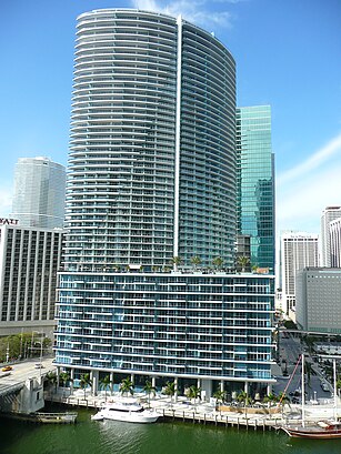
EPIC Residences Address: 270 Biscayne Boulevard Way street in Miami
Attractions near EPIC Residences
Color Marketing Group International Summit,Brickell Ave / SE 2nd Ave,Brickell Ave / US-1,Regency Club,Epic Hotel - A Kimpton Hotel,PyCodeConf,ACA Holdings Corporate Office,Gym@Hyatt Regency,1408,Room 1016,Hyatt Regency Miami Convention Center,Four Ambassador,Defense Logistics Info Svc,Packeteer Inc,Hyatt Hotel,James Knight Ctr,Distribio,Bijoux Design Creations,Le Bonefont Distribution Ctr,Mary Kay CosmeticsHow to get to popular attractions in Miami with public transit
The Diplomat Beach Resort, Hollywood,Surfside Beach, Miami Beach,Buffalo Wild Wings, North Westside,Claude Pepper Federal Building, Miami,Carpaccio, Miami Beach,The Mall at Wellington Green, Sunshine Parkway,Palm Beach State College, Lake Worth,City of Wilton Manors, Fort Lauderdale,Coral Springs, FL, Coral Springs-Margate,Miller's Ale House - Miami Doral, North Westside,Palm Beach County Convention Center, West Palm Beach,Aruba Beach Cafe, Fort Lauderdale,Lake Worth, FL, Lake Worth,Cinepolis, Miami,Pottery Barn, Boca Raton,Ransom Everglades School, Miami,Hiatus & red road, Miramar-Pembroke Pines,Fresh Market, Miami,Miller's Ale House - Miami Kendall, Kendall-Palmetto Bay,City of Delray Beach, Boynton Beach-Delray BeachGet around Miami by public transit!
Traveling around Miami has never been so easy. See step by step directions as you travel to any attraction, street or major public transit station. View bus and train schedules, arrival times, service alerts and detailed routes on a map, so you know exactly how to get to anywhere in Miami.
When traveling to any destination around Miami use Moovit's Live Directions with Get Off Notifications to know exactly where and how far to walk, how long to wait for your line, and how many stops are left. Moovit will alert you when it's time to get off — no need to constantly re-check whether yours is the next stop.
Wondering how to use public transit in Miami or how to pay for public transit in Miami? Moovit public transit app can help you navigate your way with public transit easily, and at minimum cost. It includes public transit fees, ticket prices, and costs. Looking for a map of Miami public transit lines? Moovit public transit app shows all public transit maps in Miami with all bus, subway or light rail routes and stops on an interactive map.
Miami has 3 transit type(s), including: bus, subway or light rail, operated by several transit agencies, including Miami-Dade Transit, Miami-Dade Transit, Miami Dade Transit-Rail, Tri-Rail, Miami-Dade Transit, Broward County Transit, Palm Tran, Brightline, Brightline, MARTY, City of Homestead Trolley, Key West Transit, Treasure Coast Connector, GoLine IRT and Amtrak