Directions to East Bremerton with public transportation
The following transit lines have routes that pass near East Bremerton
How to get to East Bremerton by bus?
Click on the bus route to see step by step directions with maps, line arrival times and updated time schedules.
Bus stations near East Bremerton
- Lebo Blvd At Juniper,5 min walk,
Bus lines to East Bremerton
- 225,To Bremerton TC,
What are the closest stations to East Bremerton?
The closest stations to East Bremerton are:
- Lebo Blvd At Juniper is 369 yards away, 5 min walk.
Which bus lines stop near East Bremerton?
These bus lines stop near East Bremerton: 217, 24.
What’s the nearest bus stop to East Bremerton?
The nearest bus stop to East Bremerton is Lebo Blvd At Juniper. It’s a 5 min walk away.
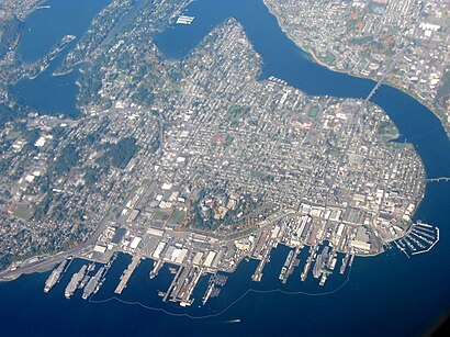
See East Bremerton on the map
Public Transportation to East Bremerton
Wondering how to get to East Bremerton, United States? Moovit helps you find the best way to get to East Bremerton with step-by-step directions from the nearest public transit station.
Moovit provides free maps and live directions to help you navigate through your city. View schedules, routes, timetables, and find out how long does it take to get to East Bremerton in real time.
Looking for the nearest stop or station to East Bremerton? Check out this list of stops closest to your destination: Lebo Blvd At Juniper.
Bus:21724225
Want to see if there’s another route that gets you there at an earlier time? Moovit helps you find alternative routes or times. Get directions from and directions to East Bremerton easily from the Moovit App or Website.
We make riding to East Bremerton easy, which is why over 1.5 million users, including users in Bremerton, trust Moovit as the best app for public transit. You don’t need to download an individual bus app or train app, Moovit is your all-in-one transit app that helps you find the best bus time or train time available.
For information on prices of bus and ferry, costs and ride fares to East Bremerton, please check the Moovit app.
Use the app to navigate to popular places including to the airport, hospital, stadium, grocery store, mall, coffee shop, school, college, and university.
Location: Bremerton, Seattle - Tacoma, WA
Attractions near East Bremerton
Stafford Health Care,Harrison Gift Shop,2 South Waiting Area Harrison Hospital,Elegant Nails,Toro Pazzo Brewing.,FotoCorsa Photography Studio,Sheridan Park Free Play,Sherri Zumdieck Arnp,Harrison Surgery Specialty Clinic,Shankar Sundaram MD,Harrison Health Partners,Chi Franciscan Health,Trident Networks,Lents Landing,Thoracic & Vascular Surgery,Hillblly Mtn Pntball Arena Sup,Kitsap Pulmonary & Sleep Medicine,Billys Baseball Game,Lincare,Campbell WayHow to get to popular attractions in Bremerton with public transit
Eastgate Freeway Station, Bellevue,Washington State Fair & Events Center, Puyallup,Virginia Mason Hospital, Seattle,Safeway, Issaquah,TCC Transit Center, Tacoma,Fred Meyer, Everett,Sea Airport, Seatac,Sumner Station, Sumner,Fluke Park, Everett,Doc's Marina Grill in Bainbridge Island, Bainbridge Island,Dale Turner Family YMCA, Shoreline,Loews Hotel 1000, Seattle, Seattle,Washington State Capital Campus, Olympia,Club Silverstone, Tacoma,Northgate Mall, Seattle,Seattle Japanese Garden, Seattle,Regal Cinemas Everett Mall 16 & RPX, Everett,Westlake Center, Seattle,Walmart Supercenter, Lakewood,Downtown Tacoma, TacomaGet around Bremerton by public transit!
Traveling around Bremerton has never been so easy. See step by step directions as you travel to any attraction, street or major public transit station. View bus and train schedules, arrival times, service alerts and detailed routes on a map, so you know exactly how to get to anywhere in Bremerton.
When traveling to any destination around Bremerton use Moovit's Live Directions with Get Off Notifications to know exactly where and how far to walk, how long to wait for your line, and how many stops are left. Moovit will alert you when it's time to get off — no need to constantly re-check whether yours is the next stop.
Wondering how to use public transit in Bremerton or how to pay for public transit in Bremerton? Moovit public transit app can help you navigate your way with public transit easily, and at minimum cost. It includes public transit fees, ticket prices, and costs. Looking for a map of Bremerton public transit lines? Moovit public transit app shows all public transit maps in Bremerton with all bus or ferry routes and stops on an interactive map.
Bremerton has 2 transit type(s), including: bus or ferry, operated by several transit agencies, including Sound Transit, Seattle Streetcar, Sound Transit, Metro Transit, Metro Transit, Sound Transit, Whatcom Transportation Authority, Mason Transit Authority, Snoqualmie Valley Transportation (SVT), Snoqualmie Valley Transportation, Amtrak, Island Transit, Kitsap Transit, Intercity Transit and Everett Transit