Directions to East Farmingdale (East Farmingdale, Ny) with public transportation
The following transit lines have routes that pass near East Farmingdale
How to get to East Farmingdale by bus?
Click on the bus route to see step by step directions with maps, line arrival times and updated time schedules.
How to get to East Farmingdale by train?
Click on the train route to see step by step directions with maps, line arrival times and updated time schedules.
Bus stations near East Farmingdale in East Farmingdale, Ny
- Conklin St + Rte L09, 48 min walk,
- Farmingdale State College, 50 min walk,
Train stations near East Farmingdale in East Farmingdale, Ny
- Pinelawn, 49 min walk,
Bus lines to East Farmingdale in East Farmingdale, Ny
- N70, Farm State Coll,
- 1, Halesite Fire Department Via Nys 110,
- 12, Bay Shore Via Wyandanch,
What are the closest stations to East Farmingdale?
The closest stations to East Farmingdale are:
- Conklin St + Rte L09 is 3977 yards away, 48 min walk.
- Pinelawn is 4124 yards away, 49 min walk.
- Farmingdale State College is 4197 yards away, 50 min walk.
Which bus line stops near East Farmingdale?
S1
Which train line stops near East Farmingdale?
RONKONKOMA
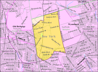
See East Farmingdale, East Farmingdale, Ny, on the map
Public Transit to East Farmingdale in East Farmingdale, Ny
Wondering how to get to East Farmingdale in East Farmingdale, Ny, United States? Moovit helps you find the best way to get to East Farmingdale with step-by-step directions from the nearest public transit station.
Moovit provides free maps and live directions to help you navigate through your city. View schedules, routes, timetables, and find out how long does it take to get to East Farmingdale in real time.
Looking for the nearest stop or station to East Farmingdale? Check out this list of stops closest to your destination: Conklin St + Rte L09; Pinelawn; Farmingdale State College.
Bus: S1, N70, 1, 12.Train: RONKONKOMA, RONKONKOMA BRANCH.
Want to see if there’s another route that gets you there at an earlier time? Moovit helps you find alternative routes or times. Get directions from and directions to East Farmingdale easily from the Moovit App or Website.
We make riding to East Farmingdale easy, which is why over 1.5 million users, including users in East Farmingdale, Ny, trust Moovit as the best app for public transit. You don’t need to download an individual bus app or train app, Moovit is your all-in-one transit app that helps you find the best bus time or train time available.
For information on prices of bus and train, costs and ride fares to East Farmingdale, please check the Moovit app.
Get to East Farmingdale with public transit and pay for the ride in the Moovit app. In addition to all info you may need for your trip to East Farmingdale, including live directions, real-time arrivals and fare prices, you can also buy public transit passes for your rides. No need for cash or paper tickets to get to East Farmingdale - everything you need is accessible in the app with a click of the button.
Use the app to navigate to popular places including to the airport, hospital, stadium, grocery store, mall, coffee shop, school, college, and university.
East Farmingdale Address: Babylon, Town of, NY street in East Farmingdale, Ny
Attractions near East Farmingdale
Grumman Republic,Natca,Molloy College-Suffolk Center,Republic Airport Republic Ave,Wal-Mart,Walmart,Dee Casino Tours,Republic Airport (FRG),Republic Airport,Republic Plaza,Walmart (Walmart Pharmacy),Towneplace Suites by Marriott,Marriott Republic Airport,Airport Marriott,Marriott Airport,Courtyard by Marriott,2 Marriott Plaza,Aviation Center at Farmingdale State College,Bank Of America,Troop L HeadquartersHow to get to popular attractions in East Farmingdale, Ny with public transit
Vernon, NJ, Clifton, Nj,Livingston NJ, Livingston, Nj,Pier 40, Manhattan,103 Canal St, Manhattan,300 Canal Place, Bronx,Cathedral Of Saint John the Divine, Manhattan,The Plaza Hotel, Manhattan,Whitehall, Manhattan,MTA Subway - Lexington Ave / 53rd St (E / M/6), Manhattan,8 Stone Street, Manhattan,Staten Island, NY, Staten Island,MTA Subway - 42nd St / Times Square / Port Authority Bus Terminal (A / C/E / N/Q / R/S / W/1 / 2/3 / 7), Manhattan,404 Pine St,Jfk Terminal 4, Queens,Bayside, NY, Queens,Circus Baby Pizza World, Manhattan,Greene St, Manhattan,3400 Bainbridge Avenue Bronx, Bronx,Nigerian Embassy, Manhattan,154 Pierrepont StreetGet around New York - New Jersey by public transit!
Traveling around New York - New Jersey has never been so easy. See step by step directions as you travel to any attraction, street or major public transit station. View bus and train schedules, arrival times, service alerts and detailed routes on a map, so you know exactly how to get to anywhere in New York - New Jersey.
When traveling to any destination around New York - New Jersey use Moovit's Live Directions with Get Off Notifications to know exactly where and how far to walk, how long to wait for your line, and how many stops are left. Moovit will alert you when it's time to get off — no need to constantly re-check whether yours is the next stop.
Wondering how to use public transit in New York - New Jersey or how to pay for public transit in New York - New Jersey? Moovit public transit app can help you navigate your way with public transit easily, and at minimum cost. It includes public transit fees, ticket prices, and costs. Looking for a map of New York - New Jersey public transit lines? Moovit public transit app shows all public transit maps in New York - New Jersey with all Bus, Train, Subway, Light Rail, Ferry and Cable Car routes and stops on an interactive map.
New York - New Jersey has 6 transit type(s), including: Bus, Train, Subway, Light Rail, Ferry and Cable Car, operated by several transit agencies, including MTA Subway, Metro-North Railroad, LIRR, PATH, Shore Line East, MTA Bus Company, MTA New York City Transit - Express routes, MTA Bus, NJ Transit, NYC Ferry, NICE bus, Bee-Line Bus, NJ Transit Rail, Norwalk Transit District, CTTransit - Waterbury-Meriden