See East Freehold, Freehold, Nj, on the map
Directions to East Freehold (Freehold, Nj) with public transportation
The following transit lines have routes that pass near East Freehold
 Bus:
Bus:
How to get to East Freehold by bus?
Click on the bus route to see step by step directions with maps, line arrival times and updated time schedules.
Bus stations near East Freehold in Freehold, Nj
- Rt-79 At Rustic Way#,17 min walk,
- Rt-79 At Diana Lane#,18 min walk,
- Cr-537 At East Freehold Rd,19 min walk,
Bus lines to East Freehold in Freehold, Nj
- 135,Freehold Ctr Via Matawan,
- 131,Freehold Hence Blvd Freehold Via Sayreville,
- 838,Freehold Raceway Mall,
What are the closest stations to East Freehold?
The closest stations to East Freehold are:
- Rt-79 At Rustic Way# is 1404 yards away, 17 min walk.
- Rt-79 At Diana Lane# is 1462 yards away, 18 min walk.
- Cr-537 At East Freehold Rd is 1581 yards away, 19 min walk.
Which bus line stops near East Freehold?
838
See East Freehold, Freehold, Nj, on the map
Public Transit to East Freehold in Freehold, Nj
Wondering how to get to East Freehold in Freehold, Nj, United States? Moovit helps you find the best way to get to East Freehold with step-by-step directions from the nearest public transit station.
Moovit provides free maps and live directions to help you navigate through your city. View schedules, routes, timetables, and find out how long does it take to get to East Freehold in real time.
Looking for the nearest stop or station to East Freehold? Check out this list of stops closest to your destination: Rt-79 At Rustic Way#; Rt-79 At Diana Lane#; Cr-537 At East Freehold Rd.
Bus:
Want to see if there’s another route that gets you there at an earlier time? Moovit helps you find alternative routes or times. Get directions from and directions to East Freehold easily from the Moovit App or Website.
We make riding to East Freehold easy, which is why over 1.5 million users, including users in Freehold, Nj, trust Moovit as the best app for public transit. You don’t need to download an individual bus app or train app, Moovit is your all-in-one transit app that helps you find the best bus time or train time available.
For information on prices of bus, subway and train, costs and ride fares to East Freehold, please check the Moovit app.
Use the app to navigate to popular places including to the airport, hospital, stadium, grocery store, mall, coffee shop, school, college, and university.
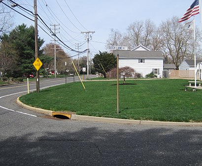
East Freehold Address: Dutch Lane Road street in Freehold, Nj
Attractions near East Freehold
E Freehold Rd (dutch freehold),Dutch Lane Rd Freehold,East Freehold Road,399 E Freehold Rd ,173 Dutch Lane Rd,1,East Freehold Fire Company,191 Dutch Lane Road,Kozlowski & Dutch,400 E Freehold Rd,Kenco Wholesale Distributor,East Freehold Fire Co. Main Base,Transforming Heart Psycho,CR-55,Kozloski Rd,55 46,Intersection of Kozlowski Rd & Dutch Lane,Freehld Township Board,East Freehold Fire Company,Freehld Township-Board of Fire Commissioners DistrictHow to get to popular attractions in Freehold, Nj with public transit
Harrah's Resort Hotel & Casino, Atlantic City, Nj,The Stumble Inn, Manhattan,LIRR - Huntington Station, Huntington Station, Ny,Beauty & Essex, Manhattan,Great Lawn, Manhattan,Dos Toros Taquería, Manhattan,Planet Fitness, Queens,Wingate by Wyndham Manhattan Midtown, Manhattan,Avenue, Manhattan,The Plaza Hotel, Manhattan,Lombardi's Coal Oven Pizza, Manhattan,Atlantic City, NJ, Atlantic City, Nj,MTA Subway - 42nd St / Bryant Park (B / D/F / M/7), Manhattan,MTA Subway - Fulton St (A / C/J / Z/2 / 3/4 / 5), Manhattan,Cookshop, Manhattan,Nassau Community College, East Garden City, Ny,Café Habana, Manhattan,Virgin America Ticket Counter, Elizabeth, Nj,Nan Xiang Xiao Long Bao, Queens,24 Hour Fitness, ManhattanGet around Freehold, Nj by public transit!
Traveling around Freehold, Nj has never been so easy. See step by step directions as you travel to any attraction, street or major public transit station. View bus and train schedules, arrival times, service alerts and detailed routes on a map, so you know exactly how to get to anywhere in Freehold, Nj.
When traveling to any destination around Freehold, Nj use Moovit's Live Directions with Get Off Notifications to know exactly where and how far to walk, how long to wait for your line, and how many stops are left. Moovit will alert you when it's time to get off — no need to constantly re-check whether yours is the next stop.
Wondering how to use public transit in Freehold, Nj or how to pay for public transit in Freehold, Nj? Moovit public transit app can help you navigate your way with public transit easily, and at minimum cost. It includes public transit fees, ticket prices, and costs. Looking for a map of Freehold, Nj public transit lines? Moovit public transit app shows all public transit maps in Freehold, Nj with all bus, subway or train routes and stops on an interactive map.
Freehold, Nj has 3 transit type(s), including: bus, subway or train, operated by several transit agencies, including MTA Subway, Metro-North Railroad, LIRR, PATH, Shore Line East, MTA Bus Company, MTA New York City Transit - Express routes, MTA Bus, NJ Transit, NYC Ferry, NICE bus, Bee-Line Bus, NJ Transit Rail, NJ Transit Rail and Norwalk Transit District