Directions to East Gwillimbury with public transportation
The following transit lines have routes that pass near East Gwillimbury
How to get to East Gwillimbury by bus?
Click on the bus route to see step by step directions with maps, line arrival times and updated time schedules.
Bus stops near East Gwillimbury
- Leslie St / Walter English Dr, 45 min walk,
- Leslie St / Mount Albert Rd, 65 min walk,
Bus lines to East Gwillimbury
- 50, Newmarket Terminal - Sb,
- 425, Huron Heights School Special - Af,
What are the closest stations to East Gwillimbury?
The closest stations to East Gwillimbury are:
- Leslie St / Walter English Dr is 3516 meters away, 45 min walk.
- Leslie St / Mount Albert Rd is 5075 meters away, 65 min walk.
Which bus lines stop near East Gwillimbury?
These bus lines stop near East Gwillimbury: 50, 58.
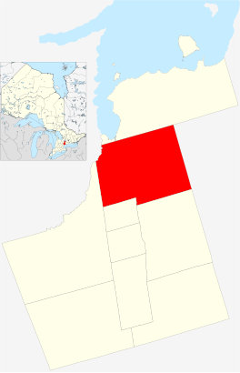
See East Gwillimbury on the map
|
|
This W3C-unspecified vector image was created with Inkscape. |
Public Transportation to East Gwillimbury
Wondering how to get to East Gwillimbury, Canada? Moovit helps you find the best way to get to East Gwillimbury with step-by-step directions from the nearest public transit station.
Moovit provides free maps and live directions to help you navigate through your city. View schedules, routes, timetables, and find out how long does it take to get to East Gwillimbury in real time.
Looking for the nearest stop or station to East Gwillimbury? Check out this list of stops closest to your destination: Leslie St / Walter English Dr; Leslie St / Mount Albert Rd.
Bus: 50, 58, 425.
Want to see if there’s another route that gets you there at an earlier time? Moovit helps you find alternative routes or times. Get directions from and directions to East Gwillimbury easily from the Moovit App or Website.
We make riding to East Gwillimbury easy, which is why over 1.5 million users, including users in East Gwillimbury, trust Moovit as the best app for public transit. You don’t need to download an individual bus app or train app, Moovit is your all-in-one transit app that helps you find the best bus time or train time available.
For information on prices of bus, costs and ride fares to East Gwillimbury, please check the Moovit app.
Use the app to navigate to popular places including to the airport, hospital, stadium, grocery store, mall, coffee shop, school, college, and university.
Location: East Gwillimbury, Toronto
|
|
This W3C-unspecified vector image was created with Inkscape. |
Attractions near East Gwillimbury
Іст-Гвіллімбері,Ист Гвилимбери,ايست ويليمباري,Lloyd E Baker Ltd,Old Mc Donald's Fine Furn Appl,Downsview Health Foods,Goode Welding & Repairs,Goodview Contracting & Stone,Fleiner Construction Ltd,Brice's Furniture & Appliances,Regina Mundi Renewal Ctr,Kerry's Place Residence,Doane Road Storage Inc,Dusty Miller Landscaping,Queensville Sideroad / 404 Carpool Lot,East Gwillimbury Skating Club,East Gwillimbury Minor Hockey,Queensville Sideroad,Northwinds Marketing,Queensville Farm Supply LtdHow to get to popular attractions in East Gwillimbury with public transit
222 Jarvis Street, Toronto,Saint Clair Avenue East, Toronto,Cherry Beach, Toronto,Scarborough Town Centre, Toronto,Enercare Centre, Toronto,Bramalea GO Station, Brampton,Newmarket, Ontario, Newmarket,OISE University of Toronto, Toronto,Mount Pleasant GO Station, Brampton,11 Polson Street, Toronto,Aldershot GO Station Platform 4, Burlington,Zum Stop 501 To York University, Brampton,Scarborough Town Center, Platform 5, Toronto,124 Eglinton Avenue West, Toronto,Hwy 401 & Winston Churchill Blvd, Halton Hills,Etobicoke, Toronto,Toronto Public Library - Toronto Reference Library, Toronto,1 Yonge Street, Toronto,Durham College (Oshawa Campus), Oshawa,Trinity Bellwoods Park, TorontoGet around Toronto by public transit!
Traveling around Toronto has never been so easy. See step by step directions as you travel to any attraction, street or major public transit station. View bus and train schedules, arrival times, service alerts and detailed routes on a map, so you know exactly how to get to anywhere in Toronto.
When traveling to any destination around Toronto use Moovit's Live Directions with Get Off Notifications to know exactly where and how far to walk, how long to wait for your line, and how many stops are left. Moovit will alert you when it's time to get off — no need to constantly re-check whether yours is the next stop.
Wondering how to use public transit in Toronto or how to pay for public transit in Toronto? Moovit public transit app can help you navigate your way with public transit easily, and at minimum cost. It includes public transit fees, ticket prices, and costs. Looking for a map of Toronto public transit lines? Moovit public transit app shows all public transit maps in Toronto with all Bus, Train, Subway, Streetcar and Ferry routes and stops on an interactive map.
Toronto has 5 transit type(s), including: Bus, Train, Subway, Streetcar and Ferry, operated by several transit agencies, including TTC, TTC Streetcar, Toronto Subway, Brampton Transit, MiWay, York Region Transit, GO Transit Bus, GO Transit, Durham Region Transit, UP Express, Grand River Transit, Guelph Transit, grt, Hamilton Street Railway, Burlington Transit