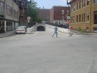
See East Side Trolley Tunnel, Boston, on the map
Directions to East Side Trolley Tunnel (Boston) with public transportation
The following transit lines have routes that pass near East Side Trolley Tunnel
Bus:
Train:
How to get to East Side Trolley Tunnel by Bus?
Click on the Bus route to see step by step directions with maps, line arrival times and updated time schedules.
How to get to East Side Trolley Tunnel by Train?
Click on the Train route to see step by step directions with maps, line arrival times and updated time schedules.
Bus stations near East Side Trolley Tunnel in Boston
- Tunnel Before S Main,1 min walk,
- S Main At Superior Court,4 min walk,
Bus lines to East Side Trolley Tunnel in Boston
- 1,Eddy/Hope/Benefit,
- 32,East Providence/Wampanoag Trail/Seekonk Square,
- 33,Riverside,
- 34,East Providence/Seekonk Square,
- 40,Butler/Elmgrove,
- 61X,Tiverton/East Bay Express,
- 35,Kennedy Plaza,
- 60,Providence Via E Main Rd,
- 78,Kennedy Plaza Via Beverage Hill Ave,
What are the closest stations to East Side Trolley Tunnel?
The closest stations to East Side Trolley Tunnel are:
- Tunnel Before S Main is 38 yards away, 1 min walk.
- S Main At Superior Court is 262 yards away, 4 min walk.
Which Bus lines stop near East Side Trolley Tunnel?
These Bus lines stop near East Side Trolley Tunnel: 1, 21, 54, 60
Which Train lines stop near East Side Trolley Tunnel?
These Train lines stop near East Side Trolley Tunnel: PROVIDENCE/STOUGHTON LINE
What’s the nearest bus stop to East Side Trolley Tunnel in Boston?
The nearest bus stop to East Side Trolley Tunnel in Boston is Tunnel Before S Main. It’s a 1 min walk away.
See East Side Trolley Tunnel, Boston, on the map

Public Transit to East Side Trolley Tunnel in Boston
Wondering how to get to East Side Trolley Tunnel in Boston, United States? Moovit helps you find the best way to get to East Side Trolley Tunnel with step-by-step directions from the nearest public transit station.
Moovit provides free maps and live directions to help you navigate through your city. View schedules, routes, timetables, and find out how long does it take to get to East Side Trolley Tunnel in real time.
Looking for the nearest stop or station to East Side Trolley Tunnel? Check out this list of stops closest to your destination: Tunnel Before S Main; S Main At Superior Court.
Bus:Train:
Want to see if there’s another route that gets you there at an earlier time? Moovit helps you find alternative routes or times. Get directions from and directions to East Side Trolley Tunnel easily from the Moovit App or Website.
We make riding to East Side Trolley Tunnel easy, which is why over 1.5 million users, including users in Boston, trust Moovit as the best app for public transit. You don’t need to download an individual bus app or train app, Moovit is your all-in-one transit app that helps you find the best bus time or train time available.
For information on prices of Bus and Train, costs and ride fares to East Side Trolley Tunnel, please check the Moovit app.
Use the app to navigate to popular places including to the airport, hospital, stadium, grocery store, mall, coffee shop, school, college, and university.
Location: Boston

Attractions near East Side Trolley Tunnel
- RICC South Garage
- RISD Illustration Studies Building
- Providence River
- Deacon Taylor House
- Ripta 78
- RISD Furniture Design Department
- RISD Washington Place
- Risd Ride
- Rhode Island Hospital Surgery
- RISD ISB
- Risd Career Center
- Ripta 35
- GD Commons
- RISD Design Center
- Ooh la hoops
- risd:store
- Risd Mail Room
- ripta 72
- New Rivers American Bistro
- Cafe Choklad
How to get to popular attractions in Boston with public transit
- Apple Providence Place
- FiRE + iCE Boston, Boston
- Hopkinton, MA, Hopkinton
- DCU Center Arena & Convention Center, Worcester
- Dillon's, Boston
- Planet Fitness, Boston
- East Providence, RI
- Mike's Food and Spirits, Somerville
- The Phoenix Landing, Cambridge
- MET Back Bay, Boston
- Newton, MA, Newton
- Union Station (WOR), Worcester
- Star Market, Waltham
- Raising Cane's Chicken Fingers, Boston
- Joe's American Bar & Grill, Boston
- The Capital Grille, Boston
- BonChon Chicken, Boston
- Stephanie's On Newbury, Boston
- Milford, MA, Milford
- Worcester Polytechnic Institute (WPI), Worcester