See East-West University, Chicago, on the map
Directions to East-West University (Chicago) with public transportation
The following transit lines have routes that pass near East-West University
 Bus:
Bus: - Train:
- Chicago 'L':
How to get to East-West University by bus?
Click on the bus route to see step by step directions with maps, line arrival times and updated time schedules.
How to get to East-West University by train?
Click on the train route to see step by step directions with maps, line arrival times and updated time schedules.
How to get to East-West University by Chicago 'L'?
Click on the Chicago 'L' route to see step by step directions with maps, line arrival times and updated time schedules.
Bus stations near East-West University in Chicago
- Michigan & 8th Street (North),1 min walk,
Bus lines to East-West University in Chicago
- 1,Bronzeville/Union Station,
- 2,Hyde Park Express,
- 3,King Drive,
- 4,Cottage Grove,
- X4,Cottage Grove Express,
- 6,Jackson Park Express,
- 10,Museum of Science & Industry,
- J14,Jeffery Jump,
- 26,South Shore Express,
- 28,Stony Island,
What are the closest stations to East-West University?
The closest stations to East-West University are:
- Michigan & 8th Street (North) is 62 yards away, 1 min walk.
Which bus lines stop near East-West University?
These bus lines stop near East-West University: 146, 147, 3, 4, 6, 62.
Which train lines stop near East-West University?
These train lines stop near East-West University: ME, UP-N.
Which Chicago 'L' line stops near East-West University?
RED LINE
What’s the nearest bus stop to East-West University in Chicago?
The nearest bus stop to East-West University in Chicago is Michigan & 8th Street (North). It’s a 1 min walk away.
See East-West University, Chicago, on the map
Public Transit to East-West University in Chicago
Wondering how to get to East-West University in Chicago, United States? Moovit helps you find the best way to get to East-West University with step-by-step directions from the nearest public transit station.
Moovit provides free maps and live directions to help you navigate through your city. View schedules, routes, timetables, and find out how long does it take to get to East-West University in real time.
Looking for the nearest stop or station to East-West University? Check out this list of stops closest to your destination: Michigan & 8th Street (North).
Bus:Train:Chicago 'L':
Want to see if there’s another route that gets you there at an earlier time? Moovit helps you find alternative routes or times. Get directions from and directions to East-West University easily from the Moovit App or Website.
We make riding to East-West University easy, which is why over 1.5 million users, including users in Chicago, trust Moovit as the best app for public transit. You don’t need to download an individual bus app or train app, Moovit is your all-in-one transit app that helps you find the best bus time or train time available.
For information on prices of Chicago 'L', bus and train, costs and ride fares to East-West University, please check the Moovit app.
Use the app to navigate to popular places including to the airport, hospital, stadium, grocery store, mall, coffee shop, school, college, and university.
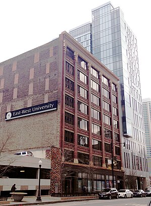
East-West University Address: South Michigan Avenue street in Chicago
Attractions near East-West University
Rook Cafe & Smoothie Bar,Johnson Publishing Company Building,Essex On The Park,Essex Inn,Essex Inn Chicago,Authorized Appliance Repair Company,Truby's Hair Art Gallery,Fashion Fair Cosmetics Division,Yureka Yoga,Chicago Overhead Garage Door Service,888 S Michgan Ave Condominium,808 South Michigan Avenue,Wiley L Book Store,S Michigan Ave,13th Floor,Washington Pittman and McKeever,Well Fit Therapy Group,Renaissance Hotels,Goodwill,Blackstone HotelHow to get to popular attractions in Chicago with public transit
Metra - Tinley Park / 80th Ave, Tinley Park,Metra - Prairie Crossing / Libertyville (MD-N), Libertyville,Target, South Elgin,SpringHill Suites Chicago Downtown / River North, Chicago,Hala Kahiki Tiki Bar & Lounge, River Grove,Naperville Riverwalk, Naperville,Autobahn Country Club, Joliet,Chicago Marriott Naperville, Naperville,Metra - Blue Island Vermont Street, Blue Island,Garfield Ridge, Chicago,Elmhurst Center for Health, Elmhurst,Woodfield Mall, Schaumburg,191 N. Wacker, Chicago,Intersection of Algonquin Road & Illinois Route 53, Rolling Meadows,Hotel Arista, Naperville,Advocate Condell Medical Center, Libertyville,Walmart Supercenter, Streamwood,Metra - Wood Dale, Wood Dale,Ford City Mall, Chicago,Downtown La Grange, La GrangeGet around Chicago by public transit!
Traveling around Chicago has never been so easy. See step by step directions as you travel to any attraction, street or major public transit station. View bus and train schedules, arrival times, service alerts and detailed routes on a map, so you know exactly how to get to anywhere in Chicago.
When traveling to any destination around Chicago use Moovit's Live Directions with Get Off Notifications to know exactly where and how far to walk, how long to wait for your line, and how many stops are left. Moovit will alert you when it's time to get off — no need to constantly re-check whether yours is the next stop.
Wondering how to use public transit in Chicago or how to pay for public transit in Chicago? Moovit public transit app can help you navigate your way with public transit easily, and at minimum cost. It includes public transit fees, ticket prices, and costs. Looking for a map of Chicago public transit lines? Moovit public transit app shows all public transit maps in Chicago with all Chicago 'L', bus or train routes and stops on an interactive map.
Chicago has 3 transit type(s), including: Chicago 'L', bus or train, operated by several transit agencies, including CTA 'L', Metra, Northern Indiana Commuter Transportation District, CTA, PACE, O'Hare International Airport Shuttle Bus, Gary Public Transit, Amtrak, River Valley Metro, Valpo Transit, DeKalb Public Transit, FlixBus-us, Greyhound-us, Van Galder (Coach USA) and Wisconsin Coach Lines