Directions to East Whittier CA (South Whittier) with public transportation
The following transit lines have routes that pass near East Whittier CA
How to get to East Whittier CA by bus?
Click on the bus route to see step by step directions with maps, line arrival times and updated time schedules.
Bus stops near East Whittier CA in South Whittier
- Leffingwell Rd & Stamy Rd, 5 min walk,
- Leffingwell / Stamy, 6 min walk,
- LA Mirada/Hornell, 8 min walk,
Bus lines to East Whittier CA in South Whittier
- SUNSHINE SHUTTLE ROUTE B, Whittwood Town Center,
- 120, Whittwood Town Center,
- 50, 50 Washington Bl,
What are the closest stations to East Whittier CA?
The closest stations to East Whittier CA are:
- Leffingwell Rd & Stamy Rd is 374 yards away, 5 min walk.
- Leffingwell / Stamy is 405 yards away, 6 min walk.
- LA Mirada/Hornell is 615 yards away, 8 min walk.
Which bus lines stop near East Whittier CA?
These bus lines stop near East Whittier CA: 120, 129, 4, 50, SUNSHINE SHUTTLE ROUTE B.
What’s the nearest bus stop to East Whittier CA in South Whittier?
The nearest bus stop to East Whittier CA in South Whittier is Leffingwell Rd & Stamy Rd. It’s a 5 min walk away.
What time is the first bus to East Whittier CA in South Whittier?
The 120 is the first bus that goes to East Whittier CA in South Whittier. It stops nearby at 4:28 AM.
What time is the last bus to East Whittier CA in South Whittier?
The 120 is the last bus that goes to East Whittier CA in South Whittier. It stops nearby at 10:18 PM.
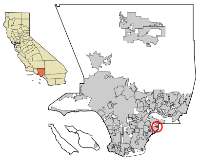
See East Whittier CA, South Whittier, on the map
Public Transit to East Whittier CA in South Whittier
Wondering how to get to East Whittier CA in South Whittier, United States? Moovit helps you find the best way to get to East Whittier CA with step-by-step directions from the nearest public transit station.
Moovit provides free maps and live directions to help you navigate through your city. View schedules, routes, timetables, and find out how long does it take to get to East Whittier CA in real time.
Looking for the nearest stop or station to East Whittier CA? Check out this list of stops closest to your destination: Leffingwell Rd & Stamy Rd; Leffingwell / Stamy; LA Mirada/Hornell.
Bus: 120, 129, 4, 50, SUNSHINE SHUTTLE ROUTE B.
Want to see if there’s another route that gets you there at an earlier time? Moovit helps you find alternative routes or times. Get directions from and directions to East Whittier CA easily from the Moovit App or Website.
We make riding to East Whittier CA easy, which is why over 1.5 million users, including users in South Whittier, trust Moovit as the best app for public transit. You don’t need to download an individual bus app or train app, Moovit is your all-in-one transit app that helps you find the best bus time or train time available.
For information on prices of bus and train, costs and ride fares to East Whittier CA, please check the Moovit app.
Use the app to navigate to popular places including to the airport, hospital, stadium, grocery store, mall, coffee shop, school, college, and university.
Location: South Whittier, Los Angeles
Popular routes to East Whittier CA, South Whittier
Attractions near East Whittier CA
Javier Gutierrez-Excellence Real Estate,11:1 Succulent Nursery,la Mirada Boulevard,Oza Air Conditioner and Heating,Hillview Middle School,Whittier College,Navy Federal Credit Union,Westermeyer John R DDS,Fresco Auto Detailing,Whiiter Express Car Wash,Just for You Hair Salon,2amcons Clothing,Mulberry Pharmacy,One Nails and Spa,Emb Bookkeeping Plus Tax,Orchard Dale Elementary,Skills Organization,Orange County Copier Repair,East Whittier Terrace,Walmart Neighborhood MarketHow to get to popular attractions in South Whittier with public transit
Volcom Skate Park, Costa Mesa,HB Lifeguard Tower 11, Huntington Beach,Saddleback College Quad, Mission Viejo,Kaiser Permanente Anaheim - Kraemer Pharmacy, Anaheim,Theo Lacy Jail Facility, Orange,Experian Parking Structure, Costa Mesa,Chadwick School,Metroflex, Long Beach,Placerita Jr. High School, Santa Clarita,Blizzard Entertainment Building 3, Irvine,Rancho Park DPSS, Sawtelle, La,Sunset Boulevard & Alvarado Street, Echo Park, La,Taco Bell, Fountain Valley,Northrop Grumman R10, Redondo Beach,Montecito Heights, CA, Highland Park, La,Alhambra Hospital Medical Center, Alhambra,Burlington Coat Factory, Inglewood,San Antonio Regional Hospital, Upland,Friendship Auditorium, Griffith Park, La,Fred Kavli Theatre, Thousand OaksGet around Los Angeles by public transit!
Traveling around Los Angeles has never been so easy. See step by step directions as you travel to any attraction, street or major public transit station. View bus and train schedules, arrival times, service alerts and detailed routes on a map, so you know exactly how to get to anywhere in Los Angeles.
When traveling to any destination around Los Angeles use Moovit's Live Directions with Get Off Notifications to know exactly where and how far to walk, how long to wait for your line, and how many stops are left. Moovit will alert you when it's time to get off — no need to constantly re-check whether yours is the next stop.
Wondering how to use public transit in Los Angeles or how to pay for public transit in Los Angeles? Moovit public transit app can help you navigate your way with public transit easily, and at minimum cost. It includes public transit fees, ticket prices, and costs. Looking for a map of Los Angeles public transit lines? Moovit public transit app shows all public transit maps in Los Angeles with all Bus, Train, Subway, Light Rail, Ferry and Funicular routes and stops on an interactive map.
Los Angeles has 6 transit type(s), including: Bus, Train, Subway, Light Rail, Ferry and Funicular, operated by several transit agencies, including Metro - Los Angeles, Metrolink Trains, METRO, Long Beach Transit, LADOT, OCTA, Foothill Transit, Big Blue Bus, Riverside Transit Agency, LAX FlyAway, Airporter Shuttle, Playa Vista Shuttle, Amtrak, OMNITRANS, Pasadena Transit