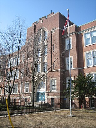
See Eastern Commerce, Toronto, on the map
Directions to Eastern Commerce (Toronto) with public transportation
The following transit lines have routes that pass near Eastern Commerce
 Bus:
Bus: - Train:
- Subway:
How to get to Eastern Commerce by bus?
Click on the bus route to see step by step directions with maps, line arrival times and updated time schedules.
How to get to Eastern Commerce by train?
Click on the train route to see step by step directions with maps, line arrival times and updated time schedules.
How to get to Eastern Commerce by subway?
Click on the subway route to see step by step directions with maps, line arrival times and updated time schedules.
Bus stations near Eastern Commerce in Toronto
- Danforth Ave At Donlands Ave,2 min walk,
- Donlands Station,3 min walk,
Subway stations near Eastern Commerce in Toronto
- Donlands,4 min walk,
Bus lines to Eastern Commerce in Toronto
- 300A,3450 Danforth Ave,
- 300B,Kennedy Station - Platform B,
- 300S,Bloor St West at Bathurst St,
- 56,Donlands Station,
- 56A,Eglinton Station,
- 83,Donlands Station,
What are the closest stations to Eastern Commerce?
The closest stations to Eastern Commerce are:
- Danforth Ave At Donlands Ave is 131 meters away, 2 min walk.
- Donlands Station is 197 meters away, 3 min walk.
- Donlands is 216 meters away, 4 min walk.
Which bus lines stop near Eastern Commerce?
These bus lines stop near Eastern Commerce: 56, 72.
Which train line stops near Eastern Commerce?
LE
Which subway line stops near Eastern Commerce?
2
What’s the nearest subway station to Eastern Commerce in Toronto?
The nearest subway station to Eastern Commerce in Toronto is Donlands. It’s a 4 min walk away.
What’s the nearest bus stop to Eastern Commerce in Toronto?
The nearest bus stop to Eastern Commerce in Toronto is Danforth Ave At Donlands Ave. It’s a 2 min walk away.
See Eastern Commerce, Toronto, on the map
Public Transit to Eastern Commerce in Toronto
Wondering how to get to Eastern Commerce in Toronto, Canada? Moovit helps you find the best way to get to Eastern Commerce with step-by-step directions from the nearest public transit station.
Moovit provides free maps and live directions to help you navigate through your city. View schedules, routes, timetables, and find out how long does it take to get to Eastern Commerce in real time.
Looking for the nearest stop or station to Eastern Commerce? Check out this list of stops closest to your destination: Danforth Ave At Donlands Ave; Donlands Station; Donlands.
Bus:Train:Subway:
Want to see if there’s another route that gets you there at an earlier time? Moovit helps you find alternative routes or times. Get directions from and directions to Eastern Commerce easily from the Moovit App or Website.
We make riding to Eastern Commerce easy, which is why over 1.5 million users, including users in Toronto, trust Moovit as the best app for public transit. You don’t need to download an individual bus app or train app, Moovit is your all-in-one transit app that helps you find the best bus time or train time available.
For information on prices of subway, bus, train and Streetcar, costs and ride fares to Eastern Commerce, please check the Moovit app.
Use the app to navigate to popular places including to the airport, hospital, stadium, grocery store, mall, coffee shop, school, college, and university.
Location: Toronto
Attractions near Eastern Commerce
Eastern Collegiate Institute,Eastern Commerce Soccer Field,Eastern Commerce Collegiate Institute,Canadian Training Institute,16 Phin Avenue,Subway Academy I,7-Eleven,St Leonard's Society of Toronto,Ben Kerr Lane,Woodgreen Equipment & Training,Withdrawal Management Ctr,Peter's Travel and Tours,989 Danforth Ave,Woodgreen Youth Job Centre,Boodle Fight,east york detox,Asia Bakery,Reeves,Minuet Cafe,Marmara CaféHow to get to popular attractions in Toronto with public transit
Outlet Collection at Niagara, Niagara-On-The-Lake,Oliver & Bonacini Café Grill, Yonge and Front, Toronto,St Joseph's Healthcare (Charlton Campus), Hamilton,RioCan Georgian Mall, Barrie,Brampton ON, Brampton,Rogers Centre, Toronto,City of Hamilton, Hamilton,Starbucks, Toronto,Hwy 401 & Hwy 400, Toronto,Kinka Izakaya, Toronto,Cf Toronto Eaton Centre Shipping / Receiving, Toronto,GoodLife Fitness Centres, Toronto,Insomnia Restaurant and Lounge, Toronto,GoodLife Fitness Centres, Toronto,University of Guelph, Guelph,Humber College - Lakeshore Campus, Toronto,Erin Mills Town Centre, Mississauga,Canadian Tire Home Office, Toronto,Starbucks, Toronto,Earls Kitchen & Bar, TorontoGet around Toronto by public transit!
Traveling around Toronto has never been so easy. See step by step directions as you travel to any attraction, street or major public transit station. View bus and train schedules, arrival times, service alerts and detailed routes on a map, so you know exactly how to get to anywhere in Toronto.
When traveling to any destination around Toronto use Moovit's Live Directions with Get Off Notifications to know exactly where and how far to walk, how long to wait for your line, and how many stops are left. Moovit will alert you when it's time to get off — no need to constantly re-check whether yours is the next stop.
Wondering how to use public transit in Toronto or how to pay for public transit in Toronto? Moovit public transit app can help you navigate your way with public transit easily, and at minimum cost. It includes public transit fees, ticket prices, and costs. Looking for a map of Toronto public transit lines? Moovit public transit app shows all public transit maps in Toronto with all subway, bus, train or Streetcar routes and stops on an interactive map.
Toronto has 4 transit type(s), including: subway, bus, train or Streetcar, operated by several transit agencies, including TTC, TTC Streetcar, Toronto Subway, GO Transit Bus, GO Transit, Amtrak, York Region Transit, Grand River Transit, Guelph Transit, grt, Hamilton Street Railway, MiWay, Brampton Transit, Burlington Transit and Oakville Transit