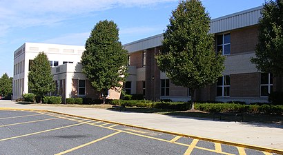
See Easton High School on the map
Directions to Easton High School with public transportation
The following transit lines have routes that pass near Easton High School
 Bus:
Bus:
How to get to Easton High School by bus?
Click on the bus route to see step by step directions with maps, line arrival times and updated time schedules.
Bus stations near Easton High School
- Dutchmans Lane,10 min walk,
- Parkview,11 min walk,
- The Greens,20 min walk,
Bus lines to Easton High School
- D,Easton,
- WALMART - TOWN PARKING LOT,Easton,
- HAPS BUILDING - WALMART,Easton,
What are the closest stations to Easton High School?
The closest stations to Easton High School are:
- Dutchmans Lane is 791 yards away, 10 min walk.
- Parkview is 873 yards away, 11 min walk.
- The Greens is 1624 yards away, 20 min walk.
Which bus line stops near Easton High School?
1
What’s the nearest bus stop to Easton High School?
The nearest bus stop to Easton High School is Dutchmans Lane. It’s a 10 min walk away.
How much is the bus fare to Easton High School?
The bus fare to Easton High School costs about $1.90 - $2.00.
See Easton High School on the map
Public Transportation to Easton High School
Wondering how to get to Easton High School, United States? Moovit helps you find the best way to get to Easton High School with step-by-step directions from the nearest public transit station.
Moovit provides free maps and live directions to help you navigate through your city. View schedules, routes, timetables, and find out how long does it take to get to Easton High School in real time.
Looking for the nearest stop or station to Easton High School? Check out this list of stops closest to your destination: Dutchmans Lane; Parkview; The Greens.
Bus:
Want to see if there’s another route that gets you there at an earlier time? Moovit helps you find alternative routes or times. Get directions from and directions to Easton High School easily from the Moovit App or Website.
We make riding to Easton High School easy, which is why over 1.5 million users, including users in Easton, trust Moovit as the best app for public transit. You don’t need to download an individual bus app or train app, Moovit is your all-in-one transit app that helps you find the best bus time or train time available.
For information on prices of bus, costs and ride fares to Easton High School, please check the Moovit app.
Use the app to navigate to popular places including to the airport, hospital, stadium, grocery store, mall, coffee shop, school, college, and university.
Easton High School Address: Ocean Gateway street in Easton
Attractions near Easton High School
Easton Warriors Football,Plaza Tapatia,Unit Univ Fllwshp At Easton,Maryland Delaware Appraisal,716 Elwood Ave,Richard W Ortel DDS,Margie Quimby DDS,Serino Orthodontics,Bayside Family Practice,Dickinson Medical Group,Susan Forlifer MD,Philip R Bowman LLC,Horace K Wood DDS,Dentistry For Children,Chesapeake Internal Medicine,Cheryl Ortel MD,Eastern Shore Gynecology,Aquacare Rehabilitation Svc,National Medical Imaging,Hill's Drug StoresHow to get to popular attractions in Easton with public transit
Dumfries, VA, Prince William County,Estadio, Washington,Urbana, Washington,Daniel O'Connell's Irish Restaurant & Bar, Alexandria,Arlington Rooftop Bar & Grill, Arlington County,Bar Louie, Washington,District Chophouse & Brewery, Washington,The Greene Turtle Sports Bar & Grille, Washington,AMC Owings Mills 17, Baltimore County,I-95 Exit 158: Prince William Pkwy, Prince William County,Hank's Oyster Bar, Washington,Teaism Penn Quarter, Washington,Dave & Buster's, Anne Arundel County,Hyatt Regency Baltimore Inner Harbor, Baltimore,Manassas, VA, Manassas,Gordon Biersch Brewery Restaurant, Fairfax County,Horseshoe Baltimore, Baltimore,Tunnicliff's Tavern, Washington,Bluejacket Brewery, Washington,BWI Rental Car Facility, Anne Arundel CountyGet around Easton by public transit!
Traveling around Easton has never been so easy. See step by step directions as you travel to any attraction, street or major public transit station. View bus and train schedules, arrival times, service alerts and detailed routes on a map, so you know exactly how to get to anywhere in Easton.
When traveling to any destination around Easton use Moovit's Live Directions with Get Off Notifications to know exactly where and how far to walk, how long to wait for your line, and how many stops are left. Moovit will alert you when it's time to get off — no need to constantly re-check whether yours is the next stop.
Wondering how to use public transit in Easton or how to pay for public transit in Easton? Moovit public transit app can help you navigate your way with public transit easily, and at minimum cost. It includes public transit fees, ticket prices, and costs. Looking for a map of Easton public transit lines? Moovit public transit app shows all public transit maps in Easton with all bus routes and stops on an interactive map.
Easton has 1 transit type(s), including: bus, operated by several transit agencies, including WMATA, WMATA, Montgomery County Ride On, Fairfax Connector, TheBus, DC Circulator, MDOT MTA, Marc, MDOT MTA, MDOT MTA, Virginia Railway Express (VRE), PRTC, DASH - Alexandria, Arlington Transit (ART) and DC Streetcar