Directions to Ebeltoft (Syddjurs) with public transportation
The following transit lines have routes that pass near Ebeltoft
How to get to Ebeltoft by bus?
Click on the bus route to see step by step directions with maps, line arrival times and updated time schedules.
Bus stops near Ebeltoft in Syddjurs
- Skelhøjevej/Nørrealle (Syddjurs Kom), 3 min walk,
Bus lines to Ebeltoft in Syddjurs
- 1, Knebel (Syddjurs Kom) - Ebeltoft Busterminal (Syddjurs Kom),
- 2, Knebel (Syddjurs Kom) - Ebeltoft Busterminal (Syddjurs Kom),
- 3, Ebeltoft Busterminal (Syddjurs Kom) - Ebeltoft C (Syddjurs Kom),
- 12, Knebel (Syddjurs Kom) - Knebel (Syddjurs Kom),
- 123, Aarhus Rutebilstation - Ebeltoft Busterminal (Syddjurs Kom),
- 312, Ryomgård St. (Syddjurs Kom) - Ebeltoft Busterminal (Syddjurs Kom),
- 351, Grenaa Gymnasium (Norddjurs Kom) - Ebeltoft Busterminal (Syddjurs Kom),
- 351, Grenaa Trafikterminal (Norddjurs Kom) - Ebeltoft Busterminal (Syddjurs Kom),
What are the closest stations to Ebeltoft?
The closest stations to Ebeltoft are:
- Skelhøjevej/Nørrealle (Syddjurs Kom) is 119 meters away, 3 min walk.
Which bus line stops near Ebeltoft?
123
What’s the nearest bus stop to Ebeltoft in Syddjurs?
The nearest bus stop to Ebeltoft in Syddjurs is Skelhøjevej/Nørrealle (Syddjurs Kom). It’s a 3 min walk away.
What time is the first bus to Ebeltoft in Syddjurs?
The 123 is the first bus that goes to Ebeltoft in Syddjurs. It stops nearby at 3:44 AM.
What time is the last bus to Ebeltoft in Syddjurs?
The 123 is the last bus that goes to Ebeltoft in Syddjurs. It stops nearby at 12:41 AM.
See Ebeltoft, Syddjurs, on the map
Public Transit to Ebeltoft in Syddjurs
Wondering how to get to Ebeltoft in Syddjurs, Denmark? Moovit helps you find the best way to get to Ebeltoft with step-by-step directions from the nearest public transit station.
Moovit provides free maps and live directions to help you navigate through your city. View schedules, routes, timetables, and find out how long does it take to get to Ebeltoft in real time.
Looking for the nearest stop or station to Ebeltoft? Check out this list of stops closest to your destination: Skelhøjevej/Nørrealle (Syddjurs Kom).
Bus: 123, 1, 2, 3, 12.
Want to see if there’s another route that gets you there at an earlier time? Moovit helps you find alternative routes or times. Get directions from and directions to Ebeltoft easily from the Moovit App or Website.
We make riding to Ebeltoft easy, which is why over 1.5 million users, including users in Syddjurs, trust Moovit as the best app for public transit. You don’t need to download an individual bus app or train app, Moovit is your all-in-one transit app that helps you find the best bus time or train time available.
For information on prices of bus, costs and ride fares to Ebeltoft, please check the Moovit app.
Use the app to navigate to popular places including to the airport, hospital, stadium, grocery store, mall, coffee shop, school, college, and university.
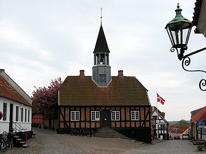
Ebeltoft Address: Boeslumvej street in Syddjurs
Attractions near Ebeltoft
Vognmand Søren Peter Sørensen Aps,Riddersholm Design,Skelhøj,Æpplatoftæ Brænderi,Ebeltoft Ebelfestival,Photographit,Dinepenge.Nu,Alubyg A/S,Pinocchio Kommunikation Aps,Ebeltoft Idrætsforening,Ebeltoft Tennisklub,Oh Kurser i/S,Ole Skotte Møller Holding Aps,Familiekrøniken,Ide og Byg,Foreningen Ebeltoft Net,Murer- & Entreprenørfirma J. Kvist Aps,Fotografit,Oversættelse V / Christine Andersen,U og E Thyregod PetersenHow to get to popular attractions in Syddjurs with public transit
Copenhagen Ocean Cruise Terminal 1,Charlottenlund Fort, Gentofte,Esplanaden, København,Learnmark Horsens, Stadionsvej, Horsens,Hvidovre Hospital Busstop, Hvidovre,Hasmark Strand, Nordfyns,Scandic Kødbyen, København,Vikingeskibsmuseet, Roskilde,Green Comfort Lagersalg, Randers,Tivoli Gardens, København,Himmelbjerget, Skanderborg,Rådhuspladsen, København,Hotel Sabro Kro, Århus,E45, Frakørsel 33, Rebild,Ny Ellebjerg st., København,Bilka, Horsens,Operaen,Knuthenborg Safaripark, Lolland,Ac Hotel Bella Sky Copenhagen, København,La Banchina, KøbenhavnGet around Denmark by public transit!
Traveling around Denmark has never been so easy. See step by step directions as you travel to any attraction, street or major public transit station. View bus and train schedules, arrival times, service alerts and detailed routes on a map, so you know exactly how to get to anywhere in Denmark.
When traveling to any destination around Denmark use Moovit's Live Directions with Get Off Notifications to know exactly where and how far to walk, how long to wait for your line, and how many stops are left. Moovit will alert you when it's time to get off — no need to constantly re-check whether yours is the next stop.
Wondering how to use public transit in Denmark or how to pay for public transit in Denmark? Moovit public transit app can help you navigate your way with public transit easily, and at minimum cost. It includes public transit fees, ticket prices, and costs. Looking for a map of Denmark public transit lines? Moovit public transit app shows all public transit maps in Denmark with all Bus, Train, Metro, Light Rail and Ferry routes and stops on an interactive map.
Denmark has 5 transit type(s), including: Bus, Train, Metro, Light Rail and Ferry, operated by several transit agencies, including Metroselskabet, DSB S-tog, Lokaltog A/S, Midttrafik, Odense Letbane, DSB, NT, GoCollective, Skånetrafiken, Movia, FYNBUS, Sydtrafik, Bornholms Trafik, Citybus, Ærø Kommune