Directions to Edgemont Oil Llc (Boston) with public transportation
The following transit lines have routes that pass near Edgemont Oil Llc
 Bus: 17.
How to get to Edgemont Oil Llc by bus?
Click on the bus route to see step by step directions with maps, line arrival times and updated time schedules.
From Plum Island Beach, Newburyport
77 minFrom Rockingham Mall Salem New Hampshire, Lawrence
75 minFrom Methuen, Methuen Town
111 minFrom Lawrence, Massachusetts, Lawrence
74 minFrom Parque de las ardillas, Lawrence
72 minFrom Amesbury, MA, Amesbury
29 minFrom Salisbury Beach, Salisbury
50 minFrom Lawrence, MA, Lawrence
75 minFrom QRD, Methuen Town
110 min
Bus stop near Edgemont Oil Llc in Boston
- West Main Street & Birch Meadow Road - Merrimac Heights Academy, 5 min walk,VIEW
Bus lines to Edgemont Oil Llc in Boston
- 17, Salisbury Beach,VIEW
What are the closest stations to Edgemont Oil Llc?
The closest stations to Edgemont Oil Llc are:
- West Main Street & Birch Meadow Road - Merrimac Heights Academy is 422 yards away, 5 min walk.
Which bus line stops near Edgemont Oil Llc?
17 (Washington Square Transit Center)
What’s the nearest bus station to Edgemont Oil Llc in Boston?
The nearest bus station to Edgemont Oil Llc in Boston is West Main Street & Birch Meadow Road - Merrimac Heights Academy. It’s a 5 min walk away.
What time is the first bus to Edgemont Oil Llc in Boston?
The 17 is the first bus that goes to Edgemont Oil Llc in Boston. It stops nearby at 5:13 AM.
What time is the last bus to Edgemont Oil Llc in Boston?
The 17 is the last bus that goes to Edgemont Oil Llc in Boston. It stops nearby at 8:27 PM.
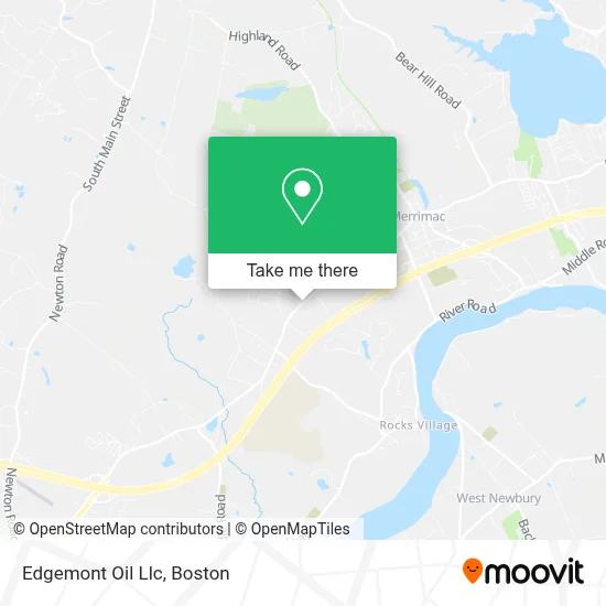
See Edgemont Oil Llc, Boston, on the map
Public Transit to Edgemont Oil Llc in Boston
Wondering how to get to Edgemont Oil Llc in Boston? Moovit helps you find the best way to get to Edgemont Oil Llc with step-by-step directions from the nearest public transit station.
Moovit provides free maps and live directions to help you navigate through your city. View schedules, routes, timetables, and find out how long does it take to get to Edgemont Oil Llc in real time.
Looking for the nearest stop or station to Edgemont Oil Llc? Check out this list of stops closest to your destination: West Main Street & Birch Meadow Road - Merrimac Heights Academy.
Bus: 17.
Want to see if there’s another route that gets you there at an earlier time? Moovit helps you find alternative routes or times. Get directions from and directions to Edgemont Oil Llc easily from the Moovit App or Website.
We make riding to Edgemont Oil Llc easy, which is why over 1.7 million users, including users in Boston, trust Moovit as the best app for public transit. You don’t need to download an individual bus app or train app, Moovit is your all-in-one transit app that helps you find the best bus time or train time available.
For information on prices of bus, costs and ride fares to Edgemont Oil Llc, please check the Moovit app.
Use the app to navigate to popular places including to the airport, hospital, stadium, grocery store, mall, coffee shop, school, college, and university.
Edgemont Oil Llc Address: 115 W Main St street in Boston
- Regency Village Clubhouse,
- Merrihill Tree Farm,
- Birchmeadow Estates,
- A Dt - ADT Alarm & Security - Main Number,
- Friends of the Merrimac Public Library,
- Lifeline Baptist Church,
- New Heights Community Church,
- U-Haul,
- Town Line Convenience,
- Quick Stop,
- ATM,
- AC M Specialized Cores,
- Boston Hill Fence,
- Blue Star Memorial Hwy Parking,
- Poets Inn,
- Whittier Reg Votech HS,
- ATM,
- New England Equine Rescue - North,
- Rockingham Mall,
- Hilldale Landscapes
Places Near Edgemont Oil Llc (Boston)
- Massachusetts General Hospital, Boston,
- Boston Children's Hospital, Boston,
- Mgm Music Hall, Boston,
- Isabella Stewart Gardner Museum, Boston,
- Boston Common, Boston,
- Castle Island, Boston,
- Leader Bank Pavilion (Leader Bank Pavillion), Boston,
- Wilbur Theatre, Boston,
- Seaport District, Boston,
- Quincy Market, Boston,
- Boston Convention & Exhibition Center, Boston,
- House Of Blues, Boston,
- Td Garden, Boston,
- Prudential Center, Boston,
- Museum Of Science, Boston,
- Boston Medical Center, Boston,
- Wang Theater, Boston,
- Cheers, Boston,
- Faneuil Hall, Boston,
- North End, Boston
How to get to popular places in Boston with public transit
Get around Boston by public transit!
Traveling around Boston has never been so easy. See step by step directions as you travel to any attraction, street or major public transit station. View bus and train schedules, arrival times, service alerts and detailed routes on a map, so you know exactly how to get to anywhere in Boston.
When traveling to any destination around Boston use Moovit's Live Directions with Get Off Notifications to know exactly where and how far to walk, how long to wait for your line, and how many stops are left. Moovit will alert you when it's time to get off — no need to constantly re-check whether yours is the next stop.
Wondering how to use public transit in Boston or how to pay for public transit in Boston? Moovit public transit app can help you navigate your way with public transit easily, and at minimum cost. It includes public transit fees, ticket prices, and costs. Looking for a map of Boston public transit lines? Moovit public transit app shows all public transit maps in Boston with all Bus, Train, Subway and Ferry routes and stops on an interactive map.
Boston has 4 transit type(s), including: Bus, Train, Subway and Ferry, operated by several transit agencies, including MBTA, Southeastern Regional Transit Authority, MetroWest Regional Transit Authority, Rhode Island Public Transit Authority, WRTA, Lowell Regional Transit Authority, Merrimack Valley Transit, Montachusett Regional Transit Authority, Cape Cod Regional Transit Authority, Brockton Area Transit Authority, Martha's Vineyard Transit Authority, the WAVE - Nantucket Regional Transit Authority, GATRA, Cape Ann Transportation Authority and Massport