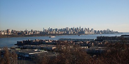
See Edgewater, New Jersey, Edgewater, Nj, on the map
Directions to Edgewater, New Jersey (Edgewater, Nj) with public transportation
The following transit lines have routes that pass near Edgewater, New Jersey
 Bus:
Bus: - Ferry:
How to get to Edgewater, New Jersey by bus?
Click on the bus route to see step by step directions with maps, line arrival times and updated time schedules.
Bus stations near Edgewater, New Jersey in Edgewater, Nj
- River Rd at Hilliard Ave,1 min walk,
- Palisade Ave at Warren Ave,26 min walk,
Ferry stations near Edgewater, New Jersey in Edgewater, Nj
- Edgewater Ferry Landing,36 min walk,
Bus lines to Edgewater, New Jersey in Edgewater, Nj
- 158,Fort Lee,
- 188,New York Gw Bridge Bus Station,
- 755,Edgewater Via Fort Lee & Cedar Lane,
- 156,156r New York Via River Road,
- 159,Cliffside Park Winston Twrs,
- 181,New York Gw Bridge Bus Station,
What are the closest stations to Edgewater, New Jersey?
The closest stations to Edgewater, New Jersey are:
- River Rd at Hilliard Ave is 52 yards away, 1 min walk.
- Palisade Ave at Warren Ave is 2215 yards away, 26 min walk.
- Edgewater Ferry Landing is 3035 yards away, 36 min walk.
Which bus lines stop near Edgewater, New Jersey?
These bus lines stop near Edgewater, New Jersey: 158, 188.
What’s the nearest bus stop to Edgewater, New Jersey in Edgewater, Nj?
The nearest bus stop to Edgewater, New Jersey in Edgewater, Nj is River Rd at Hilliard Ave. It’s a 1 min walk away.
What time is the first bus to Edgewater, New Jersey in Edgewater, Nj?
The 156 is the first bus that goes to Edgewater, New Jersey in Edgewater, Nj. It stops nearby at 5:06 AM.
What time is the last bus to Edgewater, New Jersey in Edgewater, Nj?
The 156 is the last bus that goes to Edgewater, New Jersey in Edgewater, Nj. It stops nearby at 2:34 AM.
What time is the first ferry to Edgewater, New Jersey in Edgewater, Nj?
The EDGEWATER FERRY LANDING AND BROOKFIELD PLACE TERMINAL is the first ferry that goes to Edgewater, New Jersey in Edgewater, Nj. It stops nearby at 6:10 AM.
What time is the last ferry to Edgewater, New Jersey in Edgewater, Nj?
The EDGEWATER FERRY LANDING AND BROOKFIELD PLACE TERMINAL is the last ferry that goes to Edgewater, New Jersey in Edgewater, Nj. It stops nearby at 7:50 PM.
How much is the subway fare to Edgewater, New Jersey?
The subway fare to Edgewater, New Jersey costs about $2.90.
See Edgewater, New Jersey, Edgewater, Nj, on the map
Public Transit to Edgewater, New Jersey in Edgewater, Nj
Wondering how to get to Edgewater, New Jersey in Edgewater, Nj, United States? Moovit helps you find the best way to get to Edgewater, New Jersey with step-by-step directions from the nearest public transit station.
Moovit provides free maps and live directions to help you navigate through your city. View schedules, routes, timetables, and find out how long does it take to get to Edgewater, New Jersey in real time.
Looking for the nearest stop or station to Edgewater, New Jersey? Check out this list of stops closest to your destination: River Rd at Hilliard Ave; Palisade Ave at Warren Ave; Edgewater Ferry Landing.
Bus:Ferry:
Want to see if there’s another route that gets you there at an earlier time? Moovit helps you find alternative routes or times. Get directions from and directions to Edgewater, New Jersey easily from the Moovit App or Website.
We make riding to Edgewater, New Jersey easy, which is why over 1.5 million users, including users in Edgewater, Nj, trust Moovit as the best app for public transit. You don’t need to download an individual bus app or train app, Moovit is your all-in-one transit app that helps you find the best bus time or train time available.
For information on prices of bus and subway, costs and ride fares to Edgewater, New Jersey, please check the Moovit app.
Use the app to navigate to popular places including to the airport, hospital, stadium, grocery store, mall, coffee shop, school, college, and university.
Edgewater, New Jersey Address: Bergen, NJ street in Edgewater, Nj
Attractions near Edgewater, New Jersey
McDonald's,Real Estate,Labcorp Njb16,Hilliard Ave and River Rd,River Road Edgewater NJ,Thismakeupgirl.Com (This Makeup Girl),River Thai Food (Thai Kitchen Restaurant and Take Out),Edgewater Sandwich (Italian Sandwich),Hudson 505,HJJ Music,Homes in Edgewater,Mary Love Psychic Medium,Edgewater Marina,Whole Foods Market,Whole Foods Market,Holy Rosary Church,Hudson River Social Club,Jade Spa,River Rd and RT-5,Brownstone Pancake FactoryHow to get to popular attractions in Edgewater, Nj with public transit
Food Gallery 32, Manhattan,Secaucus, NJ, Secaucus, Nj,Clinton St. Baking Co. & Restaurant, Manhattan,Grimaldi's Pizzeria,Roberta's Pizza,Dos Toros Taquería, Manhattan,Harrah's Resort Hotel & Casino, Atlantic City, Nj,MTA Subway - Fulton St (A / C/J / Z/2 / 3/4 / 5), Manhattan,Hotel Chantelle, Manhattan,The Dead Rabbit, Manhattan,Eataly, Manhattan,The 13th Step, Manhattan,24 Hour Fitness, Manhattan,Freehold Raceway Mall, Freehold Township,Gregory's Coffee, Manhattan,Ferrara Bakery, Manhattan,Stamford, CT, Stamford, Ct,Burger Joint, Manhattan,Virgin America Ticket Counter, Elizabeth, Nj,MTA Subway - Broadway (N/W), QueensGet around Edgewater, Nj by public transit!
Traveling around Edgewater, Nj has never been so easy. See step by step directions as you travel to any attraction, street or major public transit station. View bus and train schedules, arrival times, service alerts and detailed routes on a map, so you know exactly how to get to anywhere in Edgewater, Nj.
When traveling to any destination around Edgewater, Nj use Moovit's Live Directions with Get Off Notifications to know exactly where and how far to walk, how long to wait for your line, and how many stops are left. Moovit will alert you when it's time to get off — no need to constantly re-check whether yours is the next stop.
Wondering how to use public transit in Edgewater, Nj or how to pay for public transit in Edgewater, Nj? Moovit public transit app can help you navigate your way with public transit easily, and at minimum cost. It includes public transit fees, ticket prices, and costs. Looking for a map of Edgewater, Nj public transit lines? Moovit public transit app shows all public transit maps in Edgewater, Nj with all bus or subway routes and stops on an interactive map.
Edgewater, Nj has 2 transit type(s), including: bus or subway, operated by several transit agencies, including MTA Subway, Metro-North Railroad, LIRR, PATH, Shore Line East, MTA Bus Company, MTA New York City Transit - Express routes, MTA Bus, NJ Transit, NYC Ferry, NICE bus, Bee-Line Bus, NJ Transit Rail, NJ Transit Rail and Norwalk Transit District