See Elizabeth Ziegler Public School, Waterloo, on the map
Directions to Elizabeth Ziegler Public School (Waterloo) with public transportation
The following transit lines have routes that pass near Elizabeth Ziegler Public School
 Bus:
Bus:
How to get to Elizabeth Ziegler Public School by bus?
Click on the bus route to see step by step directions with maps, line arrival times and updated time schedules.
Bus stations near Elizabeth Ziegler Public School in Waterloo
- Weber / Allen,7 min walk,
- King / Union,17 min walk,
Bus lines to Elizabeth Ziegler Public School in Waterloo
- 8,Fairway Station,
- 16,Waterloo Public Square Station,
What are the closest stations to Elizabeth Ziegler Public School?
The closest stations to Elizabeth Ziegler Public School are:
- Weber / Allen is 451 meters away, 7 min walk.
- King / Union is 1250 meters away, 17 min walk.
Which bus lines stop near Elizabeth Ziegler Public School?
These bus lines stop near Elizabeth Ziegler Public School: 5, 8.
What’s the nearest bus stop to Elizabeth Ziegler Public School in Waterloo?
The nearest bus stop to Elizabeth Ziegler Public School in Waterloo is Weber / Allen. It’s a 7 min walk away.
See Elizabeth Ziegler Public School, Waterloo, on the map
Public Transit to Elizabeth Ziegler Public School in Waterloo
Wondering how to get to Elizabeth Ziegler Public School in Waterloo, Canada? Moovit helps you find the best way to get to Elizabeth Ziegler Public School with step-by-step directions from the nearest public transit station.
Moovit provides free maps and live directions to help you navigate through your city. View schedules, routes, timetables, and find out how long does it take to get to Elizabeth Ziegler Public School in real time.
Looking for the nearest stop or station to Elizabeth Ziegler Public School? Check out this list of stops closest to your destination: Weber / Allen; King / Union.
Bus:
Want to see if there’s another route that gets you there at an earlier time? Moovit helps you find alternative routes or times. Get directions from and directions to Elizabeth Ziegler Public School easily from the Moovit App or Website.
We make riding to Elizabeth Ziegler Public School easy, which is why over 1.5 million users, including users in Waterloo, trust Moovit as the best app for public transit. You don’t need to download an individual bus app or train app, Moovit is your all-in-one transit app that helps you find the best bus time or train time available.
For information on prices of bus, costs and ride fares to Elizabeth Ziegler Public School, please check the Moovit app.
Use the app to navigate to popular places including to the airport, hospital, stadium, grocery store, mall, coffee shop, school, college, and university.
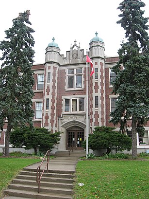
Elizabeth Ziegler Public School Address: Moore Avenue South street in Waterloo
Attractions near Elizabeth Ziegler Public School
Kuppers Orthodontics,K. Papp,Busy Corner Garage,Fenigo,KW Auctions,Dr. Fadia El Boreky & Dr. Sameh Fikry,Spur Line Trail,SpaSurgica,Sauble Beach,Dr. Kawa Ibrahiem,Ватерлоо,Вотерлу,Canada Post,iShawarma,Bridgeport Plaza,Sally Beauty Outlet,Canada Post,Grand River Transit Bus stop 2665,Vasiga J George,Your Dollar Store With MoreHow to get to popular attractions in Waterloo with public transit
Oshawa GO Station, Oshawa,Canada's Wonderland, Vaughan,Oshawa, Ontario, Oshawa,Starbucks, Toronto,Fresh On Spadina, Toronto,University Of Toronto Mississauga Campus, Mississauga,Earls Kitchen & Bar, Toronto,TTC 512 St. Clair Streetcar, Toronto,Canada's Wonderland, Vaughan,Pacific Mall, Markham,Jack Astor's Bar & Grill, Toronto,The Pilot Tavern, Toronto,Outlet Collection at Niagara, Niagara-On-The-Lake,Starbucks, Waterloo,Union Station (YBZ), Toronto,Orangeville, Ontario, Orangeville,GoodLife Fitness Centres, Toronto,Cf Toronto Eaton Centre Shipping / Receiving, Toronto,Barrie, Ontario, Barrie,Dixie Outlet Mall, MississaugaGet around Waterloo by public transit!
Traveling around Waterloo has never been so easy. See step by step directions as you travel to any attraction, street or major public transit station. View bus and train schedules, arrival times, service alerts and detailed routes on a map, so you know exactly how to get to anywhere in Waterloo.
When traveling to any destination around Waterloo use Moovit's Live Directions with Get Off Notifications to know exactly where and how far to walk, how long to wait for your line, and how many stops are left. Moovit will alert you when it's time to get off — no need to constantly re-check whether yours is the next stop.
Wondering how to use public transit in Waterloo or how to pay for public transit in Waterloo? Moovit public transit app can help you navigate your way with public transit easily, and at minimum cost. It includes public transit fees, ticket prices, and costs. Looking for a map of Waterloo public transit lines? Moovit public transit app shows all public transit maps in Waterloo with all bus routes and stops on an interactive map.
Waterloo has 1 transit type(s), including: bus, operated by several transit agencies, including TTC, TTC Streetcar, Toronto Subway, GO Transit Bus, GO Transit, Amtrak, York Region Transit, Grand River Transit, Guelph Transit, grt, Hamilton Street Railway, MiWay, Brampton Transit, Burlington Transit and Oakville Transit