Directions to Em Fix Locksmith (Danvers) with public transportation
The following transit lines have routes that pass near Em Fix Locksmith
How to get to Em Fix Locksmith by bus?
Click on the bus route to see step by step directions with maps, line arrival times and updated time schedules.
Bus stops near Em Fix Locksmith in Danvers
Bus lines to Em Fix Locksmith in Danvers
What are the closest stations to Em Fix Locksmith?
The closest stations to Em Fix Locksmith are:
- Market Basket is 634 yards away, 8 min walk.
- Liberty Tree Mall is 1487 yards away, 18 min walk.
Which bus line stops near Em Fix Locksmith?
435 (Salem Depot)
What’s the nearest bus station to Em Fix Locksmith in Danvers?
The nearest bus station to Em Fix Locksmith in Danvers is Market Basket. It’s a 8 min walk away.
What time is the first bus to Em Fix Locksmith in Danvers?
The CITY OF BEVERLY SHUTTLE is the first bus that goes to Em Fix Locksmith in Danvers. It stops nearby at 11:35 AM.
What time is the last bus to Em Fix Locksmith in Danvers?
The CITY OF BEVERLY SHUTTLE is the last bus that goes to Em Fix Locksmith in Danvers. It stops nearby at 4:00 PM.
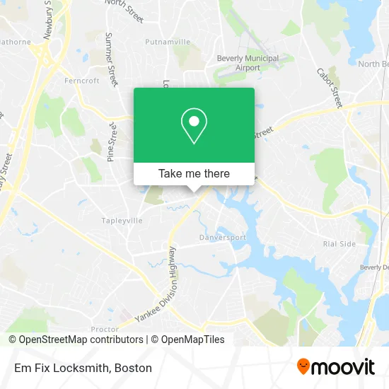
See Em Fix Locksmith, Danvers, on the map
Public Transit to Em Fix Locksmith in Danvers
Wondering how to get to Em Fix Locksmith in Danvers? Moovit helps you find the best way to get to Em Fix Locksmith with step-by-step directions from the nearest public transit station.
Moovit provides free maps and live directions to help you navigate through your city. View schedules, routes, timetables, and find out how long does it take to get to Em Fix Locksmith in real time.
Looking for the nearest stop or station to Em Fix Locksmith? Check out this list of stops closest to your destination: Market Basket; Liberty Tree Mall.
Bus: 435, CITY OF BEVERLY SHUTTLE, SATURDAY MALL SHUTTLE.
Want to see if there’s another route that gets you there at an earlier time? Moovit helps you find alternative routes or times. Get directions from and directions to Em Fix Locksmith easily from the Moovit App or Website.
We make riding to Em Fix Locksmith easy, which is why over 1.7 million users, including users in Danvers, trust Moovit as the best app for public transit. You don’t need to download an individual bus app or train app, Moovit is your all-in-one transit app that helps you find the best bus time or train time available.
For information on prices of bus and train, costs and ride fares to Em Fix Locksmith, please check the Moovit app.
Use the app to navigate to popular places including to the airport, hospital, stadium, grocery store, mall, coffee shop, school, college, and university.
Em Fix Locksmith Address: 107 High St street in Danvers
- Gabbie McClain - M&T Bank,
- ATM,
- Same Day Garage Door Repair Garage Door,
- Rainbow Carpet Cleaning Carpet Cleaning,
- Legacy Tattoo,
- GMC Trucks Danvers,
- Happy Garden (Dumpling Garden),
- Toys N Things,
- The Porterhouse,
- Luxen Construction,
- Danvers Law Offices (Danvers Fire Department),
- Moore Colour,
- Innovative Resource Group,
- Creese & Cook Tannery Superfund Site,
- Excel Paving,
- Plan Room Construction & Telecommunications Services (Cts), Inc.,
- Drain,
- Depot,
- Minute Key,
- Doggie Depot
Places Near Em Fix Locksmith (Danvers)
- Prudential Center, Boston,
- Castle Island, Boston,
- Cheers, Boston,
- Leader Bank Pavilion (Leader Bank Pavillion), Boston,
- Quincy Market, Boston,
- Td Garden, Boston,
- Wilbur Theatre, Boston,
- Boston Convention & Exhibition Center, Boston,
- North End, Boston,
- Museum Of Science, Boston,
- House Of Blues, Boston,
- Mgm Music Hall, Boston,
- Faneuil Hall, Boston,
- Boston Children's Hospital, Boston,
- Isabella Stewart Gardner Museum, Boston,
- Boston Medical Center, Boston,
- Massachusetts General Hospital, Boston,
- Boston Common, Boston,
- Wang Theater, Boston,
- Seaport District, Boston
How to get to popular places in Boston with public transit
Get around Danvers by public transit!
Traveling around Danvers has never been so easy. See step by step directions as you travel to any attraction, street or major public transit station. View bus and train schedules, arrival times, service alerts and detailed routes on a map, so you know exactly how to get to anywhere in Danvers.
When traveling to any destination around Danvers use Moovit's Live Directions with Get Off Notifications to know exactly where and how far to walk, how long to wait for your line, and how many stops are left. Moovit will alert you when it's time to get off — no need to constantly re-check whether yours is the next stop.
Wondering how to use public transit in Danvers or how to pay for public transit in Danvers? Moovit public transit app can help you navigate your way with public transit easily, and at minimum cost. It includes public transit fees, ticket prices, and costs. Looking for a map of Danvers public transit lines? Moovit public transit app shows all public transit maps in Danvers with all Bus, Train, Subway and Ferry routes and stops on an interactive map.
Boston has 4 transit type(s), including: Bus, Train, Subway and Ferry, operated by several transit agencies, including MBTA, Southeastern Regional Transit Authority, MetroWest Regional Transit Authority, Rhode Island Public Transit Authority, WRTA, Lowell Regional Transit Authority, Merrimack Valley Transit, Montachusett Regional Transit Authority, Cape Cod Regional Transit Authority, Brockton Area Transit Authority, Martha's Vineyard Transit Authority, the WAVE - Nantucket Regional Transit Authority, GATRA, Cape Ann Transportation Authority and Massport