Directions to Emery Collegiate Institute (Toronto) with public transportation
The following transit lines have routes that pass near Emery Collegiate Institute
How to get to Emery Collegiate Institute by bus?
Click on the bus route to see step by step directions with maps, line arrival times and updated time schedules.
Bus stations near Emery Collegiate Institute in Toronto
- Weston Rd at Lanyard Rd,6 min walk,
- Weston Rd at Imogene Ave,10 min walk,
- Finch Ave West at Weston Rd,12 min walk,
- 40 Norfinch Dr,35 min walk,
Bus lines to Emery Collegiate Institute in Toronto
- 165,WESTON RD. NORTH,
- 989,WESTON EXPRESS,
- 165S,Wilson Station,
- 36B,Humberwood Blvd Loop at View Green Cres,
- 36D,Milvan Dr at Penn Dr (South),
- 36F,Milvan Dr at Penn Dr (South),
- 336,Woodbine Race Track Loop - Main Entrance,
- 84,Sheppard Ave West at Yonge St,
What are the closest stations to Emery Collegiate Institute?
The closest stations to Emery Collegiate Institute are:
- Weston Rd at Lanyard Rd is 385 meters away, 6 min walk.
- Weston Rd at Imogene Ave is 709 meters away, 10 min walk.
- Finch Ave West at Weston Rd is 858 meters away, 12 min walk.
- 40 Norfinch Dr is 2612 meters away, 35 min walk.
Which bus lines stop near Emery Collegiate Institute?
These bus lines stop near Emery Collegiate Institute: 165, 36.
What’s the nearest bus stop to Emery Collegiate Institute in Toronto?
The nearest bus stop to Emery Collegiate Institute in Toronto is Weston Rd at Lanyard Rd. It’s a 6 min walk away.
See Emery Collegiate Institute, Toronto, on the map
Public Transit to Emery Collegiate Institute in Toronto
Wondering how to get to Emery Collegiate Institute in Toronto, Canada? Moovit helps you find the best way to get to Emery Collegiate Institute with step-by-step directions from the nearest public transit station.
Moovit provides free maps and live directions to help you navigate through your city. View schedules, routes, timetables, and find out how long does it take to get to Emery Collegiate Institute in real time.
Looking for the nearest stop or station to Emery Collegiate Institute? Check out this list of stops closest to your destination: Weston Rd at Lanyard Rd; Weston Rd at Imogene Ave; Finch Ave West at Weston Rd; 40 Norfinch Dr.
Bus:16536989165S36B36D36F33684
Want to see if there’s another route that gets you there at an earlier time? Moovit helps you find alternative routes or times. Get directions from and directions to Emery Collegiate Institute easily from the Moovit App or Website.
We make riding to Emery Collegiate Institute easy, which is why over 1.5 million users, including users in Toronto, trust Moovit as the best app for public transit. You don’t need to download an individual bus app or train app, Moovit is your all-in-one transit app that helps you find the best bus time or train time available.
For information on prices of bus, subway and train, costs and ride fares to Emery Collegiate Institute, please check the Moovit app.
Use the app to navigate to popular places including to the airport, hospital, stadium, grocery store, mall, coffee shop, school, college, and university.
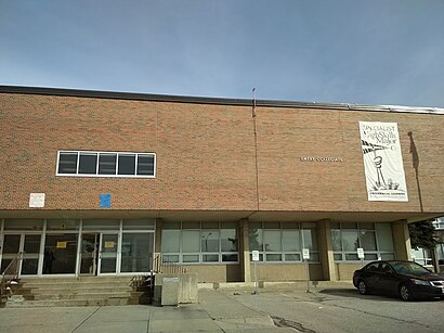
Emery Collegiate Institute Address: 3395 Weston Road, North York, ON M9M 2V9, Canada street in Toronto
Attractions near Emery Collegiate Institute
3395 Weston Road,Habitant Arena,Habitant Arena,Primo,Algonquin Park,6 Vena Way,Jules Banquet Centre,Mrcorn,Gazala Dental Centre,1000 Arrow Road,Caribbean Queen,Johnny's Barber Shop & Accessories,Caribu West Indian Cuisine,Leila's Curry Pot & Roti Hut,Terrace Square Plaza,Terrace Square Pharmacy,True North Medical Centre,Money Mart,Pizza Pros,Caribbean Island Food MartHow to get to popular attractions in Toronto with public transit
GoodLife Fitness Centres, Toronto,Wayne Gretzky's Toronto, Toronto,The Pilot Tavern, Toronto,TTC #511 Bathurst Streetcar, Toronto,University Of Toronto Mississauga Campus, Mississauga,Yorkdale Subway Station, Toronto,IKEA, Burlington,CF Fairview Park, Kitchener,Starbucks, Toronto,Starbucks, Toronto,University of Guelph, Guelph,Gateway Terminal, Brampton,Oshawa GO Station, Oshawa,Newmarket, Ontario, Newmarket,Canada's Wonderland, Vaughan,The Beach, Toronto,Cambridge, Ontario, Cambridge,Kitchener Memorial Auditorium Complex, Kitchener,City of St. Catharines, St. Catharines,Cn Tower, TorontoGet around Toronto by public transit!
Traveling around Toronto has never been so easy. See step by step directions as you travel to any attraction, street or major public transit station. View bus and train schedules, arrival times, service alerts and detailed routes on a map, so you know exactly how to get to anywhere in Toronto.
When traveling to any destination around Toronto use Moovit's Live Directions with Get Off Notifications to know exactly where and how far to walk, how long to wait for your line, and how many stops are left. Moovit will alert you when it's time to get off — no need to constantly re-check whether yours is the next stop.
Wondering how to use public transit in Toronto or how to pay for public transit in Toronto? Moovit public transit app can help you navigate your way with public transit easily, and at minimum cost. It includes public transit fees, ticket prices, and costs. Looking for a map of Toronto public transit lines? Moovit public transit app shows all public transit maps in Toronto with all bus, subway or train routes and stops on an interactive map.
Toronto has 3 transit type(s), including: bus, subway or train, operated by several transit agencies, including TTC, TTC Streetcar, Toronto Subway, GO Transit Bus, GO Transit, Amtrak, York Region Transit, Grand River Transit, Guelph Transit, grt, Hamilton Street Railway, MiWay, Brampton Transit, Burlington Transit and Oakville Transit