How to get to Emprende Project by bus?
Click on the bus route to see step by step directions with maps, line arrival times and updated time schedules.
From Ciudad de la Imagen, Pozuelo De Alarcón
31 minFrom Tanatorio De Móstoles, Área Metropolitana De Madrid Y Corredor Del Henares
53 minFrom Alcorcon, Alcorcón
43 minFrom Avenida Carlos V, Móstoles
52 minFrom Tres Aguas, Alcorcón
17 minFrom La Fortuna, Área Metropolitana De Madrid Y Corredor Del Henares
65 minFrom Poligono Industrial Urtinsa, Alcorcón
50 minFrom Hospital Universitario Puerta de Hierro, Majadahonda
35 minFrom Universidad Rey Juan Carlos (Campus Fuenlabrada), Fuenlabrada
90 minFrom Hospital Universitario De Fuenlabrada., Área Metropolitana De Madrid Y Corredor Del Henares
92 min
Bus stops near Emprende Project in Villaviciosa De Odón
Metro station near Emprende Project in Villaviciosa De Odón
- Universidad Rey Juan Carlos, 61 min walk,VIEW
Train station near Emprende Project in Villaviciosa De Odón
- Móstoles - El Soto, 60 min walk,VIEW
Bus lines to Emprende Project in Villaviciosa De Odón
- 510, Berlín - Est. Alcorcón Central,VIEW
- 518, Tera - Centro Comercial,VIEW
- 567, Av. Villaviciosa - Urb. El Castillo,VIEW
- 510B, Tajo - Universidad,VIEW
- N504, Virgen Del Puerto - Campo Del Moro,VIEW
- 519, Tera - Centro Comercial,VIEW
- 510A, Ctra. Cchel. A Aravaca - Colonia Jardín,VIEW
- 519A, Hospital Rey Juan Carlos,VIEW
- 581, Virgen Del Pilar - Jenaro Núñez,VIEW
- 551, P.º Extremadura - Cuatro Vientos,VIEW
What are the closest stations to Emprende Project?
The closest stations to Emprende Project are:
- Av. Ppe. Asturias - Vicente Blasco Ibáñez is 126 meters away, 3 min walk.
- Av. Ppe. Asturias - Centro De Salud is 137 meters away, 2 min walk.
- Av. Príncipe Asturias - Pelícano is 212 meters away, 3 min walk.
- Av. Calatalifa - Magnolia is 725 meters away, 10 min walk.
- Universidad Rey Juan Carlos is 4660 meters away, 61 min walk.
- Móstoles - El Soto is 4664 meters away, 60 min walk.
Which bus lines stop near Emprende Project?
These bus lines stop near Emprende Project: 510A, 518, 519, 551, 567.
What’s the nearest bus station to Emprende Project in Villaviciosa De Odón?
The nearest bus stations to Emprende Project in Villaviciosa De Odón are Av. Ppe. Asturias - Vicente Blasco Ibáñez and Av. Príncipe Asturias - Pelícano. The closest one is a 3 min walk away.
What time is the first metro to Emprende Project in Villaviciosa De Odón?
The M-12 is the first metro that goes to Emprende Project in Villaviciosa De Odón. It stops nearby at 6:05 AM.
What time is the last metro to Emprende Project in Villaviciosa De Odón?
The M-12 is the last metro that goes to Emprende Project in Villaviciosa De Odón. It stops nearby at 2:22 AM.
What time is the first train to Emprende Project in Villaviciosa De Odón?
The C5 is the first train that goes to Emprende Project in Villaviciosa De Odón. It stops nearby at 5:16 AM.
What time is the last train to Emprende Project in Villaviciosa De Odón?
The C5 is the last train that goes to Emprende Project in Villaviciosa De Odón. It stops nearby at 12:41 AM.
What time is the first bus to Emprende Project in Villaviciosa De Odón?
The N504 is the first bus that goes to Emprende Project in Villaviciosa De Odón. It stops nearby at 3:57 AM.
What time is the last bus to Emprende Project in Villaviciosa De Odón?
The N504 is the last bus that goes to Emprende Project in Villaviciosa De Odón. It stops nearby at 2:54 AM.
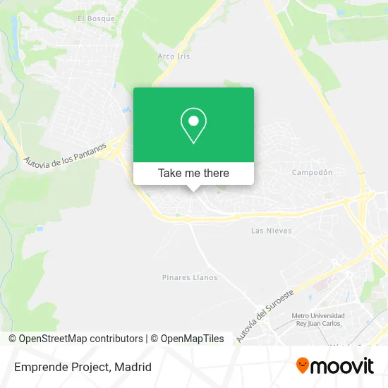
See Emprende Project, Villaviciosa De Odón, on the map
Public Transit to Emprende Project in Villaviciosa De Odón
Wondering how to get to Emprende Project in Villaviciosa De Odón? Moovit helps you find the best way to get to Emprende Project with step-by-step directions from the nearest public transit station.
Moovit provides free maps and live directions to help you navigate through your city. View schedules, routes, timetables, and find out how long does it take to get to Emprende Project in real time.
Looking for the nearest stop or station to Emprende Project? Check out this list of stops closest to your destination: Av. Ppe. Asturias - Vicente Blasco Ibáñez; Av. Ppe. Asturias - Centro De Salud; Av. Príncipe Asturias - Pelícano; Av. Calatalifa - Magnolia; Universidad Rey Juan Carlos; Móstoles - El Soto.
Bus: 510A, 518, 519, 551, 567, 519A, 510, 510B, N504, 581.Train: C5.Metro: M-12.
Want to see if there’s another route that gets you there at an earlier time? Moovit helps you find alternative routes or times. Get directions from and directions to Emprende Project easily from the Moovit App or Website.
We make riding to Emprende Project easy, which is why over 1.5 million users, including users in Villaviciosa De Odón, trust Moovit as the best app for public transit. You don’t need to download an individual bus app or train app, Moovit is your all-in-one transit app that helps you find the best bus time or train time available.
For information on prices of bus, metro and train, costs and ride fares to Emprende Project, please check the Moovit app.
Use the app to navigate to popular places including to the airport, hospital, stadium, grocery store, mall, coffee shop, school, college, and university.
Emprende Project Address: Avenida Príncipe de Asturias, 129 28670 Villaviciosa de Odón street in Villaviciosa De Odón
- Lopez Perea Pilar,
- Ibra Barber Shop,
- La Casa del Aloe Vera,
- Spazio Decorativo GM,
- Holly S Studio,
- Giulia di Labi,
- Fichalia 2024,
- El Cruce,
- Bsr Cafetería,
- Logo Sonrisas,
- Servicios Hosteleros a Colectividades,
- Srta Pizpiretta Arreg,
- Laboral Risk Madrid,
- BM Supermercados,
- Centro Comercial Villacenter,
- Fotomatón,
- Stech Milano,
- Ferrokey Villaviciosa de Odón Sánchez Filio Industrial,
- Avenida Príncipe de Asturias 127,
- Parada del mercadona
Places Near Emprende Project (Villaviciosa De Odón)
- Palacio De Vistalegre, Área Metropolitana De Madrid Y Corredor Del Henares,
- Rastro De Madrid, Área Metropolitana De Madrid Y Corredor Del Henares,
- Estadio Wanda Metropolitano, Área Metropolitana De Madrid Y Corredor Del Henares,
- Tres Aguas, Alcorcón,
- Mendez Alvaro, Madrid,
- Hospital Clínico Universitario San Carlos, Madrid,
- Hospital Universitario Ramón y Cajal, Madrid,
- Calle de López de Hoyos 169, Madrid,
- Plaza Mayor, Madrid,
- Centro Comercial La Gavia, Área Metropolitana De Madrid Y Corredor Del Henares,
- Plenilunio, Área Metropolitana De Madrid Y Corredor Del Henares,
- Mercadillo de Majadahonda, Majadahonda,
- Sala La Riviera, Madrid,
- Wizink Center, Madrid,
- Hospital Universitario La Paz, Madrid,
- Centro Comercial Islazul, Área Metropolitana De Madrid Y Corredor Del Henares,
- Nassica, Área Metropolitana De Madrid Y Corredor Del Henares,
- Estacion de Chamartin, Madrid,
- Centro Comercial La Vaguada, Área Metropolitana De Madrid Y Corredor Del Henares,
- Centro Comercial Oasiz Madrid, Área Metropolitana De Madrid Y Corredor Del Henares
How to get to popular places in Madrid with public transit
Get around Villaviciosa De Odón by public transit!
Traveling around Villaviciosa De Odón has never been so easy. See step by step directions as you travel to any attraction, street or major public transit station. View bus and train schedules, arrival times, service alerts and detailed routes on a map, so you know exactly how to get to anywhere in Villaviciosa De Odón.
When traveling to any destination around Villaviciosa De Odón use Moovit's Live Directions with Get Off Notifications to know exactly where and how far to walk, how long to wait for your line, and how many stops are left. Moovit will alert you when it's time to get off — no need to constantly re-check whether yours is the next stop.
Wondering how to use public transit in Villaviciosa De Odón or how to pay for public transit in Villaviciosa De Odón? Moovit public transit app can help you navigate your way with public transit easily, and at minimum cost. It includes public transit fees, ticket prices, and costs. Looking for a map of Villaviciosa De Odón public transit lines? Moovit public transit app shows all public transit maps in Villaviciosa De Odón with all Bus, Train, Metro and Light Rail routes and stops on an interactive map.
Madrid has 4 transit type(s), including: Bus, Train, Metro and Light Rail, operated by several transit agencies, including Metro de Madrid, Metro Ligero, Tranvía de Parla, Renfe Cercanías - Servicios de Autobús especiales, Renfe Cercanias, Renfe Cercanías, EMT, Interurbanos, Urbanos de Alcalá de Henares, Urbanos de Alcobendas, Urbanos de Alcorcón, Urbanos de Algete, Urbanos de Aranjuez, Urbanos de Arganda del Rey and Urbanos de Arroyomolinos