Directions to Erindale Academy (Mississauga) with public transportation
The following transit lines have routes that pass near Erindale Academy
How to get to Erindale Academy by bus?
Click on the bus route to see step by step directions with maps, line arrival times and updated time schedules.
How to get to Erindale Academy by train?
Click on the train route to see step by step directions with maps, line arrival times and updated time schedules.
Bus stations near Erindale Academy in Mississauga
- Mississauga Rd At The Collegeway, 7 min walk,
- Dundas St at the Credit Woodlands, 12 min walk,
Bus lines to Erindale Academy in Mississauga
- 1, 1 W Dundas To Ridgeway,
- 6, 6 E Credit Woodlands To City Centre,
What are the closest stations to Erindale Academy?
The closest stations to Erindale Academy are:
- Mississauga Rd At The Collegeway is 487 meters away, 7 min walk.
- Dundas St at the Credit Woodlands is 862 meters away, 12 min walk.
Which bus line stops near Erindale Academy?
1
Which train line stops near Erindale Academy?
MI
What’s the nearest bus stop to Erindale Academy in Mississauga?
The nearest bus stop to Erindale Academy in Mississauga is Mississauga Rd At The Collegeway. It’s a 7 min walk away.
What time is the first bus to Erindale Academy in Mississauga?
The 1 is the first bus that goes to Erindale Academy in Mississauga. It stops nearby at 3:07 AM.
What time is the last bus to Erindale Academy in Mississauga?
The 1 is the last bus that goes to Erindale Academy in Mississauga. It stops nearby at 3:10 AM.
How much is the bus fare to Erindale Academy?
The bus fare to Erindale Academy costs about $3.10 - $3.75.
See Erindale Academy, Mississauga, on the map
Public Transit to Erindale Academy in Mississauga
Wondering how to get to Erindale Academy in Mississauga, Canada? Moovit helps you find the best way to get to Erindale Academy with step-by-step directions from the nearest public transit station.
Moovit provides free maps and live directions to help you navigate through your city. View schedules, routes, timetables, and find out how long does it take to get to Erindale Academy in real time.
Looking for the nearest stop or station to Erindale Academy? Check out this list of stops closest to your destination: Mississauga Rd At The Collegeway; Dundas St at the Credit Woodlands.
Bus: 1, 6.Train: MI.
Want to see if there’s another route that gets you there at an earlier time? Moovit helps you find alternative routes or times. Get directions from and directions to Erindale Academy easily from the Moovit App or Website.
We make riding to Erindale Academy easy, which is why over 1.5 million users, including users in Mississauga, trust Moovit as the best app for public transit. You don’t need to download an individual bus app or train app, Moovit is your all-in-one transit app that helps you find the best bus time or train time available.
For information on prices of bus and train, costs and ride fares to Erindale Academy, please check the Moovit app.
Use the app to navigate to popular places including to the airport, hospital, stadium, grocery store, mall, coffee shop, school, college, and university.
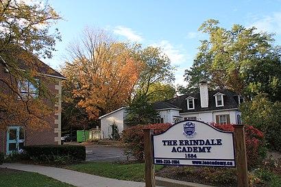
Erindale Academy Address: 1576 Dundas St W Mississauga, ON L5C street in Mississauga
Attractions near Erindale Academy
Froebel Education Centre,The Erindale Academy,Starbucks,Bello Law,Dundas St at Robinson St,Chabad Hebrew School,Davidson Douglas M,The Beer Store,U-Haul,Toronto Mortgage Exchange,Nicholas Obal - Real Estate Salesperson,Sally Beauty Supply,Pasch, Robert & Associates,Tanya Crepulja, Sales Representative,Hassan Bukhari - Mississauga Real Estate Agent,The Sutton Group,The Printed Copy,Michael Czan's Real Estate Team,Our Dogs' Life,Dundas St at Nanticoke RDHow to get to popular attractions in Mississauga with public transit
Downey's Farm, Brampton,Porter Airline Passenger Pickup, Toronto,4256 Bathurst St. Medical Centre, Toronto,University Avenue & Armoury Street, Toronto,GO Train - Barrie, Toronto,Highway 401 & 404 Merge, Toronto,York Mills Go Bus Terminal, Toronto,Humber College - Lakeshore Campus, Toronto,Amazon (YYZ14), Toronto,Jack Layton Ferry Terminal, Toronto,Pickering Town Centre, Pickering,Saint Clair Avenue East, Toronto,Seneca College-Newnham, Toronto,Brock Rd, Pickering,181 Bay Street, Toronto,Yonge & Eglinton, Toronto,Sobeys, Toronto,Keele Street, Toronto,CNE Bandshell, Toronto,Rogers Centre, TorontoGet around Toronto by public transit!
Traveling around Toronto has never been so easy. See step by step directions as you travel to any attraction, street or major public transit station. View bus and train schedules, arrival times, service alerts and detailed routes on a map, so you know exactly how to get to anywhere in Toronto.
When traveling to any destination around Toronto use Moovit's Live Directions with Get Off Notifications to know exactly where and how far to walk, how long to wait for your line, and how many stops are left. Moovit will alert you when it's time to get off — no need to constantly re-check whether yours is the next stop.
Wondering how to use public transit in Toronto or how to pay for public transit in Toronto? Moovit public transit app can help you navigate your way with public transit easily, and at minimum cost. It includes public transit fees, ticket prices, and costs. Looking for a map of Toronto public transit lines? Moovit public transit app shows all public transit maps in Toronto with all Bus, Train, Subway, Streetcar and Ferry routes and stops on an interactive map.
Toronto has 5 transit type(s), including: Bus, Train, Subway, Streetcar and Ferry, operated by several transit agencies, including TTC, TTC Streetcar, Toronto Subway, GO Transit Bus, GO Transit, Amtrak, York Region Transit, Grand River Transit, Guelph Transit, grt, Hamilton Street Railway, MiWay, Brampton Transit, Burlington Transit, Oakville Transit