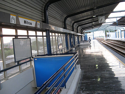
Estación Mitras stop - Wednesday schedule
| Line | Direction | Time |
|---|---|---|
| ECO | Valle Soleado - Lincoln | 5:05 |
| L01 | Dirección Exposición | 5:11 |
| L01 | Dirección Exposición | 5:19 |
| L01 | Dirección Talleres | 5:23 |
| ECO | Lincoln - Valle Soleado | 5:24 |
| L01 | Dirección Exposición | 5:27 |
| L01 | Dirección Talleres | 5:31 |
| L01 | Dirección Exposición | 5:35 |
| ECO | Valle Soleado - Lincoln | 5:38 |
| L01 | Dirección Talleres | 5:39 |
| L01 | Dirección Exposición | 5:43 |
| L01 | Dirección Talleres | 5:47 |
| L01 | Dirección Exposición | 5:51 |
| ECO | Lincoln - Valle Soleado | 5:54 |
| L01 | Dirección Talleres | 5:55 |
| L01 | Dirección Exposición | 5:59 |
| L01 | Dirección Talleres | 6:03 |
| L01 | Dirección Exposición | 6:07 |
| ECO | Valle Soleado - Lincoln | 6:08 |
| L01 | Dirección Talleres | 6:11 |
| L01 | Dirección Exposición | 6:15 |
| L01 | Dirección Talleres | 6:19 |
| L01 | Dirección Exposición | 6:21 |
| ECO | Lincoln - Valle Soleado | 6:24 |
| L01 | Dirección Exposición | 6:26 |
See Estación Mitras, Nuevo León, on the map
Directions to Estación Mitras (Nuevo León) with public transportation
The following transit lines have routes that pass near Estación Mitras
 Bus:
Bus: - Metrorrey:
How to get to Estación Mitras by bus?
Click on the bus route to see step by step directions with maps, line arrival times and updated time schedules.
How to get to Estación Mitras by Metrorrey?
Click on the Metrorrey route to see step by step directions with maps, line arrival times and updated time schedules.
Bus stations near Estación Mitras in Nuevo León
- Rodrigo Gómez (Estación Mitras),1 min walk,
- Rodrigo Gómez (Golfo de California - Adolfo Ruíz Cortines),2 min walk,
- Golfo de California, 142a,4 min walk,
Metrorrey stations near Estación Mitras in Nuevo León
- Estación Hospital,25 min walk,
Bus lines to Estación Mitras in Nuevo León
- 201,Perimetral Norte - Estación Mitras,
- 201,Perimetral Sur - Estación Mitras,
- TME,Mitras - Villas de San Francisco,
- 013,San Miguel - C4,
- 013,Pedregal - Alianza Real,
- 013,Barrio Oaxaca - Camino Real,
- 310,Fomerrey 110 - Valle de Lincoln - Penal,
- 113,Canteras,
- 314,Paraje San José - Central de Autobuses,
- 340,Palmiras - Clínica 17,
What are the closest stations to Estación Mitras?
The closest stations to Estación Mitras are:
- Rodrigo Gómez (Estación Mitras) is 18 meters away, 1 min walk.
- Rodrigo Gómez (Golfo de California - Adolfo Ruíz Cortines) is 78 meters away, 2 min walk.
- Golfo de California, 142a is 243 meters away, 4 min walk.
- Estación Hospital is 1898 meters away, 25 min walk.
Which bus lines stop near Estación Mitras?
These bus lines stop near Estación Mitras: 013, 113, 201, ECO.
Which Metrorrey line stops near Estación Mitras?
L01
What’s the nearest Metrorrey station to Estación Mitras in Nuevo León?
The nearest Metrorrey station to Estación Mitras in Nuevo León is Estación Hospital. It’s a 25 min walk away.
What’s the nearest bus stop to Estación Mitras in Nuevo León?
The nearest bus stop to Estación Mitras in Nuevo León is Rodrigo Gómez (Estación Mitras). It’s a 1 min walk away.
What time is the first Metrorrey to Estación Mitras in Nuevo León?
The L01 is the first Metrorrey that goes to Estación Mitras in Nuevo León. It stops nearby at 5:08 AM.
What time is the last Metrorrey to Estación Mitras in Nuevo León?
The L01 is the last Metrorrey that goes to Estación Mitras in Nuevo León. It stops nearby at 12:11 AM.
What time is the first bus to Estación Mitras in Nuevo León?
The 340 is the first bus that goes to Estación Mitras in Nuevo León. It stops nearby at 4:01 AM.
What time is the last bus to Estación Mitras in Nuevo León?
The 314 is the last bus that goes to Estación Mitras in Nuevo León. It stops nearby at 1:28 AM.
See Estación Mitras, Nuevo León, on the map
Public transit to Estación Mitras stop in Nuevo León
Looking for directions to Estación Mitras in Nuevo León, México?
Download the Moovit App to find the current schedule and step-by-step directions for Bus or Metrorrey routes that pass through Estación Mitras.
Looking for the nearest stops closest to Estación Mitras ? Check out this list of closest stops to your destination: Rodrigo Gómez (Estación Mitras); Rodrigo Gómez (Golfo de California - Adolfo Ruíz Cortines); Golfo de California; Estación Hospital.
Bus:Metrorrey:
We make riding on public transit to Estación Mitras easy, which is why over 1.5 million users, including users in Nuevo León trust Moovit as the best app for public transit.
Use the app to navigate to popular places including to the airport, hospital, stadium, grocery store, mall, coffee shop, school, college, and university.
The stop has the following entrances: Golfo de California, Rodrigo Gómez, Rodrigo Gómez, Rodrigo Gómez, Rodrigo Gómez and Rodrigo Gómez
The first line to this stop is ECO, at 5:05, and the last line is ECO at 4:52.
0 Rodrigo Gómez, Monterrey, Mexico
This stop serves Metrorrey and Ecovía’s lines
Popular routes from Estación Mitras, Nuevo León
Bus stops near Estación Mitras
Rodrigo Gómez (Estación Mitras),Rodrigo Gómez (Golfo de California - Adolfo Ruíz Cortines),Golfo de California, 142aMetrorrey station near Estación Mitras
Estación HospitalPopular public transit stations in Nuevo León
Cuauhtémoc (Manuel M. Del Llano - Santiago Tapia),Juan Álvarez (Isaac Garza - Jerónimo Treviño),Valle Oriente 223,Gustavo Díaz Ordaz (Clínica 58 Del I.M.S.S.),Raúl Salinas Lozano (Las Torres - Unión),Loma Verde (Loma La Paz - Loma Alta),Entrada de Villas Regina,Adolfo Ruíz Cortines (Jardín de Las Delicias - Nueva Castilla),Av. Colinas de Santa Engracia,Carr. A San Roque (Panteón Jardines de La Resurrección),Padre Mier (Ignacio Zaragoza - Mariano Escobedo),Nogal (Álamo - Abedul),Enrique C. Livas (Undécima Avenida - Lázaro Cárdenas),Félix U. Gómez (Estación Los Ángeles),Estación Cuauhtémoc,Eje Metropolitano 36,Aarón Sáenz Garza (Club de Tiro - Insurgentes),Carlos Salazar (Porfirio Díaz - Ignacio Luis Vallarta),16 de Septiembre (Chihuahua - Baja California),Rodrigo Gómez (Leonor Navarro - Planta)Get around Nuevo León by public transit!
Traveling around Nuevo León has never been so easy. See step by step directions as you travel to any attraction, street or major public transit station. View bus and train schedules, arrival times, service alerts and detailed routes on a map, so you know exactly how to get to anywhere in Nuevo León.
When traveling to any destination around Nuevo León use Moovit's Live Directions with Get Off Notifications to know exactly where and how far to walk, how long to wait for your line, and how many stops are left. Moovit will alert you when it's time to get off — no need to constantly re-check whether yours is the next stop.
Wondering how to use public transit in Nuevo León or how to pay for public transit in Nuevo León? Moovit public transit app can help you navigate your way with public transit easily, and at minimum cost. It includes public transit fees, ticket prices, and costs. Looking for a map of Nuevo León public transit lines? Moovit public transit app shows all public transit maps in Nuevo León with all bus or Metrorrey routes and stops on an interactive map.
Nuevo León has 2 transit type(s), including: bus or Metrorrey, operated by several transit agencies, including Metrorrey, Ecovía, Transmetro, Intramunicipales, Greyhound, Microbús, Circuito Contigo, Metrobús, PSQBUS, Suburbanas, Muevo León, Universidad Autónoma de Nuevo León (UANL), Radiales, Periféricas and Alimentadoras