See Estación de Francos Rodríguez, Madrid, on the map
Directions to Estación de Francos Rodríguez (Madrid) with public transportation
The following transit lines have routes that pass near Estación de Francos Rodríguez
 Bus:
Bus: - Train:
- Metro:
How to get to Estación de Francos Rodríguez by bus?
Click on the bus route to see step by step directions with maps, line arrival times and updated time schedules.
How to get to Estación de Francos Rodríguez by train?
Click on the train route to see step by step directions with maps, line arrival times and updated time schedules.
How to get to Estación de Francos Rodríguez by metro?
Click on the metro route to see step by step directions with maps, line arrival times and updated time schedules.
Bus stations near Estación de Francos Rodríguez in Madrid
- Metro Francos Rodríguez,1 min walk,
- Rubio Y Galí - Francos Rodríguez,3 min walk,
- Francos Rodríguez - Numancia,6 min walk,
Metro stations near Estación de Francos Rodríguez in Madrid
- Alvarado,8 min walk,
- Valdezarza,16 min walk,
Bus lines to Estación de Francos Rodríguez in Madrid
- 127,C. Periodistas,
- 132,Hospital La Paz,
- N21,Arroyo Fresno,
- 64,Pitis,
- 126,Barrio Del Pilar,
- 44,Marques De Viana,
- 128,Barrio Del Pilar,
What are the closest stations to Estación de Francos Rodríguez?
The closest stations to Estación de Francos Rodríguez are:
- Metro Francos Rodríguez is 51 meters away, 1 min walk.
- Rubio Y Galí - Francos Rodríguez is 176 meters away, 3 min walk.
- Francos Rodríguez - Numancia is 436 meters away, 6 min walk.
- Alvarado is 538 meters away, 8 min walk.
- Valdezarza is 1229 meters away, 16 min walk.
Which bus lines stop near Estación de Francos Rodríguez?
These bus lines stop near Estación de Francos Rodríguez: 126, 127, 132, 44, 64.
Which train lines stop near Estación de Francos Rodríguez?
These train lines stop near Estación de Francos Rodríguez: C1, C2, C4B, C7.
Which metro line stops near Estación de Francos Rodríguez?
M-7
What’s the nearest metro station to Estación de Francos Rodríguez in Madrid?
The nearest metro station to Estación de Francos Rodríguez in Madrid is Alvarado. It’s a 8 min walk away.
What’s the nearest bus stop to Estación de Francos Rodríguez in Madrid?
The nearest bus stop to Estación de Francos Rodríguez in Madrid is Metro Francos Rodríguez. It’s a 1 min walk away.
What time is the first metro to Estación de Francos Rodríguez in Madrid?
The M-1 is the first metro that goes to Estación de Francos Rodríguez in Madrid. It stops nearby at 6:05 AM.
What time is the last metro to Estación de Francos Rodríguez in Madrid?
The M-1 is the last metro that goes to Estación de Francos Rodríguez in Madrid. It stops nearby at 2:14 AM.
What time is the first bus to Estación de Francos Rodríguez in Madrid?
The N21 is the first bus that goes to Estación de Francos Rodríguez in Madrid. It stops nearby at 3:00 AM.
What time is the last bus to Estación de Francos Rodríguez in Madrid?
The N21 is the last bus that goes to Estación de Francos Rodríguez in Madrid. It stops nearby at 3:23 AM.
How much is the train fare to Estación de Francos Rodríguez?
The train fare to Estación de Francos Rodríguez costs about €1.70.
How much is the bus fare to Estación de Francos Rodríguez?
The bus fare to Estación de Francos Rodríguez costs about €1.30 - €2.00.
How much is the metro fare to Estación de Francos Rodríguez?
The metro fare to Estación de Francos Rodríguez costs about €1.50 - €2.00.
See Estación de Francos Rodríguez, Madrid, on the map
Public Transit to Estación de Francos Rodríguez in Madrid
Wondering how to get to Estación de Francos Rodríguez in Madrid, Spain? Moovit helps you find the best way to get to Estación de Francos Rodríguez with step-by-step directions from the nearest public transit station.
Moovit provides free maps and live directions to help you navigate through your city. View schedules, routes, timetables, and find out how long does it take to get to Estación de Francos Rodríguez in real time.
Looking for the nearest stop or station to Estación de Francos Rodríguez? Check out this list of stops closest to your destination: Metro Francos Rodríguez; Rubio Y Galí - Francos Rodríguez; Francos Rodríguez - Numancia; Alvarado; Valdezarza.
Bus:Train:Metro:
Want to see if there’s another route that gets you there at an earlier time? Moovit helps you find alternative routes or times. Get directions from and directions to Estación de Francos Rodríguez easily from the Moovit App or Website.
We make riding to Estación de Francos Rodríguez easy, which is why over 1.5 million users, including users in Madrid, trust Moovit as the best app for public transit. You don’t need to download an individual bus app or train app, Moovit is your all-in-one transit app that helps you find the best bus time or train time available.
For information on prices of metro, bus and train, costs and ride fares to Estación de Francos Rodríguez, please check the Moovit app.
Use the app to navigate to popular places including to the airport, hospital, stadium, grocery store, mall, coffee shop, school, college, and university.
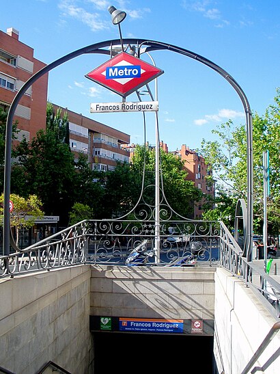
Estación de Francos Rodríguez Address: Avenida de Pablo Iglesias street in Madrid
Attractions near Estación de Francos Rodríguez
Farmacia Lda Marta Ga Solano,Pablo Iglesias, Impares - Francos Rodríguez,Fuente De La Glorieta De Rocío Durcal,Fuente Glorieta de Rocío Dúrcal,Glorieta Francos Rodríguez,Mano a Mano,Avenida de Pablo Iglesias 92,Biblioteca Pública Municipal Manuel Vázquez Montalbán,Escuela Municipal De Música Manuel Vázquez Montalbán,Metro Francos Rodríguez,Colegio Público Ignacio Zuloaga,Cuatro Estaciones,La Mina,Glorieta de Rocío Dúrcal,Biblioteca Manuel Vazquez Montalban,Calle de Francos Rodríguez 67,Francos Rodríguez Madrid Metro,Audrey,Calle de Sánchez Preciado 41, 1, 7,Calle de MoguerHow to get to popular attractions in Madrid with public transit
Plaza De Castilla, Madrid,Prado de Somosaguas, Pozuelo De Alarcón,Museo Arqueológico Nacional, Madrid,El Corte Inglés, Madrid,Universidad Pontificia Comillas - Icade, Madrid,Hospital Universitario De Móstoles., Móstoles,Hospital General Universitario Gregorio Marañón., Madrid,Chueca, Madrid,Facultad De Matemáticas, Madrid,Distrito de Hortaleza, Madrid,Parque Warner, San Martín De La Vega,Faunia, Madrid,Brunete, Brunete,Parque Europa, Torrejón De Ardoz,Colegio De Ee Hospital Infantil San Rafael, Madrid,Collado Villalba, Collado Villalba,Museo Sorolla, Madrid,Parque Del Retiro, Madrid,Fuenlabrada, Fuenlabrada,Netthink Isobar, MadridGet around Madrid by public transit!
Traveling around Madrid has never been so easy. See step by step directions as you travel to any attraction, street or major public transit station. View bus and train schedules, arrival times, service alerts and detailed routes on a map, so you know exactly how to get to anywhere in Madrid.
When traveling to any destination around Madrid use Moovit's Live Directions with Get Off Notifications to know exactly where and how far to walk, how long to wait for your line, and how many stops are left. Moovit will alert you when it's time to get off — no need to constantly re-check whether yours is the next stop.
Wondering how to use public transit in Madrid or how to pay for public transit in Madrid? Moovit public transit app can help you navigate your way with public transit easily, and at minimum cost. It includes public transit fees, ticket prices, and costs. Looking for a map of Madrid public transit lines? Moovit public transit app shows all public transit maps in Madrid with all metro, bus or train routes and stops on an interactive map.
Madrid has 3 transit type(s), including: metro, bus or train, operated by several transit agencies, including Metro de Madrid, Metro Ligero, Tranvía de Parla, Renfe Cercanías - No en este proyecto, Renfe Cercanías, EMT, Interurbanos, Urbanos de Alcalá de Henares, Urbanos de Alcobendas, Urbanos de Alcorcón, Urbanos de Algete, Urbanos de Aranjuez, Urbanos de Arganda del Rey, Urbanos de Arroyomolinos and Urbanos de Boadilla del Monte