How to get to Estrada Adhemar Bebiano by bus?
Click on the bus route to see step by step directions with maps, line arrival times and updated time schedules.
From Guadalupe, Guadalupe
47 minFrom Rua Chaves Faria 64, Imperial De São Cristóvão
30 minFrom RioFarmes, Cidade Nova
44 minFrom Centro, Centro
49 minFrom Policlínica Naval Nossa Senhora da Glória, Tijuca
45 minFrom Rio Imagem, Centro
43 minFrom Estrada de Jacarepaguá, Freguesia (Jacarepaguá)
32 minFrom CEDI - Centro Estadual de Diagnóstico Por Imagem, Centro
44 minFrom Hospital Municipal Moacyr Rodrigues Do Carmo, Duque De Caxias
47 minFrom Hospital Central da Aeronáutica (HCA), Rio Comprido
49 min
How to get to Estrada Adhemar Bebiano by train?
Click on the train route to see step by step directions with maps, line arrival times and updated time schedules.
From Guadalupe, Guadalupe
60 minFrom Rua Chaves Faria 64, Imperial De São Cristóvão
62 minFrom RioFarmes, Cidade Nova
67 minFrom Centro, Centro
54 minFrom Policlínica Naval Nossa Senhora da Glória, Tijuca
66 minFrom Rio Imagem, Centro
54 minFrom CEDI - Centro Estadual de Diagnóstico Por Imagem, Centro
56 minFrom Hospital Central da Aeronáutica (HCA), Rio Comprido
68 min
How to get to Estrada Adhemar Bebiano by metro?
Click on the metro route to see step by step directions with maps, line arrival times and updated time schedules.
From Rua Chaves Faria 64, Imperial De São Cristóvão
48 minFrom RioFarmes, Cidade Nova
41 minFrom Centro, Centro
41 minFrom Policlínica Naval Nossa Senhora da Glória, Tijuca
50 minFrom Rio Imagem, Centro
37 minFrom CEDI - Centro Estadual de Diagnóstico Por Imagem, Centro
39 minFrom Hospital Central da Aeronáutica (HCA), Rio Comprido
56 min
Bus stops near Estrada Adhemar Bebiano in Inhaúma
Metro station near Estrada Adhemar Bebiano in Inhaúma
- Inhaúma, 8 min walk,VIEW
Train station near Estrada Adhemar Bebiano in Inhaúma
- Del Castilho, 10 min walk,VIEW
Bus lines to Estrada Adhemar Bebiano in Inhaúma
- 292, Engenho da Rainha - Castelo (Brs 4 - Via Bonsucesso / Av. Brasil),VIEW
- 296, Irajá - Castelo (Brs 4 - Via Norte Shopping),VIEW
- 311, Engenheiro Leal - Candelária (Brs 4 - Via Del Castilho / São Cristóvão),VIEW
- 492L, Caxias - Engenho da Rainha (Via Itaóca),VIEW
- 629, Irajá - Saens Peña,VIEW
- SN 629, Irajá - Saens Peña,VIEW
- 687, Pavuna - Méier (Via Est. Velha da Pavuna),VIEW
- 711, Rocha Miranda - Rio Comprido (Brs 6 - Via Inhaúma / Benfica),VIEW
- 908, Terminal Deodoro - Bonsucesso (Direto - Via Guadalupe / Metrô Inhaúma),VIEW
- 946, Pavuna - Engenho da Rainha (via Norte Shopping - Madureira Shopping),VIEW
- SN 908, Terminal Deodoro,VIEW
- SV 908, Bonsucesso,VIEW
- 688, Pavuna,VIEW
What are the closest stations to Estrada Adhemar Bebiano?
The closest stations to Estrada Adhemar Bebiano are:
- Estrada Adhemar Bebiano, 2702 is 48 meters away, 1 min walk.
- Rua Dona Emília, 162 is 176 meters away, 3 min walk.
- Rua Padre Januário, 137-277 is 360 meters away, 5 min walk.
- Metrô Inhaúma is 607 meters away, 8 min walk.
- Inhaúma is 613 meters away, 8 min walk.
- Del Castilho is 736 meters away, 10 min walk.
Which bus lines stop near Estrada Adhemar Bebiano?
These bus lines stop near Estrada Adhemar Bebiano: 292, 311, 629, 687, 946.
Which metro line stops near Estrada Adhemar Bebiano?
L2 (Pavuna)
Which train line stops near Estrada Adhemar Bebiano?
RAMAL BELFORD ROXO (Central do Brasil)
What’s the nearest metro station to Estrada Adhemar Bebiano in Inhaúma?
The nearest metro station to Estrada Adhemar Bebiano in Inhaúma is Inhaúma. It’s a 8 min walk away.
What’s the nearest train station to Estrada Adhemar Bebiano in Inhaúma?
The nearest train station to Estrada Adhemar Bebiano in Inhaúma is Del Castilho. It’s a 10 min walk away.
What’s the nearest bus station to Estrada Adhemar Bebiano in Inhaúma?
The nearest bus station to Estrada Adhemar Bebiano in Inhaúma is Estrada Adhemar Bebiano, 2702. It’s a 1 min walk away.
What time is the first metro to Estrada Adhemar Bebiano in Inhaúma?
The L2 is the first metro that goes to Estrada Adhemar Bebiano in Inhaúma. It stops nearby at 5:16 AM.
What time is the last metro to Estrada Adhemar Bebiano in Inhaúma?
The L2 is the last metro that goes to Estrada Adhemar Bebiano in Inhaúma. It stops nearby at 12:35 AM.
What time is the first train to Estrada Adhemar Bebiano in Inhaúma?
The RAMAL BELFORD ROXO is the first train that goes to Estrada Adhemar Bebiano in Inhaúma. It stops nearby at 5:05 AM.
What time is the last train to Estrada Adhemar Bebiano in Inhaúma?
The RAMAL BELFORD ROXO is the last train that goes to Estrada Adhemar Bebiano in Inhaúma. It stops nearby at 10:18 PM.
What time is the first bus to Estrada Adhemar Bebiano in Inhaúma?
The SN 908 is the first bus that goes to Estrada Adhemar Bebiano in Inhaúma. It stops nearby at 3:13 AM.
What time is the last bus to Estrada Adhemar Bebiano in Inhaúma?
The SN 908 is the last bus that goes to Estrada Adhemar Bebiano in Inhaúma. It stops nearby at 2:57 AM.
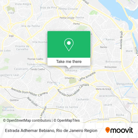
See Estrada Adhemar Bebiano, Inhaúma, on the map
Public Transit to Estrada Adhemar Bebiano in Inhaúma
Wondering how to get to Estrada Adhemar Bebiano in Inhaúma? Moovit helps you find the best way to get to Estrada Adhemar Bebiano with step-by-step directions from the nearest public transit station.
Moovit provides free maps and live directions to help you navigate through your city. View schedules, routes, timetables, and find out how long does it take to get to Estrada Adhemar Bebiano in real time.
Looking for the nearest stop or station to Estrada Adhemar Bebiano? Check out this list of stops closest to your destination: Estrada Adhemar Bebiano; Rua Dona Emília; Rua Padre Januário; Metrô Inhaúma; Inhaúma; Del Castilho.
Bus: 292, 311, 629, 687, 946, 296, 492L, SN 908, SV 908, 688.Metro: L2.Train: RAMAL BELFORD ROXO.
Want to see if there’s another route that gets you there at an earlier time? Moovit helps you find alternative routes or times. Get directions from and directions to Estrada Adhemar Bebiano easily from the Moovit App or Website.
We make riding to Estrada Adhemar Bebiano easy, which is why over 1.5 million users, including users in Inhaúma, trust Moovit as the best app for public transit. You don’t need to download an individual bus app or train app, Moovit is your all-in-one transit app that helps you find the best bus time or train time available.
For information on prices of bus, metro and train, costs and ride fares to Estrada Adhemar Bebiano, please check the Moovit app.
Use the app to navigate to popular places including to the airport, hospital, stadium, grocery store, mall, coffee shop, school, college, and university.
Estrada Adhemar Bebiano Address: Estrada Adhemar Bebiano, Rio de Janeiro - RJ, Brasil street in Inhaúma
- Ducao Pet Shop,
- Travessa Paiva Brito / Estrada Adhemar Bebiano,
- Ipiranga (Posto de Gasolina Coroa do Mar Ltda),
- Tatá Festa - Salão de Festas,
- pagode da piscina,
- Rua Jaó / Rua Castro Lopes,
- Rua Castro Lopes 152,
- Litografia Valença,
- Rua Dona Emília, 148,
- Rua Dona Emilia Próximo ao 200,
- Roda de Samba da Feira de Inhaúma,
- Rua Dona Emília / Rua Teixeira de Macedo,
- Rua Dona Emília / Estrada Adhemar Bebiano,
- Rua Jaó 20,
- Igreja Metodista Em Inhauma,
- Rua Dona Emília,
- Feira de Inhaúma,
- Gloria's Salão Rua Antonio Austregésilo 353, Inhauma,
- Est Adhemar Bebiano 2806,
- So Kombi 178 Auto Pecas
Places Near Estrada Adhemar Bebiano (Inhaúma)
- Rio De Janeiro,
- Shopping Nova América, Del Castilho,
- Shopping RioSul, Botafogo,
- Feira Livre da Gloria, Glória,
- Hospital Municipal Ronaldo Gazolla, Acari,
- Feirão De Malhas, Duque De Caxias,
- Rodoviária Novo Rio (Rodoviária do Rio de Janeiro), Santo Cristo,
- Praia do Arpoador, Ipanema,
- Museu Do Amanhã, Centro,
- Rua Ulysses Guimarães 16, Cidade Nova,
- Hospital Pedro Ernesto, Vila Isabel,
- Niterói, Niterói,
- Rua Licínio Cardoso, São Francisco Xavier,
- Norte Shopping, Cachambi,
- Shopping Downtown, Barra Da Tijuca,
- Avenida Venezuela 134, Saúde,
- Hospital Federal Do Andaraí, Andaraí,
- Hospital Federal Cardoso Fontes, Jacarepaguá,
- Avenida Rio Branco, Centro,
- Shopping Rio Sul, Botafogo
How to get to popular places in Rio de Janeiro Region with public transit
Get around Inhaúma by public transit!
Traveling around Inhaúma has never been so easy. See step by step directions as you travel to any attraction, street or major public transit station. View bus and train schedules, arrival times, service alerts and detailed routes on a map, so you know exactly how to get to anywhere in Inhaúma.
When traveling to any destination around Inhaúma use Moovit's Live Directions with Get Off Notifications to know exactly where and how far to walk, how long to wait for your line, and how many stops are left. Moovit will alert you when it's time to get off — no need to constantly re-check whether yours is the next stop.
Wondering how to use public transit in Inhaúma or how to pay for public transit in Inhaúma? Moovit public transit app can help you navigate your way with public transit easily, and at minimum cost. It includes public transit fees, ticket prices, and costs. Looking for a map of Inhaúma public transit lines? Moovit public transit app shows all public transit maps in Inhaúma with all Bus, Train, Metro, Light Rail, Ferry, Cable Car, Gondola and Funicular routes and stops on an interactive map.
Rio de Janeiro Region has 8 transit type(s), including: Bus, Train, Metro, Light Rail, Ferry, Cable Car, Gondola and Funicular, operated by several transit agencies, including TrensRJ, Metrô Rio, VLT Carioca, Barcas Rio, BRT MOBI-Rio, Auto Viação Alpha, Auto Viação Tijuca, Gire Transportes, Transurb, Viação Nossa Senhora das Graças, Consórcio INTERSUL, Braso Lisboa (Municipal), Caprichosa Auto Ônibus, Auto Viação Três Amigos and Rodoviária Âncora Matias