Directions to Euroguild (Norwood) with public transportation
The following transit lines have routes that pass near Euroguild
 Bus: 34E.
- Train: FRANKLIN/FOXBORO.
How to get to Euroguild by bus?
Click on the bus route to see step by step directions with maps, line arrival times and updated time schedules.
How to get to Euroguild by train?
Click on the train route to see step by step directions with maps, line arrival times and updated time schedules.
Bus stop near Euroguild in Norwood
- Washington St @ Short St, 4 min walk,VIEW
Train station near Euroguild in Norwood
- Norwood Depot, 9 min walk,VIEW
Bus lines to Euroguild in Norwood
- 34E, Forest Hills,VIEW
What are the closest stations to Euroguild?
The closest stations to Euroguild are:
- Washington St @ Short St is 285 yards away, 4 min walk.
- Norwood Depot is 682 yards away, 9 min walk.
Which bus line stops near Euroguild?
34E (Walpole Center Via Washington St)
Which train line stops near Euroguild?
FRANKLIN/FOXBORO (#1709 | Foxboro)
What’s the nearest train station to Euroguild in Norwood?
The nearest train station to Euroguild in Norwood is Norwood Depot. It’s a 9 min walk away.
What’s the nearest bus station to Euroguild in Norwood?
The nearest bus station to Euroguild in Norwood is Washington St @ Short St. It’s a 4 min walk away.
What time is the first bus to Euroguild in Norwood?
The 34E is the first bus that goes to Euroguild in Norwood. It stops nearby at 5:43 AM.
What time is the last bus to Euroguild in Norwood?
The 34E is the last bus that goes to Euroguild in Norwood. It stops nearby at 1:02 AM.
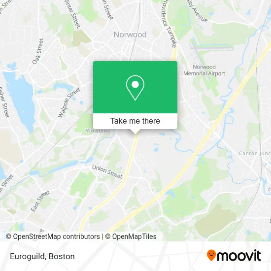
See Euroguild, Norwood, on the map
Public Transit to Euroguild in Norwood
Wondering how to get to Euroguild in Norwood? Moovit helps you find the best way to get to Euroguild with step-by-step directions from the nearest public transit station.
Moovit provides free maps and live directions to help you navigate through your city. View schedules, routes, timetables, and find out how long does it take to get to Euroguild in real time.
Looking for the nearest stop or station to Euroguild? Check out this list of stops closest to your destination: Washington St @ Short St; Norwood Depot.
Bus: 34E.Train: FRANKLIN/FOXBORO.
Want to see if there’s another route that gets you there at an earlier time? Moovit helps you find alternative routes or times. Get directions from and directions to Euroguild easily from the Moovit App or Website.
We make riding to Euroguild easy, which is why over 1.7 million users, including users in Norwood, trust Moovit as the best app for public transit. You don’t need to download an individual bus app or train app, Moovit is your all-in-one transit app that helps you find the best bus time or train time available.
For information on prices of bus and train, costs and ride fares to Euroguild, please check the Moovit app.
Use the app to navigate to popular places including to the airport, hospital, stadium, grocery store, mall, coffee shop, school, college, and university.
Euroguild Address: 1275 Boston Providence Tpke street in Norwood
- Holiday Inn Express & Suites Norwood-Boston Area, an Ihg Hotel,
- Residence Inn Boston Norwood,
- Carmax,
- Neponset River Regional Chamber,
- Little D's Kitchen,
- Magic Room,
- Luke Adams Glass,
- DMG Brokerage,
- FOUR POINTS BY SHERATON-Norwood,
- Four Points by Sheraton Norwood Hotel & Conference Center,
- Nucar Volkswagen of Norwood,
- Friendly's (Friendlys Restuarants),
- Julian A,
- NJD Painting,
- Rouhana Auto Sales,
- Dedham Flower Shop,
- Primestone Masonry,
- Norwood Youth Football & Cheer,
- Superior Locksmith of Norwood,
- Monster Mini-Golf
Places Near Euroguild (Norwood)
- House Of Blues, Boston,
- Seaport District, Boston,
- Leader Bank Pavilion (Leader Bank Pavillion), Boston,
- Td Garden, Boston,
- North End, Boston,
- Castle Island, Boston,
- Boston Common, Boston,
- Boston Medical Center, Boston,
- Museum Of Science, Boston,
- Massachusetts General Hospital, Boston,
- Isabella Stewart Gardner Museum, Boston,
- Prudential Center, Boston,
- Wang Theater, Boston,
- Wilbur Theatre, Boston,
- Boston Convention & Exhibition Center, Boston,
- Faneuil Hall, Boston,
- Boston Children's Hospital, Boston,
- Mgm Music Hall, Boston,
- Quincy Market, Boston,
- Cheers, Boston
How to get to popular places in Boston with public transit
Get around Norwood by public transit!
Traveling around Norwood has never been so easy. See step by step directions as you travel to any attraction, street or major public transit station. View bus and train schedules, arrival times, service alerts and detailed routes on a map, so you know exactly how to get to anywhere in Norwood.
When traveling to any destination around Norwood use Moovit's Live Directions with Get Off Notifications to know exactly where and how far to walk, how long to wait for your line, and how many stops are left. Moovit will alert you when it's time to get off — no need to constantly re-check whether yours is the next stop.
Wondering how to use public transit in Norwood or how to pay for public transit in Norwood? Moovit public transit app can help you navigate your way with public transit easily, and at minimum cost. It includes public transit fees, ticket prices, and costs. Looking for a map of Norwood public transit lines? Moovit public transit app shows all public transit maps in Norwood with all Bus, Train, Subway and Ferry routes and stops on an interactive map.
Boston has 4 transit type(s), including: Bus, Train, Subway and Ferry, operated by several transit agencies, including MBTA, Southeastern Regional Transit Authority, MetroWest Regional Transit Authority, Rhode Island Public Transit Authority, WRTA, Lowell Regional Transit Authority, Merrimack Valley Transit, Montachusett Regional Transit Authority, Cape Cod Regional Transit Authority, Brockton Area Transit Authority, Martha's Vineyard Transit Authority, the WAVE - Nantucket Regional Transit Authority, GATRA, Cape Ann Transportation Authority and Massport