Directions to Evan Richman Photography & Video (Boston) with public transportation
The following transit lines have routes that pass near Evan Richman Photography & Video
 Bus: 65, GREEN LINE C SHUTTLE, GREEN LINE C SHUTTLE, SHUTTLE, GREEN LINE B SHUTTLE.
- Train: FRAMINGHAM/WORCESTER.
- Subway: GREEN LINE B, GREEN LINE C.
How to get to Evan Richman Photography & Video by bus?
Click on the bus route to see step by step directions with maps, line arrival times and updated time schedules.
From The Beehive, Boston
46 minFrom Massachusetts General Hospital, Boston
52 minFrom Seaport Boston Hotel, Boston
58 minFrom DoubleTree by Hilton Boston Logan Airport Chelsea, Chelsea
95 minFrom Bunker Hill Monument, Boston
72 minFrom Faneuil Hall, Boston
49 minFrom Terminal E- Logan International Airport, Boston
45 minFrom Silver Line Stop Terminal B, Boston
48 minFrom Terminal B- Logan International Airport, Boston
48 minFrom Massport Security Badge Office, Boston
45 min
How to get to Evan Richman Photography & Video by train?
Click on the train route to see step by step directions with maps, line arrival times and updated time schedules.
How to get to Evan Richman Photography & Video by subway?
Click on the subway route to see step by step directions with maps, line arrival times and updated time schedules.
From The Beehive, Boston
49 minFrom Silver Line Stop Terminal B, Boston
78 minFrom Terminal B- Logan International Airport, Boston
78 minFrom Massachusetts General Hospital, Boston
53 minFrom Seaport Boston Hotel, Boston
67 minFrom Bunker Hill Monument, Boston
68 minFrom Faneuil Hall, Boston
49 minFrom Terminal E- Logan International Airport, Boston
62 minFrom Massport Security Badge Office, Boston
62 min
Bus stops near Evan Richman Photography & Video in Boston
Subway stations near Evan Richman Photography & Video in Boston
Bus lines to Evan Richman Photography & Video in Boston
- 65, Kenmore,VIEW
- GREEN LINE C SHUTTLE, Cleveland Circle - Saint Mary's Street,VIEW
- GREEN LINE C SHUTTLE, Cleveland Circle - Coolidge Corner,VIEW
- SHUTTLE, Cleveland Circle - Kenmore (Shuttle),VIEW
- GREEN LINE B SHUTTLE, Boston College - Babcock Street,VIEW
- GREEN LINE B SHUTTLE, Boston College - Blandford Street,VIEW
- GREEN LINE B SHUTTLE, Washington Street - Kenmore,VIEW
- GREEN LINE B SHUTTLE, Boston College - Washington Street,VIEW
- GREEN LINE B SHUTTLE, Washington Street - Blandford Street,VIEW
- GREEN LINE B SHUTTLE, Boston College - Back Bay (Shuttle),VIEW
- GREEN LINE B SHUTTLE, Boston College - Packard's Corner,VIEW
- SHUTTLE, Boston College - Kenmore (Shuttle),VIEW
What are the closest stations to Evan Richman Photography & Video?
The closest stations to Evan Richman Photography & Video are:
- Washington St @ Beacon St is 136 yards away, 2 min walk.
- Tappan Street is 273 yards away, 4 min walk.
- Washington Street - Commonwealth Ave @ Washington St is 418 yards away, 5 min walk.
- Washington Street is 599 yards away, 8 min walk.
Which bus line stops near Evan Richman Photography & Video?
65 (Brighton Center)
Which train line stops near Evan Richman Photography & Video?
FRAMINGHAM/WORCESTER (#521 | Worcester)
Which subway line stops near Evan Richman Photography & Video?
GREEN LINE B (Boston College)
What’s the nearest subway station to Evan Richman Photography & Video in Boston?
The nearest subway station to Evan Richman Photography & Video in Boston is Tappan Street. It’s a 4 min walk away.
What’s the nearest bus station to Evan Richman Photography & Video in Boston?
The nearest bus station to Evan Richman Photography & Video in Boston is Washington St @ Beacon St. It’s a 2 min walk away.
What time is the first subway to Evan Richman Photography & Video in Boston?
The GREEN LINE C is the first subway that goes to Evan Richman Photography & Video in Boston. It stops nearby at 5:04 AM.
What time is the last subway to Evan Richman Photography & Video in Boston?
The GREEN LINE B is the last subway that goes to Evan Richman Photography & Video in Boston. It stops nearby at 2:30 AM.
What time is the first bus to Evan Richman Photography & Video in Boston?
The 65 is the first bus that goes to Evan Richman Photography & Video in Boston. It stops nearby at 6:00 AM.
What time is the last bus to Evan Richman Photography & Video in Boston?
The 65 is the last bus that goes to Evan Richman Photography & Video in Boston. It stops nearby at 8:55 PM.
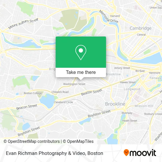
See Evan Richman Photography & Video, Boston, on the map
Public Transit to Evan Richman Photography & Video in Boston
Wondering how to get to Evan Richman Photography & Video in Boston? Moovit helps you find the best way to get to Evan Richman Photography & Video with step-by-step directions from the nearest public transit station.
Moovit provides free maps and live directions to help you navigate through your city. View schedules, routes, timetables, and find out how long does it take to get to Evan Richman Photography & Video in real time.
Looking for the nearest stop or station to Evan Richman Photography & Video? Check out this list of stops closest to your destination: Washington St @ Beacon St; Tappan Street; Washington Street - Commonwealth Ave @ Washington St; Washington Street.
Bus: 65, GREEN LINE C SHUTTLE, GREEN LINE C SHUTTLE, SHUTTLE, GREEN LINE B SHUTTLE, GREEN LINE B SHUTTLE, GREEN LINE B SHUTTLE, GREEN LINE B SHUTTLE, GREEN LINE B SHUTTLE.Train: FRAMINGHAM/WORCESTER.Subway: GREEN LINE B, GREEN LINE C.
Want to see if there’s another route that gets you there at an earlier time? Moovit helps you find alternative routes or times. Get directions from and directions to Evan Richman Photography & Video easily from the Moovit App or Website.
We make riding to Evan Richman Photography & Video easy, which is why over 1.7 million users, including users in Boston, trust Moovit as the best app for public transit. You don’t need to download an individual bus app or train app, Moovit is your all-in-one transit app that helps you find the best bus time or train time available.
For information on prices of bus, subway and train, costs and ride fares to Evan Richman Photography & Video, please check the Moovit app.
Use the app to navigate to popular places including to the airport, hospital, stadium, grocery store, mall, coffee shop, school, college, and university.
Evan Richman Photography & Video Address: 206 Corey Rd street in Boston
- 287 Summit Ave Parking,
- Providence House Senior Comm,
- 228 Corey Rd Parking,
- Brecher,
- Transperfect Translations Intl,
- Jpe Services,
- Bler Travel,
- Brookliner,
- CVS/pharmacy,
- X Movers,
- Amazon Counter at Whole Foods Market,
- Adornment Appliance Repair,
- Exxon,
- Let's Play Music,
- Boston Neuroscience,
- F & F Property Management,
- Fast Heating & Cooling Repair,
- Brightline Management,
- Milano Pizzeria & Pasta,
- Milano Pizza and Pasta
Places Near Evan Richman Photography & Video (Boston)
- Boston Children's Hospital, Boston,
- House Of Blues, Boston,
- Wilbur Theatre, Boston,
- Museum Of Science, Boston,
- Prudential Center, Boston,
- Wang Theater, Boston,
- Boston Convention & Exhibition Center, Boston,
- Cheers, Boston,
- Td Garden, Boston,
- Seaport District, Boston,
- Mgm Music Hall, Boston,
- Faneuil Hall, Boston,
- Quincy Market, Boston,
- Castle Island, Boston,
- Isabella Stewart Gardner Museum, Boston,
- Boston Common, Boston,
- Boston Medical Center, Boston,
- North End, Boston,
- Massachusetts General Hospital, Boston,
- Leader Bank Pavilion (Leader Bank Pavillion), Boston
How to get to popular places in Boston with public transit
Get around Boston by public transit!
Traveling around Boston has never been so easy. See step by step directions as you travel to any attraction, street or major public transit station. View bus and train schedules, arrival times, service alerts and detailed routes on a map, so you know exactly how to get to anywhere in Boston.
When traveling to any destination around Boston use Moovit's Live Directions with Get Off Notifications to know exactly where and how far to walk, how long to wait for your line, and how many stops are left. Moovit will alert you when it's time to get off — no need to constantly re-check whether yours is the next stop.
Wondering how to use public transit in Boston or how to pay for public transit in Boston? Moovit public transit app can help you navigate your way with public transit easily, and at minimum cost. It includes public transit fees, ticket prices, and costs. Looking for a map of Boston public transit lines? Moovit public transit app shows all public transit maps in Boston with all Bus, Train, Subway and Ferry routes and stops on an interactive map.
Boston has 4 transit type(s), including: Bus, Train, Subway and Ferry, operated by several transit agencies, including MBTA, Southeastern Regional Transit Authority, MetroWest Regional Transit Authority, Rhode Island Public Transit Authority, WRTA, Lowell Regional Transit Authority, Merrimack Valley Transit, Montachusett Regional Transit Authority, Cape Cod Regional Transit Authority, Brockton Area Transit Authority, Martha's Vineyard Transit Authority, the WAVE - Nantucket Regional Transit Authority, GATRA, Cape Ann Transportation Authority and Massport