Directions to Evanstechnology (Boston) with public transportation
The following transit lines have routes that pass near Evanstechnology
 Bus: 35, 61X, 33, 78.
- Train: ACELA, NORTHEAST REGIONAL, PROVIDENCE LINE SHUTTLE, PROVIDENCE LINE SHUTTLE, PROVIDENCE LINE SHUTTLE.
How to get to Evanstechnology by bus?
Click on the bus route to see step by step directions with maps, line arrival times and updated time schedules.
Bus stops near Evanstechnology in Boston
Train stations near Evanstechnology in Boston
- Providence, 52 min walk,VIEW
Bus lines to Evanstechnology in Boston
What are the closest stations to Evanstechnology?
The closest stations to Evanstechnology are:
- N Broadway After Wilmarth is 9 yards away, 1 min walk.
- Waterman After James is 537 yards away, 7 min walk.
- Taunton & Waterman (At 314 Waterman) is 574 yards away, 7 min walk.
- Providence is 4395 yards away, 52 min walk.
Which bus line stops near Evanstechnology?
35 (South Attleboro Station Via Newport Ave)
What’s the nearest bus station to Evanstechnology in Boston?
The nearest bus station to Evanstechnology in Boston is N Broadway After Wilmarth. It’s a 1 min walk away.
What time is the first train to Evanstechnology in Boston?
The PROVIDENCE/STOUGHTON is the first train that goes to Evanstechnology in Boston. It stops nearby at 4:10 AM.
What time is the last train to Evanstechnology in Boston?
The NORTHEAST REGIONAL is the last train that goes to Evanstechnology in Boston. It stops nearby at 9:17 AM.
What time is the first bus to Evanstechnology in Boston?
The 78 is the first bus that goes to Evanstechnology in Boston. It stops nearby at 5:33 AM.
What time is the last bus to Evanstechnology in Boston?
The 78 is the last bus that goes to Evanstechnology in Boston. It stops nearby at 10:23 PM.
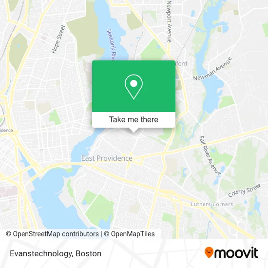
See Evanstechnology, Boston, on the map
Public Transit to Evanstechnology in Boston
Wondering how to get to Evanstechnology in Boston? Moovit helps you find the best way to get to Evanstechnology with step-by-step directions from the nearest public transit station.
Moovit provides free maps and live directions to help you navigate through your city. View schedules, routes, timetables, and find out how long does it take to get to Evanstechnology in real time.
Looking for the nearest stop or station to Evanstechnology? Check out this list of stops closest to your destination: N Broadway After Wilmarth; Waterman After James; Taunton & Waterman (At 314 Waterman); Providence.
Bus: 35, 61X, 33, 78.Train: ACELA, NORTHEAST REGIONAL, PROVIDENCE LINE SHUTTLE, PROVIDENCE LINE SHUTTLE, PROVIDENCE LINE SHUTTLE, FOXBORO EVENT SERVICE, PROVIDENCE/STOUGHTON.
Want to see if there’s another route that gets you there at an earlier time? Moovit helps you find alternative routes or times. Get directions from and directions to Evanstechnology easily from the Moovit App or Website.
We make riding to Evanstechnology easy, which is why over 1.7 million users, including users in Boston, trust Moovit as the best app for public transit. You don’t need to download an individual bus app or train app, Moovit is your all-in-one transit app that helps you find the best bus time or train time available.
For information on prices of bus and train, costs and ride fares to Evanstechnology, please check the Moovit app.
Use the app to navigate to popular places including to the airport, hospital, stadium, grocery store, mall, coffee shop, school, college, and university.
Evanstechnology Address: 33 Eastern Ave street in Boston
- Onna W. Moniz-John Park,
- SLN Marketing Communications,
- James Pinheiro - Unitedhealthcare Licensed Sales Agent,
- Leadingage Ri Leadership,
- Westport Properties,
- Celeste MacPhee Muscular Therapy,
- FedEx,
- 400 Hobson Ave,
- Wozny Barbar & Associates,
- Collaborative Club,
- smart Start Ignition Interlock,
- Check the Florist,
- Starlight Limousine,
- East Bay Refreshmnts,
- All Points Taxi,
- Studio Rainwater,
- City Limits Tint,
- DUNKIN',
- KCM Group,
- Holy Rosary Band Society
Places Near Evanstechnology (Boston)
- Td Garden, Boston,
- Massachusetts General Hospital, Boston,
- Wang Theater, Boston,
- Boston Children's Hospital, Boston,
- Leader Bank Pavilion (Leader Bank Pavillion), Boston,
- Boston Medical Center, Boston,
- Seaport District, Boston,
- Faneuil Hall, Boston,
- House Of Blues, Boston,
- Wilbur Theatre, Boston,
- Boston Common, Boston,
- Boston Convention & Exhibition Center, Boston,
- Museum Of Science, Boston,
- Castle Island, Boston,
- North End, Boston,
- Isabella Stewart Gardner Museum, Boston,
- Prudential Center, Boston,
- Cheers, Boston,
- Mgm Music Hall, Boston,
- Quincy Market, Boston
How to get to popular places in Boston with public transit
Get around Boston by public transit!
Traveling around Boston has never been so easy. See step by step directions as you travel to any attraction, street or major public transit station. View bus and train schedules, arrival times, service alerts and detailed routes on a map, so you know exactly how to get to anywhere in Boston.
When traveling to any destination around Boston use Moovit's Live Directions with Get Off Notifications to know exactly where and how far to walk, how long to wait for your line, and how many stops are left. Moovit will alert you when it's time to get off — no need to constantly re-check whether yours is the next stop.
Wondering how to use public transit in Boston or how to pay for public transit in Boston? Moovit public transit app can help you navigate your way with public transit easily, and at minimum cost. It includes public transit fees, ticket prices, and costs. Looking for a map of Boston public transit lines? Moovit public transit app shows all public transit maps in Boston with all Bus, Train, Subway and Ferry routes and stops on an interactive map.
Boston has 4 transit type(s), including: Bus, Train, Subway and Ferry, operated by several transit agencies, including MBTA, Southeastern Regional Transit Authority, MetroWest Regional Transit Authority, Rhode Island Public Transit Authority, WRTA, Lowell Regional Transit Authority, Merrimack Valley Transit, Montachusett Regional Transit Authority, Cape Cod Regional Transit Authority, Brockton Area Transit Authority, Martha's Vineyard Transit Authority, the WAVE - Nantucket Regional Transit Authority, GATRA, Cape Ann Transportation Authority and Massport