How to get to Evelyn Images by bus?
Click on the bus route to see step by step directions with maps, line arrival times and updated time schedules.
From the mall at rockingham park mall, Boston
88 minFrom Newton, MA, Newton
106 minFrom Warren St, Boston
70 minFrom Boston Marriott Newton, Newton
74 minFrom Davis Sq, Somerville
104 minFrom Sommerville Theatre, Somerville
104 minFrom The Burren, Somerville
103 minFrom Roadrunner, Boston
75 minFrom Apple Cinemas, Cambridge
106 min
How to get to Evelyn Images by train?
Click on the train route to see step by step directions with maps, line arrival times and updated time schedules.
Bus stop near Evelyn Images in Waltham
- Totten Pond Rd @ Winter St, 3 min walk,VIEW
Train station near Evelyn Images in Waltham
- Waltham, 44 min walk,VIEW
Bus lines to Evelyn Images in Waltham
- 61, North Waltham,VIEW
What are the closest stations to Evelyn Images?
The closest stations to Evelyn Images are:
- Totten Pond Rd @ Winter St is 191 yards away, 3 min walk.
- Waltham is 3716 yards away, 44 min walk.
Which bus lines stop near Evelyn Images?
These bus lines stop near Evelyn Images: 556, 61, 70.
Which train line stops near Evelyn Images?
FITCHBURG (#409 | Wachusett)
What’s the nearest bus station to Evelyn Images in Waltham?
The nearest bus station to Evelyn Images in Waltham is Totten Pond Rd @ Winter St. It’s a 3 min walk away.
What time is the first train to Evelyn Images in Waltham?
The FITCHBURG is the first train that goes to Evelyn Images in Waltham. It stops nearby at 5:27 AM.
What time is the last train to Evelyn Images in Waltham?
The FITCHBURG is the last train that goes to Evelyn Images in Waltham. It stops nearby at 12:19 AM.
What time is the first bus to Evelyn Images in Waltham?
The 61 is the first bus that goes to Evelyn Images in Waltham. It stops nearby at 6:02 AM.
What time is the last bus to Evelyn Images in Waltham?
The 61 is the last bus that goes to Evelyn Images in Waltham. It stops nearby at 8:24 PM.
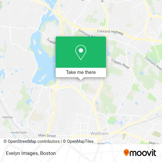
See Evelyn Images, Waltham, on the map
Public Transit to Evelyn Images in Waltham
Wondering how to get to Evelyn Images in Waltham? Moovit helps you find the best way to get to Evelyn Images with step-by-step directions from the nearest public transit station.
Moovit provides free maps and live directions to help you navigate through your city. View schedules, routes, timetables, and find out how long does it take to get to Evelyn Images in real time.
Looking for the nearest stop or station to Evelyn Images? Check out this list of stops closest to your destination: Totten Pond Rd @ Winter St; Waltham.
Bus: 556, 61, 70.Train: FITCHBURG.
Want to see if there’s another route that gets you there at an earlier time? Moovit helps you find alternative routes or times. Get directions from and directions to Evelyn Images easily from the Moovit App or Website.
We make riding to Evelyn Images easy, which is why over 1.7 million users, including users in Waltham, trust Moovit as the best app for public transit. You don’t need to download an individual bus app or train app, Moovit is your all-in-one transit app that helps you find the best bus time or train time available.
For information on prices of bus, train and subway, costs and ride fares to Evelyn Images, please check the Moovit app.
Use the app to navigate to popular places including to the airport, hospital, stadium, grocery store, mall, coffee shop, school, college, and university.
Evelyn Images Address: 681 Main St Ste 3-30 street in Waltham
- Waltham Apt,
- 52launch,
- Baystate Window Cleaning,
- College Farm,
- Stylish Cat Furniture,
- Neurometrix Neurometrix,
- Oscient Pharmaceuticals,
- Tarnow Michael,
- Holmes Scott C Law Offices,
- John Lappini,
- Torcasio, Sal F,
- Maa Network,
- Kelly's Property Services,
- Low Cost Organic Cleaning Solutions,
- Classic Catering,
- USPS Collection Box - Blue Box,
- M Brown Amy Attorney at Law,
- Amymbrown Attorney at Law,
- M. E. Sullivan Law, LLC,
- Banash David M PC
Places Near Evelyn Images (Waltham)
- Isabella Stewart Gardner Museum, Boston,
- North End, Boston,
- Mgm Music Hall, Boston,
- Leader Bank Pavilion (Leader Bank Pavillion), Boston,
- Quincy Market, Boston,
- Massachusetts General Hospital, Boston,
- Boston Convention & Exhibition Center, Boston,
- Castle Island, Boston,
- Museum Of Science, Boston,
- Td Garden, Boston,
- Faneuil Hall, Boston,
- House Of Blues, Boston,
- Boston Children's Hospital, Boston,
- Wang Theater, Boston,
- Cheers, Boston,
- Wilbur Theatre, Boston,
- Boston Medical Center, Boston,
- Boston Common, Boston,
- Seaport District, Boston,
- Prudential Center, Boston
How to get to popular places in Boston with public transit
Get around Waltham by public transit!
Traveling around Waltham has never been so easy. See step by step directions as you travel to any attraction, street or major public transit station. View bus and train schedules, arrival times, service alerts and detailed routes on a map, so you know exactly how to get to anywhere in Waltham.
When traveling to any destination around Waltham use Moovit's Live Directions with Get Off Notifications to know exactly where and how far to walk, how long to wait for your line, and how many stops are left. Moovit will alert you when it's time to get off — no need to constantly re-check whether yours is the next stop.
Wondering how to use public transit in Waltham or how to pay for public transit in Waltham? Moovit public transit app can help you navigate your way with public transit easily, and at minimum cost. It includes public transit fees, ticket prices, and costs. Looking for a map of Waltham public transit lines? Moovit public transit app shows all public transit maps in Waltham with all Bus, Train, Subway and Ferry routes and stops on an interactive map.
Boston has 4 transit type(s), including: Bus, Train, Subway and Ferry, operated by several transit agencies, including MBTA, Southeastern Regional Transit Authority, MetroWest Regional Transit Authority, Rhode Island Public Transit Authority, WRTA, Lowell Regional Transit Authority, Merrimack Valley Transit, Montachusett Regional Transit Authority, Cape Cod Regional Transit Authority, Brockton Area Transit Authority, Martha's Vineyard Transit Authority, the WAVE - Nantucket Regional Transit Authority, GATRA, Cape Ann Transportation Authority and Massport