Directions to Evenfall (Andover) with public transportation
The following transit lines have routes that pass near Evenfall
 Bus: 2, 21, HAVERHILL LINE SHUTTLE, HAVERHILL LINE SHUTTLE, HAVERHILL LINE SHUTTLE.
- Train: HAVERHILL.
How to get to Evenfall by bus?
Click on the bus route to see step by step directions with maps, line arrival times and updated time schedules.
From Lawrence, Massachusetts, Lawrence
44 minFrom Middlesex Community College, Lowell
61 minFrom Wilmington, MA, Wilmington
139 minFrom Methuen, Methuen Town
60 minFrom Tsongas Center, Lowell
74 minFrom Rockingham Mall Salem New Hampshire, Lawrence
51 minFrom Lowell, MA, Lowell
73 minFrom Lawrence, MA, Lawrence
41 minFrom QRD, Methuen Town
63 min
How to get to Evenfall by train?
Click on the train route to see step by step directions with maps, line arrival times and updated time schedules.
Bus stops near Evenfall in Andover
Train station near Evenfall in Andover
- Andover, 9 min walk,VIEW
Bus lines to Evenfall in Andover
What are the closest stations to Evenfall?
The closest stations to Evenfall are:
- Old Town Hall is 50 yards away, 1 min walk.
- Andover Square is 95 yards away, 2 min walk.
- Andover is 676 yards away, 9 min walk.
Which bus line stops near Evenfall?
2 (Main And School)
Which train line stops near Evenfall?
HAVERHILL (#224 | North Station)
What’s the nearest train station to Evenfall in Andover?
The nearest train station to Evenfall in Andover is Andover. It’s a 9 min walk away.
What’s the nearest bus station to Evenfall in Andover?
The nearest bus station to Evenfall in Andover is Old Town Hall. It’s a 1 min walk away.
What time is the first train to Evenfall in Andover?
The HAVERHILL is the first train that goes to Evenfall in Andover. It stops nearby at 4:58 AM.
What time is the last train to Evenfall in Andover?
The HAVERHILL is the last train that goes to Evenfall in Andover. It stops nearby at 12:31 AM.
What time is the first bus to Evenfall in Andover?
The 2 is the first bus that goes to Evenfall in Andover. It stops nearby at 5:16 AM.
What time is the last bus to Evenfall in Andover?
The 2 is the last bus that goes to Evenfall in Andover. It stops nearby at 9:28 PM.
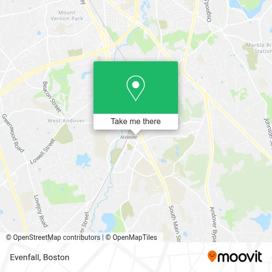
See Evenfall, Andover, on the map
Public Transit to Evenfall in Andover
Wondering how to get to Evenfall in Andover? Moovit helps you find the best way to get to Evenfall with step-by-step directions from the nearest public transit station.
Moovit provides free maps and live directions to help you navigate through your city. View schedules, routes, timetables, and find out how long does it take to get to Evenfall in real time.
Looking for the nearest stop or station to Evenfall? Check out this list of stops closest to your destination: Old Town Hall; Andover Square; Andover.
Bus: 2, 21, HAVERHILL LINE SHUTTLE, HAVERHILL LINE SHUTTLE, HAVERHILL LINE SHUTTLE, HAVERHILL LINE SHUTTLE.Train: HAVERHILL.
Want to see if there’s another route that gets you there at an earlier time? Moovit helps you find alternative routes or times. Get directions from and directions to Evenfall easily from the Moovit App or Website.
We make riding to Evenfall easy, which is why over 1.7 million users, including users in Andover, trust Moovit as the best app for public transit. You don’t need to download an individual bus app or train app, Moovit is your all-in-one transit app that helps you find the best bus time or train time available.
For information on prices of bus and train, costs and ride fares to Evenfall, please check the Moovit app.
Use the app to navigate to popular places including to the airport, hospital, stadium, grocery store, mall, coffee shop, school, college, and university.
Evenfall Address: 19 Essex St street in Andover
- Five Star Painting of Boston North Shore,
- Dorcas Social Haanstad Worker,
- A 24 All Day Emergency A Locksmith,
- ADT,
- Connect Property Group,
- Magnolia Trust & Estate,
- James Casazza,
- Samel Insurance Agency, Inc.,
- M&T Bank,
- The Injector Babe,
- Exquisite Linens and Florals,
- St Augustine Parish (St Augustine's Church),
- Eric Inman Daum, Architect, LLC,
- Law Tigers Motorcycle Lawyers,
- Sutton Management Company,
- Nearm's Garage Door & Gate Repair,
- Danvers Savings Bank,
- St. Augustine Church,
- Michael Suffoletto at Guaranteed Rate ,
- Max & Riley
Places Near Evenfall (Andover)
- Leader Bank Pavilion (Leader Bank Pavillion), Boston,
- Boston Common, Boston,
- House Of Blues, Boston,
- Wilbur Theatre, Boston,
- Massachusetts General Hospital, Boston,
- Quincy Market, Boston,
- Boston Children's Hospital, Boston,
- Mgm Music Hall, Boston,
- Faneuil Hall, Boston,
- Prudential Center, Boston,
- Wang Theater, Boston,
- North End, Boston,
- Museum Of Science, Boston,
- Boston Medical Center, Boston,
- Boston Convention & Exhibition Center, Boston,
- Castle Island, Boston,
- Td Garden, Boston,
- Cheers, Boston,
- Seaport District, Boston,
- Isabella Stewart Gardner Museum, Boston
How to get to popular places in Boston with public transit
Get around Andover by public transit!
Traveling around Andover has never been so easy. See step by step directions as you travel to any attraction, street or major public transit station. View bus and train schedules, arrival times, service alerts and detailed routes on a map, so you know exactly how to get to anywhere in Andover.
When traveling to any destination around Andover use Moovit's Live Directions with Get Off Notifications to know exactly where and how far to walk, how long to wait for your line, and how many stops are left. Moovit will alert you when it's time to get off — no need to constantly re-check whether yours is the next stop.
Wondering how to use public transit in Andover or how to pay for public transit in Andover? Moovit public transit app can help you navigate your way with public transit easily, and at minimum cost. It includes public transit fees, ticket prices, and costs. Looking for a map of Andover public transit lines? Moovit public transit app shows all public transit maps in Andover with all Bus, Train, Subway and Ferry routes and stops on an interactive map.
Boston has 4 transit type(s), including: Bus, Train, Subway and Ferry, operated by several transit agencies, including MBTA, Southeastern Regional Transit Authority, MetroWest Regional Transit Authority, Rhode Island Public Transit Authority, WRTA, Lowell Regional Transit Authority, Merrimack Valley Transit, Montachusett Regional Transit Authority, Cape Cod Regional Transit Authority, Brockton Area Transit Authority, Martha's Vineyard Transit Authority, the WAVE - Nantucket Regional Transit Authority, GATRA, Cape Ann Transportation Authority and Massport