How to get to Everest Biolabs by bus?
Click on the bus route to see step by step directions with maps, line arrival times and updated time schedules.
From Brighton District Court, Boston
73 minFrom Wellesley, MA, Wellesley
101 minFrom Alumni Stadium, Boston
74 minFrom Arsenal Yards, Watertown Town
50 minFrom Fresh Pond Mall, Cambridge
99 minFrom MBTA Alewife Station, Cambridge
124 minFrom New Balance, Boston
67 minFrom AC Hotel Boston Cambridge, Cambridge
137 minFrom AWACS (Bldg 1612), Hanscom Afb
179 minFrom Newton-Wellesley Hospital, Newton
76 min
Bus stops near Everest Biolabs in Waltham
Train station near Everest Biolabs in Waltham
- Kendal Green, 23 min walk,VIEW
What are the closest stations to Everest Biolabs?
The closest stations to Everest Biolabs are:
- 225 Second Ave (Sanofi) is 654 yards away, 8 min walk.
- Wyman St @ Winter St is 1179 yards away, 14 min walk.
- Kendal Green is 1923 yards away, 23 min walk.
Which bus lines stop near Everest Biolabs?
These bus lines stop near Everest Biolabs: 61, 70, W1.
What’s the nearest train station to Everest Biolabs in Waltham?
The nearest train station to Everest Biolabs in Waltham is Kendal Green. It’s a 23 min walk away.
What’s the nearest bus station to Everest Biolabs in Waltham?
The nearest bus station to Everest Biolabs in Waltham is 225 Second Ave (Sanofi). It’s a 8 min walk away.
What time is the first train to Everest Biolabs in Waltham?
The FITCHBURG is the first train that goes to Everest Biolabs in Waltham. It stops nearby at 5:27 AM.
What time is the last train to Everest Biolabs in Waltham?
The FITCHBURG is the last train that goes to Everest Biolabs in Waltham. It stops nearby at 12:19 AM.
What time is the first bus to Everest Biolabs in Waltham?
The 61 is the first bus that goes to Everest Biolabs in Waltham. It stops nearby at 6:04 AM.
What time is the last bus to Everest Biolabs in Waltham?
The 61 is the last bus that goes to Everest Biolabs in Waltham. It stops nearby at 8:23 PM.
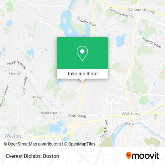
See Everest Biolabs, Waltham, on the map
Public Transit to Everest Biolabs in Waltham
Wondering how to get to Everest Biolabs in Waltham? Moovit helps you find the best way to get to Everest Biolabs with step-by-step directions from the nearest public transit station.
Moovit provides free maps and live directions to help you navigate through your city. View schedules, routes, timetables, and find out how long does it take to get to Everest Biolabs in real time.
Looking for the nearest stop or station to Everest Biolabs? Check out this list of stops closest to your destination: 225 Second Ave (Sanofi); Wyman St @ Winter St; Kendal Green.
Bus: 61, 70, W1.Train: FITCHBURG.
Want to see if there’s another route that gets you there at an earlier time? Moovit helps you find alternative routes or times. Get directions from and directions to Everest Biolabs easily from the Moovit App or Website.
We make riding to Everest Biolabs easy, which is why over 1.7 million users, including users in Waltham, trust Moovit as the best app for public transit. You don’t need to download an individual bus app or train app, Moovit is your all-in-one transit app that helps you find the best bus time or train time available.
For information on prices of bus, train and subway, costs and ride fares to Everest Biolabs, please check the Moovit app.
Use the app to navigate to popular places including to the airport, hospital, stadium, grocery store, mall, coffee shop, school, college, and university.
Everest Biolabs Address: 204 Second Ave street in Waltham
- Catapult Product Development,
- Yet2,
- Melissa Indelicato - Private Wealth Advisor, Ameriprise Financial Services,
- Wic Insurance Inc.,
- Ashley Elizabeth Peters - Financial Advisor, Ameriprise Financial Services,
- Erie Home,
- Ashley Elizabeth Peters - Financial Advisor, Ameriprise Financial Services, Llc,
- Get Group North America,
- Kaba,
- Sullivan and Cogliano,
- Melissa Indelicato - Ameriprise Financial Services,
- Minuteman Computer,
- Indelicato & Coffey,
- Bright Horizons at Waltham,
- Lobby Bar,
- Crosspoint Associates,
- Fairfield Inn & Suites Boston Waltham,
- Grand Residences by Marriott-Boston Waltham,
- Steer,
- 230 Citypoint
Places Near Everest Biolabs (Waltham)
- Wilbur Theatre, Boston,
- Boston Convention & Exhibition Center, Boston,
- Castle Island, Boston,
- Cheers, Boston,
- Boston Common, Boston,
- Isabella Stewart Gardner Museum, Boston,
- Museum Of Science, Boston,
- Td Garden, Boston,
- House Of Blues, Boston,
- Boston Medical Center, Boston,
- North End, Boston,
- Quincy Market, Boston,
- Faneuil Hall, Boston,
- Prudential Center, Boston,
- Mgm Music Hall, Boston,
- Seaport District, Boston,
- Boston Children's Hospital, Boston,
- Wang Theater, Boston,
- Massachusetts General Hospital, Boston,
- Leader Bank Pavilion (Leader Bank Pavillion), Boston
How to get to popular places in Boston with public transit
Get around Waltham by public transit!
Traveling around Waltham has never been so easy. See step by step directions as you travel to any attraction, street or major public transit station. View bus and train schedules, arrival times, service alerts and detailed routes on a map, so you know exactly how to get to anywhere in Waltham.
When traveling to any destination around Waltham use Moovit's Live Directions with Get Off Notifications to know exactly where and how far to walk, how long to wait for your line, and how many stops are left. Moovit will alert you when it's time to get off — no need to constantly re-check whether yours is the next stop.
Wondering how to use public transit in Waltham or how to pay for public transit in Waltham? Moovit public transit app can help you navigate your way with public transit easily, and at minimum cost. It includes public transit fees, ticket prices, and costs. Looking for a map of Waltham public transit lines? Moovit public transit app shows all public transit maps in Waltham with all Bus, Train, Subway and Ferry routes and stops on an interactive map.
Boston has 4 transit type(s), including: Bus, Train, Subway and Ferry, operated by several transit agencies, including MBTA, Southeastern Regional Transit Authority, MetroWest Regional Transit Authority, Rhode Island Public Transit Authority, WRTA, Lowell Regional Transit Authority, Merrimack Valley Transit, Montachusett Regional Transit Authority, Cape Cod Regional Transit Authority, Brockton Area Transit Authority, Martha's Vineyard Transit Authority, the WAVE - Nantucket Regional Transit Authority, GATRA, Cape Ann Transportation Authority and Massport