Directions to Everett Human Services with public transportation
The following transit lines have routes that pass near Everett Human Services
 Bus: 104, 109, 110, 112, 97.
- Train: NEWBURYPORT/ROCKPORT.
- Subway: ORANGE LINE.
How to get to Everett Human Services by bus?
Click on the bus route to see step by step directions with maps, line arrival times and updated time schedules.
From The Strand Theater
102 minFrom JFK Library
118 minFrom Wyndham Boston Beacon Hill
40 minFrom One International Place
43 minFrom Courtyard Boston Downtown / Tremont
61 minFrom Citizens Bank Opera House
60 minFrom City Hall Plaza
34 minFrom Jamaica Plain V.A.
82 minFrom Nahant Beach
74 minFrom John F. Kennedy Presidential Library And Museum
118 min
How to get to Everett Human Services by train?
Click on the train route to see step by step directions with maps, line arrival times and updated time schedules.
How to get to Everett Human Services by subway?
Click on the subway route to see step by step directions with maps, line arrival times and updated time schedules.
From The Strand Theater
79 minFrom JFK Library
81 minFrom Wyndham Boston Beacon Hill
54 minFrom One International Place
51 minFrom Courtyard Boston Downtown / Tremont
51 minFrom Citizens Bank Opera House
88 minFrom City Hall Plaza
46 minFrom Jamaica Plain V.A.
81 minFrom John F. Kennedy Presidential Library And Museum
81 min
Bus stops near Everett Human Services
Subway station near Everett Human Services
- Wellington, 32 min walk,VIEW
Train station near Everett Human Services
- Chelsea, 68 min walk,VIEW
Bus lines to Everett Human Services
What are the closest stations to Everett Human Services?
The closest stations to Everett Human Services are:
- Broadway @ Mansfield St is 209 yards away, 3 min walk.
- Chelsea St @ Plumer St is 259 yards away, 4 min walk.
- Anthem/Greystar is 342 yards away, 5 min walk.
- Wellington is 2688 yards away, 32 min walk.
- Chelsea is 5445 yards away, 68 min walk.
Which bus lines stop near Everett Human Services?
These bus lines stop near Everett Human Services: 104, 109, 110, 112.
Which train line stops near Everett Human Services?
NEWBURYPORT/ROCKPORT (#125 | Newburyport)
Which subway line stops near Everett Human Services?
ORANGE LINE (Oak Grove)
What’s the nearest bus station to Everett Human Services?
The nearest bus station to Everett Human Services is Broadway @ Mansfield St. It’s a 3 min walk away.
What time is the first subway to Everett Human Services?
The ORANGE LINE is the first subway that goes to Everett Human Services. It stops nearby at 5:19 AM.
What time is the last subway to Everett Human Services?
The ORANGE LINE is the last subway that goes to Everett Human Services. It stops nearby at 1:53 AM.
What time is the first train to Everett Human Services?
The NEWBURYPORT/ROCKPORT is the first train that goes to Everett Human Services. It stops nearby at 5:40 AM.
What time is the last train to Everett Human Services?
The NEWBURYPORT/ROCKPORT is the last train that goes to Everett Human Services. It stops nearby at 12:06 AM.
What time is the first bus to Everett Human Services?
The 104 is the first bus that goes to Everett Human Services. It stops nearby at 4:36 AM.
What time is the last bus to Everett Human Services?
The 110 is the last bus that goes to Everett Human Services. It stops nearby at 2:09 AM.
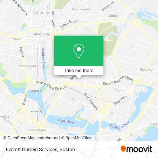
See Everett Human Services on the map
Public Transportation to Everett Human Services
Wondering how to get to Everett Human Services? Moovit helps you find the best way to get to Everett Human Services with step-by-step directions from the nearest public transit station.
Moovit provides free maps and live directions to help you navigate through your city. View schedules, routes, timetables, and find out how long does it take to get to Everett Human Services in real time.
Looking for the nearest stop or station to Everett Human Services? Check out this list of stops closest to your destination: Broadway @ Mansfield St; Chelsea St @ Plumer St; Anthem/Greystar; Wellington; Chelsea.
Bus: 104, 109, 110, 112, 97, LOWER MYSTIC LINK.Train: NEWBURYPORT/ROCKPORT.Subway: ORANGE LINE.
Want to see if there’s another route that gets you there at an earlier time? Moovit helps you find alternative routes or times. Get directions from and directions to Everett Human Services easily from the Moovit App or Website.
We make riding to Everett Human Services easy, which is why over 1.7 million users, including users in Everett, trust Moovit as the best app for public transit. You don’t need to download an individual bus app or train app, Moovit is your all-in-one transit app that helps you find the best bus time or train time available.
For information on prices of bus, subway and train, costs and ride fares to Everett Human Services, please check the Moovit app.
Use the app to navigate to popular places including to the airport, hospital, stadium, grocery store, mall, coffee shop, school, college, and university.
Everett Human Services Address: 90 Chelsea St street in Everett
- Edward G. Connolly Center,
- smart Auto Repair,
- Annes Cleaning Service,
- Pup Park on Chelsea,
- Norwood Cafe,
- Chelsea Street Bakery (Chelsea Street Bakery - Padaria Brasileira),
- Camila Santana,
- David Home Expert,
- Analux Aesthetics,
- Eletrical Services PNV,
- Lolanda Cleaning,
- Ronny Maintenance,
- Super Team Cleaning,
- Shine & Clean,
- Duarte Construction,
- Metal Kuster,
- Marj Media,
- Lyvia Vargas Cleaning Services,
- Solar Nation,
- Light Touch
Places Near Everett Human Services
- Wang Theater, Boston,
- Massachusetts General Hospital, Boston,
- Cheers, Boston,
- Td Garden, Boston,
- Boston Medical Center, Boston,
- Quincy Market, Boston,
- North End, Boston,
- Seaport District, Boston,
- Faneuil Hall, Boston,
- Isabella Stewart Gardner Museum, Boston,
- Boston Convention & Exhibition Center, Boston,
- Museum Of Science, Boston,
- Boston Common, Boston,
- Leader Bank Pavilion (Leader Bank Pavillion), Boston,
- Wilbur Theatre, Boston,
- Mgm Music Hall, Boston,
- Prudential Center, Boston,
- Castle Island, Boston,
- House Of Blues, Boston,
- Boston Children's Hospital, Boston
How to get to popular places in Boston with public transit
Get around Everett by public transit!
Traveling around Everett has never been so easy. See step by step directions as you travel to any attraction, street or major public transit station. View bus and train schedules, arrival times, service alerts and detailed routes on a map, so you know exactly how to get to anywhere in Everett.
When traveling to any destination around Everett use Moovit's Live Directions with Get Off Notifications to know exactly where and how far to walk, how long to wait for your line, and how many stops are left. Moovit will alert you when it's time to get off — no need to constantly re-check whether yours is the next stop.
Wondering how to use public transit in Everett or how to pay for public transit in Everett? Moovit public transit app can help you navigate your way with public transit easily, and at minimum cost. It includes public transit fees, ticket prices, and costs. Looking for a map of Everett public transit lines? Moovit public transit app shows all public transit maps in Everett with all Bus, Train, Subway and Ferry routes and stops on an interactive map.
Boston has 4 transit type(s), including: Bus, Train, Subway and Ferry, operated by several transit agencies, including MBTA, Southeastern Regional Transit Authority, MetroWest Regional Transit Authority, Rhode Island Public Transit Authority, WRTA, Lowell Regional Transit Authority, Merrimack Valley Transit, Montachusett Regional Transit Authority, Cape Cod Regional Transit Authority, Brockton Area Transit Authority, Martha's Vineyard Transit Authority, the WAVE - Nantucket Regional Transit Authority, GATRA, Cape Ann Transportation Authority and Massport