Directions to Evergreen Property Group (Boston) with public transportation
The following transit lines have routes that pass near Evergreen Property Group
 Bus: 10, 11, 9.
- Train: FRAMINGHAM/WORCESTER, KINGSTON, FAIRMOUNT, FRANKLIN/FOXBORO, PROVIDENCE/STOUGHTON.
- Subway: RED LINE.
- Ferry: FAST FERRY.
How to get to Evergreen Property Group by bus?
Click on the bus route to see step by step directions with maps, line arrival times and updated time schedules.
From Staybridge Suites Boston-Quincy, Quincy
94 minFrom Angell Animal Medical Center (Mspca Angell), Boston
48 minFrom Quincy Center Station, Quincy
99 minFrom Malden Catholic High School, Malden
115 minFrom Raising Cane's, Boston
70 minFrom Hyatt Place Medford, Medford
61 minFrom TownePlace Suites Boston Logan Airport/Chelsea, Chelsea
49 minFrom MBTA Alewife Station, Cambridge
93 minFrom Alumni Stadium, Newton
83 minFrom Malden, MA, Malden
86 min
How to get to Evergreen Property Group by train?
Click on the train route to see step by step directions with maps, line arrival times and updated time schedules.
How to get to Evergreen Property Group by subway?
Click on the subway route to see step by step directions with maps, line arrival times and updated time schedules.
From Staybridge Suites Boston-Quincy, Quincy
32 minFrom Angell Animal Medical Center (Mspca Angell), Boston
49 minFrom Quincy Center Station, Quincy
32 minFrom Raising Cane's, Boston
53 minFrom Hyatt Place Medford, Medford
77 minFrom TownePlace Suites Boston Logan Airport/Chelsea, Chelsea
53 minFrom MBTA Alewife Station, Cambridge
38 minFrom Alumni Stadium, Newton
79 minFrom Malden, MA, Malden
46 min
Bus stops near Evergreen Property Group in Boston
Subway station near Evergreen Property Group in Boston
- Andrew, 12 min walk,VIEW
Ferry station near Evergreen Property Group in Boston
- World Trade Center Pier, Boston, MA, 14 min walk,VIEW
Train station near Evergreen Property Group in Boston
- Newmarket, 27 min walk,VIEW
Bus lines to Evergreen Property Group in Boston
What are the closest stations to Evergreen Property Group?
The closest stations to Evergreen Property Group are:
- W 6th St @ F St is 164 yards away, 2 min walk.
- Dorchester St @ Broadway is 187 yards away, 3 min walk.
- W Broadway @ E St is 244 yards away, 3 min walk.
- Andrew is 958 yards away, 12 min walk.
- World Trade Center Pier, Boston, MA is 1171 yards away, 14 min walk.
- Newmarket is 2243 yards away, 27 min walk.
Which bus lines stop near Evergreen Property Group?
These bus lines stop near Evergreen Property Group: 10, 11, 9.
Which train lines stop near Evergreen Property Group?
These train lines stop near Evergreen Property Group: FRAMINGHAM/WORCESTER, KINGSTON.
Which subway line stops near Evergreen Property Group?
RED LINE (Alewife)
What’s the nearest subway station to Evergreen Property Group in Boston?
The nearest subway station to Evergreen Property Group in Boston is Andrew. It’s a 12 min walk away.
What’s the nearest train station to Evergreen Property Group in Boston?
The nearest train station to Evergreen Property Group in Boston is Newmarket. It’s a 27 min walk away.
What’s the nearest bus station to Evergreen Property Group in Boston?
The nearest bus station to Evergreen Property Group in Boston is W 6th St @ F St. It’s a 2 min walk away.
What’s the nearest ferry station to Evergreen Property Group in Boston?
The nearest ferry station to Evergreen Property Group in Boston is World Trade Center Pier, Boston, MA. It’s a 14 min walk away.
What time is the first subway to Evergreen Property Group in Boston?
The RED LINE is the first subway that goes to Evergreen Property Group in Boston. It stops nearby at 5:26 AM.
What time is the last subway to Evergreen Property Group in Boston?
The RED LINE is the last subway that goes to Evergreen Property Group in Boston. It stops nearby at 1:53 AM.
What time is the first train to Evergreen Property Group in Boston?
The FAIRMOUNT is the first train that goes to Evergreen Property Group in Boston. It stops nearby at 4:49 AM.
What time is the last train to Evergreen Property Group in Boston?
The FAIRMOUNT is the last train that goes to Evergreen Property Group in Boston. It stops nearby at 11:55 PM.
What time is the first bus to Evergreen Property Group in Boston?
The 10 is the first bus that goes to Evergreen Property Group in Boston. It stops nearby at 4:54 AM.
What time is the last bus to Evergreen Property Group in Boston?
The 10 is the last bus that goes to Evergreen Property Group in Boston. It stops nearby at 1:36 AM.
What time is the first ferry to Evergreen Property Group in Boston?
The FAST FERRY is the first ferry that goes to Evergreen Property Group in Boston. It stops nearby at 8:30 AM.
What time is the last ferry to Evergreen Property Group in Boston?
The FAST FERRY is the last ferry that goes to Evergreen Property Group in Boston. It stops nearby at 9:05 PM.
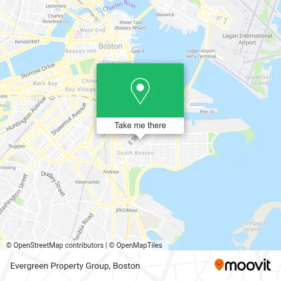
See Evergreen Property Group, Boston, on the map
Public Transit to Evergreen Property Group in Boston
Wondering how to get to Evergreen Property Group in Boston? Moovit helps you find the best way to get to Evergreen Property Group with step-by-step directions from the nearest public transit station.
Moovit provides free maps and live directions to help you navigate through your city. View schedules, routes, timetables, and find out how long does it take to get to Evergreen Property Group in real time.
Looking for the nearest stop or station to Evergreen Property Group? Check out this list of stops closest to your destination: W 6th St @ F St; Dorchester St @ Broadway; W Broadway @ E St; Andrew; World Trade Center Pier; Newmarket.
Bus: 10, 11, 9.Train: FRAMINGHAM/WORCESTER, KINGSTON, FAIRMOUNT, FRANKLIN/FOXBORO, PROVIDENCE/STOUGHTON.Subway: RED LINE.Ferry: FAST FERRY.
Want to see if there’s another route that gets you there at an earlier time? Moovit helps you find alternative routes or times. Get directions from and directions to Evergreen Property Group easily from the Moovit App or Website.
We make riding to Evergreen Property Group easy, which is why over 1.7 million users, including users in Boston, trust Moovit as the best app for public transit. You don’t need to download an individual bus app or train app, Moovit is your all-in-one transit app that helps you find the best bus time or train time available.
For information on prices of bus, subway and train, costs and ride fares to Evergreen Property Group, please check the Moovit app.
Use the app to navigate to popular places including to the airport, hospital, stadium, grocery store, mall, coffee shop, school, college, and university.
Evergreen Property Group Address: 423 W Broadway street in Boston
- Lincoln,
- Lincoln Tavern & Restaurant,
- Sherwin-Williams,
- Capo Restaurant & Supper Club,
- Supper Club at Capo,
- Capo,
- The Goodwill Store,
- Pastel Nail Studio,
- Navy Federal Credit Union,
- P.S. Gourmet Coffee,
- Marion Manor,
- Fat Baby,
- Hunter's Kitchen & Bar,
- B3 Fitness,
- Precious M Cleaners & Laundromat,
- Broadway Laundromat (Kays Laundromat),
- W 3rd St & E St,
- The Luxury Box,
- 18x9 W 5th St,
- Casper Funeral Home (Casper Funeral & Cremation Services)
Places Near Evergreen Property Group (Boston)
- House Of Blues, Boston,
- Boston Children's Hospital, Boston,
- Leader Bank Pavilion (Leader Bank Pavillion), Boston,
- Prudential Center, Boston,
- North End, Boston,
- Boston Common, Boston,
- Quincy Market, Boston,
- Faneuil Hall, Boston,
- Isabella Stewart Gardner Museum, Boston,
- Wang Theater, Boston,
- Mgm Music Hall, Boston,
- Wilbur Theatre, Boston,
- Cheers, Boston,
- Castle Island, Boston,
- Museum Of Science, Boston,
- Boston Medical Center, Boston,
- Seaport District, Boston,
- Boston Convention & Exhibition Center, Boston,
- Massachusetts General Hospital, Boston,
- Td Garden, Boston
How to get to popular places in Boston with public transit
Get around Boston by public transit!
Traveling around Boston has never been so easy. See step by step directions as you travel to any attraction, street or major public transit station. View bus and train schedules, arrival times, service alerts and detailed routes on a map, so you know exactly how to get to anywhere in Boston.
When traveling to any destination around Boston use Moovit's Live Directions with Get Off Notifications to know exactly where and how far to walk, how long to wait for your line, and how many stops are left. Moovit will alert you when it's time to get off — no need to constantly re-check whether yours is the next stop.
Wondering how to use public transit in Boston or how to pay for public transit in Boston? Moovit public transit app can help you navigate your way with public transit easily, and at minimum cost. It includes public transit fees, ticket prices, and costs. Looking for a map of Boston public transit lines? Moovit public transit app shows all public transit maps in Boston with all Bus, Train, Subway and Ferry routes and stops on an interactive map.
Boston has 4 transit type(s), including: Bus, Train, Subway and Ferry, operated by several transit agencies, including MBTA, Southeastern Regional Transit Authority, MetroWest Regional Transit Authority, Rhode Island Public Transit Authority, WRTA, Lowell Regional Transit Authority, Merrimack Valley Transit, Montachusett Regional Transit Authority, Cape Cod Regional Transit Authority, Brockton Area Transit Authority, Martha's Vineyard Transit Authority, the WAVE - Nantucket Regional Transit Authority, GATRA, Cape Ann Transportation Authority and Massport