Directions to Everpresent (Boston) with public transportation
The following transit lines have routes that pass near Everpresent
 Bus: 1, 10, 39, 43, BB.
- Train: FRAMINGHAM/WORCESTER, HAVERHILL, LOWELL, NEEDHAM, FOXBORO EVENT SERVICE.
- Subway: GREEN LINE B, GREEN LINE D, ORANGE LINE, GREEN LINE E, GREEN LINE C.
How to get to Everpresent by bus?
Click on the bus route to see step by step directions with maps, line arrival times and updated time schedules.
From La Quinta, Somerville
60 minFrom Newton, MA, Newton
41 minFrom Regent Theatre, Arlington
73 minFrom VA Hospital, Boston
60 minFrom Arlington, MA, Arlington
78 minFrom AC Hotel Boston Cambridge, Cambridge
80 minFrom Massachusetts, Boston
52 minFrom Market Basket, Revere
74 minFrom Comfort Inn & Suites Logan International Airport, Revere
54 minFrom Melrose Wakefield Hospital, Malden
92 min
How to get to Everpresent by train?
Click on the train route to see step by step directions with maps, line arrival times and updated time schedules.
How to get to Everpresent by subway?
Click on the subway route to see step by step directions with maps, line arrival times and updated time schedules.
Bus stops near Everpresent in Boston
Train station near Everpresent in Boston
- Back Bay - South End, 4 min walk,VIEW
Bus lines to Everpresent in Boston
What are the closest stations to Everpresent?
The closest stations to Everpresent are:
- Dartmouth St @ Tremont St is 1 yards away, 1 min walk.
- Tremont St @ Worcester St is 35 yards away, 1 min walk.
- Back Bay - South End is 277 yards away, 4 min walk.
- Symphony is 421 yards away, 5 min walk.
- Announcement #5 - Back Bay To Airport is 432 yards away, 6 min walk.
- Copley is 689 yards away, 9 min walk.
Which bus lines stop near Everpresent?
These bus lines stop near Everpresent: 1, 10, 39, 43, BB.
Which train lines stop near Everpresent?
These train lines stop near Everpresent: FRAMINGHAM/WORCESTER, HAVERHILL, LOWELL, NEEDHAM.
Which subway lines stop near Everpresent?
These subway lines stop near Everpresent: GREEN LINE B, GREEN LINE D, ORANGE LINE.
What’s the nearest subway station to Everpresent in Boston?
The nearest subway station to Everpresent in Boston is Symphony. It’s a 5 min walk away.
What’s the nearest train station to Everpresent in Boston?
The nearest train station to Everpresent in Boston is Back Bay - South End. It’s a 4 min walk away.
What’s the nearest bus station to Everpresent in Boston?
The nearest bus stations to Everpresent in Boston are Dartmouth St @ Tremont St and Tremont St @ Worcester St. The closest one is a 1 min walk away.
What time is the first subway to Everpresent in Boston?
The GREEN LINE D is the first subway that goes to Everpresent in Boston. It stops nearby at 5:05 AM.
What time is the last subway to Everpresent in Boston?
The GREEN LINE D is the last subway that goes to Everpresent in Boston. It stops nearby at 2:13 AM.
What time is the first train to Everpresent in Boston?
The PROVIDENCE/STOUGHTON is the first train that goes to Everpresent in Boston. It stops nearby at 4:25 AM.
What time is the last train to Everpresent in Boston?
The LAKE SHORE LIMITED is the last train that goes to Everpresent in Boston. It stops nearby at 8:26 PM.
What time is the first bus to Everpresent in Boston?
The BB is the first bus that goes to Everpresent in Boston. It stops nearby at 5:01 AM.
What time is the last bus to Everpresent in Boston?
The 10 is the last bus that goes to Everpresent in Boston. It stops nearby at 1:21 AM.
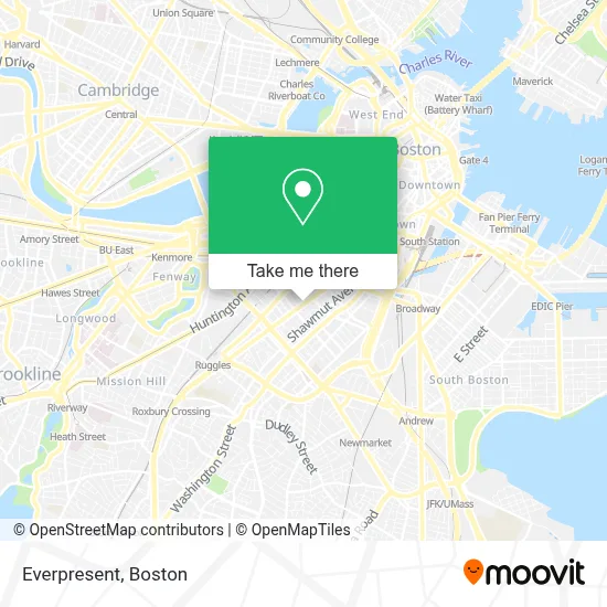
See Everpresent, Boston, on the map
Public Transit to Everpresent in Boston
Wondering how to get to Everpresent in Boston? Moovit helps you find the best way to get to Everpresent with step-by-step directions from the nearest public transit station.
Moovit provides free maps and live directions to help you navigate through your city. View schedules, routes, timetables, and find out how long does it take to get to Everpresent in real time.
Looking for the nearest stop or station to Everpresent? Check out this list of stops closest to your destination: Dartmouth St @ Tremont St; Tremont St @ Worcester St; Back Bay - South End; Symphony; Announcement #5 - Back Bay To Airport; Copley.
Bus: 1, 10, 39, 43, BB.Train: FRAMINGHAM/WORCESTER, HAVERHILL, LOWELL, NEEDHAM, FOXBORO EVENT SERVICE, FRANKLIN/FOXBORO, ORANGE LINE.Subway: GREEN LINE B, GREEN LINE D, ORANGE LINE, GREEN LINE E, GREEN LINE C.
Want to see if there’s another route that gets you there at an earlier time? Moovit helps you find alternative routes or times. Get directions from and directions to Everpresent easily from the Moovit App or Website.
We make riding to Everpresent easy, which is why over 1.7 million users, including users in Boston, trust Moovit as the best app for public transit. You don’t need to download an individual bus app or train app, Moovit is your all-in-one transit app that helps you find the best bus time or train time available.
For information on prices of bus, subway and train, costs and ride fares to Everpresent, please check the Moovit app.
Use the app to navigate to popular places including to the airport, hospital, stadium, grocery store, mall, coffee shop, school, college, and university.
Everpresent Address: 645 Tremont St street in Boston
- Heartbreak Hill Running Company,
- GURL (Gay Urban Running League),
- Benjamin Franklin Institute of Technology Polling Station,
- Plaza Betances,
- Encore,
- The Wine Emporium,
- Villa Victoria,
- US Postal Office,
- Tremont Street,
- Jhcc,
- Vejigantes,
- West Newton Apartments,
- Styles by Bianca B,
- Starlight Ministries,
- Vejigantes Restaurant,
- Tremont Street,
- St Stephen Church,
- French Riviera,
- 36 & 48 Rutland Street,
- Whipped Urban Dessert Lab
Places Near Everpresent (Boston)
- Faneuil Hall, Boston,
- North End, Boston,
- Cheers, Boston,
- Boston Children's Hospital, Boston,
- Castle Island, Boston,
- Isabella Stewart Gardner Museum, Boston,
- House Of Blues, Boston,
- Boston Convention & Exhibition Center, Boston,
- Td Garden, Boston,
- Massachusetts General Hospital, Boston,
- Wang Theater, Boston,
- Wilbur Theatre, Boston,
- Prudential Center, Boston,
- Mgm Music Hall, Boston,
- Quincy Market, Boston,
- Leader Bank Pavilion (Leader Bank Pavillion), Boston,
- Boston Medical Center, Boston,
- Boston Common, Boston,
- Museum Of Science, Boston,
- Seaport District, Boston
How to get to popular places in Boston with public transit
Get around Boston by public transit!
Traveling around Boston has never been so easy. See step by step directions as you travel to any attraction, street or major public transit station. View bus and train schedules, arrival times, service alerts and detailed routes on a map, so you know exactly how to get to anywhere in Boston.
When traveling to any destination around Boston use Moovit's Live Directions with Get Off Notifications to know exactly where and how far to walk, how long to wait for your line, and how many stops are left. Moovit will alert you when it's time to get off — no need to constantly re-check whether yours is the next stop.
Wondering how to use public transit in Boston or how to pay for public transit in Boston? Moovit public transit app can help you navigate your way with public transit easily, and at minimum cost. It includes public transit fees, ticket prices, and costs. Looking for a map of Boston public transit lines? Moovit public transit app shows all public transit maps in Boston with all Bus, Train, Subway and Ferry routes and stops on an interactive map.
Boston has 4 transit type(s), including: Bus, Train, Subway and Ferry, operated by several transit agencies, including MBTA, Southeastern Regional Transit Authority, MetroWest Regional Transit Authority, Rhode Island Public Transit Authority, WRTA, Lowell Regional Transit Authority, Merrimack Valley Transit, Montachusett Regional Transit Authority, Cape Cod Regional Transit Authority, Brockton Area Transit Authority, Martha's Vineyard Transit Authority, the WAVE - Nantucket Regional Transit Authority, GATRA, Cape Ann Transportation Authority and Massport