Directions to Everson Distributing (Boston) with public transportation
The following transit lines have routes that pass near Everson Distributing
 Bus: G19, P21.
- Train: VALLEY FLYER, VERMONTER.
How to get to Everson Distributing by bus?
Click on the bus route to see step by step directions with maps, line arrival times and updated time schedules.
From Foxwoods, Worcester
188 minFrom Palladium, Worcester
141 minFrom Gardner, MA, Gardner
301 minFrom Worcester, MA, Worcester
136 minFrom South High Community School, Worcester
255 minFrom Polar Park, Worcester
138 minFrom Saint Vincent Hospital at Worcester Medical Center, Worcester
138 minFrom Registry Of Motor Vehicles (Rmv) Branch Office, Worcester
140 minFrom Dcu Center, Worcester
138 min
How to get to Everson Distributing by train?
Click on the train route to see step by step directions with maps, line arrival times and updated time schedules.
Bus stop near Everson Distributing in Boston
- Memorial / New Ludlow, 10 min walk,VIEW
Train station near Everson Distributing in Boston
- Holyoke Amtrak, 42 min walk,VIEW
Bus lines to Everson Distributing in Boston
- G19, Holyoke Via Montcalm,VIEW
What are the closest stations to Everson Distributing?
The closest stations to Everson Distributing are:
- Memorial / New Ludlow is 815 yards away, 10 min walk.
- Holyoke Amtrak is 3508 yards away, 42 min walk.
Which bus lines stop near Everson Distributing?
These bus lines stop near Everson Distributing: G19, P21.
Which train lines stop near Everson Distributing?
These train lines stop near Everson Distributing: VALLEY FLYER, VERMONTER.
What’s the nearest bus station to Everson Distributing in Boston?
The nearest bus station to Everson Distributing in Boston is Memorial / New Ludlow. It’s a 10 min walk away.
What time is the first train to Everson Distributing in Boston?
The VALLEY FLYER is the first train that goes to Everson Distributing in Boston. It stops nearby at 6:45 AM.
What time is the last train to Everson Distributing in Boston?
The VALLEY FLYER is the last train that goes to Everson Distributing in Boston. It stops nearby at 9:51 PM.
What time is the first bus to Everson Distributing in Boston?
The G19 is the first bus that goes to Everson Distributing in Boston. It stops nearby at 6:33 AM.
What time is the last bus to Everson Distributing in Boston?
The G19 is the last bus that goes to Everson Distributing in Boston. It stops nearby at 7:51 PM.
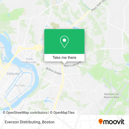
See Everson Distributing, Boston, on the map
Public Transit to Everson Distributing in Boston
Wondering how to get to Everson Distributing in Boston? Moovit helps you find the best way to get to Everson Distributing with step-by-step directions from the nearest public transit station.
Moovit provides free maps and live directions to help you navigate through your city. View schedules, routes, timetables, and find out how long does it take to get to Everson Distributing in real time.
Looking for the nearest stop or station to Everson Distributing? Check out this list of stops closest to your destination: Memorial / New Ludlow; Holyoke Amtrak.
Bus: G19, P21.Train: VALLEY FLYER, VERMONTER.
Want to see if there’s another route that gets you there at an earlier time? Moovit helps you find alternative routes or times. Get directions from and directions to Everson Distributing easily from the Moovit App or Website.
We make riding to Everson Distributing easy, which is why over 1.7 million users, including users in Boston, trust Moovit as the best app for public transit. You don’t need to download an individual bus app or train app, Moovit is your all-in-one transit app that helps you find the best bus time or train time available.
For information on prices of bus and train, costs and ride fares to Everson Distributing, please check the Moovit app.
Use the app to navigate to popular places including to the airport, hospital, stadium, grocery store, mall, coffee shop, school, college, and university.
Everson Distributing Address: 280 New Ludlow Rd street in Boston
- Coinstar,
- Creating Comfort Outlet,
- Winn Liquors,
- Western Mass Physician Assoc,
- Jules Jules and Ju,
- Bedside Books,
- Fairhaven,
- West Mass Elder Care Britton,
- Fairhaven Assisted Living Facility,
- Fairview Branch Chicopee Public Library,
- Buttery Brook Memorial Pool,
- St. Anne Church,
- The Art Space,
- Fairview Veterans Memorial Elementary School,
- Buttery Brook Park,
- Veterans' Memorial,
- Social J Marketing,
- Whalley Percision,
- Sons Of Zion Cemetery,
- Buttery Brook
Places Near Everson Distributing (Boston)
- Wang Theater, Boston,
- Boston Children's Hospital, Boston,
- Seaport District, Boston,
- Faneuil Hall, Boston,
- Cheers, Boston,
- Massachusetts General Hospital, Boston,
- Td Garden, Boston,
- Boston Common, Boston,
- Museum Of Science, Boston,
- Isabella Stewart Gardner Museum, Boston,
- North End, Boston,
- Mgm Music Hall, Boston,
- Wilbur Theatre, Boston,
- House Of Blues, Boston,
- Boston Convention & Exhibition Center, Boston,
- Boston Medical Center, Boston,
- Castle Island, Boston,
- Quincy Market, Boston,
- Prudential Center, Boston,
- Leader Bank Pavilion (Leader Bank Pavillion), Boston
How to get to popular places in Boston with public transit
Get around Boston by public transit!
Traveling around Boston has never been so easy. See step by step directions as you travel to any attraction, street or major public transit station. View bus and train schedules, arrival times, service alerts and detailed routes on a map, so you know exactly how to get to anywhere in Boston.
When traveling to any destination around Boston use Moovit's Live Directions with Get Off Notifications to know exactly where and how far to walk, how long to wait for your line, and how many stops are left. Moovit will alert you when it's time to get off — no need to constantly re-check whether yours is the next stop.
Wondering how to use public transit in Boston or how to pay for public transit in Boston? Moovit public transit app can help you navigate your way with public transit easily, and at minimum cost. It includes public transit fees, ticket prices, and costs. Looking for a map of Boston public transit lines? Moovit public transit app shows all public transit maps in Boston with all Bus, Train, Subway and Ferry routes and stops on an interactive map.
Boston has 4 transit type(s), including: Bus, Train, Subway and Ferry, operated by several transit agencies, including MBTA, Southeastern Regional Transit Authority, MetroWest Regional Transit Authority, Rhode Island Public Transit Authority, WRTA, Lowell Regional Transit Authority, Merrimack Valley Transit, Montachusett Regional Transit Authority, Cape Cod Regional Transit Authority, Brockton Area Transit Authority, Martha's Vineyard Transit Authority, the WAVE - Nantucket Regional Transit Authority, GATRA, Cape Ann Transportation Authority and Massport