Directions to Evident Microscopy (Needham) with public transportation
The following transit lines have routes that pass near Evident Microscopy
 Bus: 52, 59.
- Train: NEEDHAM.
- Subway: GREEN LINE D.
How to get to Evident Microscopy by bus?
Click on the bus route to see step by step directions with maps, line arrival times and updated time schedules.
From 110 Francis Street Garage, Boston
91 minFrom Spaulding Rehab, Boston
78 minFrom Brigham and Women's, Boston
96 minFrom MBTA Jackson Square Station, Boston
104 minFrom Brigham and Women's Hospital, Boston
94 minFrom Angell Animal Medical Center (Mspca Angell), Boston
92 minFrom Bidmc, Boston
94 minFrom Washington St, Boston
91 minFrom Boston Children's Hospital, Boston
95 minFrom Warren St, Boston
79 min
How to get to Evident Microscopy by train?
Click on the train route to see step by step directions with maps, line arrival times and updated time schedules.
From 110 Francis Street Garage, Boston
91 minFrom Spaulding Rehab, Boston
77 minFrom Brigham and Women's, Boston
86 minFrom MBTA Jackson Square Station, Boston
88 minFrom Brigham and Women's Hospital, Boston
88 minFrom Bidmc, Boston
90 minFrom Washington St, Boston
77 minFrom Boston Children's Hospital, Boston
91 minFrom Warren St, Boston
120 min
How to get to Evident Microscopy by subway?
Click on the subway route to see step by step directions with maps, line arrival times and updated time schedules.
From 110 Francis Street Garage, Boston
81 minFrom Brigham and Women's, Boston
85 minFrom MBTA Jackson Square Station, Boston
104 minFrom Brigham and Women's Hospital, Boston
84 minFrom Angell Animal Medical Center (Mspca Angell), Boston
93 minFrom Bidmc, Boston
79 minFrom Washington St, Boston
113 minFrom Boston Children's Hospital, Boston
77 minFrom Warren St, Boston
88 min
Train station near Evident Microscopy in Needham
- Needham Center, 7 min walk,VIEW
Subway station near Evident Microscopy in Needham
- Newton Highlands, 15 min walk,VIEW
What are the closest stations to Evident Microscopy?
The closest stations to Evident Microscopy are:
- Needham Center is 554 yards away, 7 min walk.
- Newton Highlands is 1238 yards away, 15 min walk.
Which bus lines stop near Evident Microscopy?
These bus lines stop near Evident Microscopy: 52, 59.
Which train line stops near Evident Microscopy?
NEEDHAM (#625 | Needham Heights)
Which subway line stops near Evident Microscopy?
GREEN LINE D (Riverside)
What’s the nearest subway station to Evident Microscopy in Needham?
The nearest subway station to Evident Microscopy in Needham is Newton Highlands. It’s a 15 min walk away.
What’s the nearest train station to Evident Microscopy in Needham?
The nearest train station to Evident Microscopy in Needham is Needham Center. It’s a 7 min walk away.
What time is the first subway to Evident Microscopy in Needham?
The GREEN LINE D is the first subway that goes to Evident Microscopy in Needham. It stops nearby at 4:50 AM.
What time is the last subway to Evident Microscopy in Needham?
The GREEN LINE D is the last subway that goes to Evident Microscopy in Needham. It stops nearby at 2:41 AM.
What time is the first train to Evident Microscopy in Needham?
The NEEDHAM is the first train that goes to Evident Microscopy in Needham. It stops nearby at 7:05 AM.
What time is the last train to Evident Microscopy in Needham?
The NEEDHAM is the last train that goes to Evident Microscopy in Needham. It stops nearby at 6:38 PM.
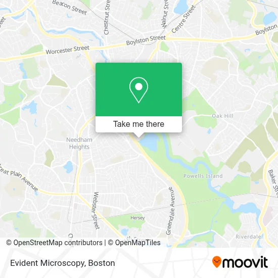
See Evident Microscopy, Needham, on the map
Public Transit to Evident Microscopy in Needham
Wondering how to get to Evident Microscopy in Needham? Moovit helps you find the best way to get to Evident Microscopy with step-by-step directions from the nearest public transit station.
Moovit provides free maps and live directions to help you navigate through your city. View schedules, routes, timetables, and find out how long does it take to get to Evident Microscopy in real time.
Looking for the nearest stop or station to Evident Microscopy? Check out this list of stops closest to your destination: Needham Center; Newton Highlands.
Bus: 52, 59.Train: NEEDHAM.Subway: GREEN LINE D.
Want to see if there’s another route that gets you there at an earlier time? Moovit helps you find alternative routes or times. Get directions from and directions to Evident Microscopy easily from the Moovit App or Website.
We make riding to Evident Microscopy easy, which is why over 1.7 million users, including users in Needham, trust Moovit as the best app for public transit. You don’t need to download an individual bus app or train app, Moovit is your all-in-one transit app that helps you find the best bus time or train time available.
For information on prices of bus, subway and train, costs and ride fares to Evident Microscopy, please check the Moovit app.
Use the app to navigate to popular places including to the airport, hospital, stadium, grocery store, mall, coffee shop, school, college, and university.
Evident Microscopy Address: 140 Kendrick St street in Needham
- Tripadvisor T4b,
- Wellington Management,
- Advisory Board,
- CJ Clark Retail,
- Mathsoft Holdings,
- Blue Heron Trail,
- PTC,
- ChargePoint,
- Greendale Greenway,
- Cutler Park Reservation,
- Coca-Cola Enterprises,
- Government Offices City,
- Horizon Financial Group,
- N2 Innovation District,
- Waterstone Properties Group,
- Next Level,
- Allego,
- Boylston Tax Group,
- WB Games Boston,
- Residence Inn Boston Needham
Places Near Evident Microscopy (Needham)
- Faneuil Hall, Boston,
- Mgm Music Hall, Boston,
- Leader Bank Pavilion (Leader Bank Pavillion), Boston,
- Castle Island, Boston,
- Museum Of Science, Boston,
- Prudential Center, Boston,
- Cheers, Boston,
- Td Garden, Boston,
- Isabella Stewart Gardner Museum, Boston,
- Boston Children's Hospital, Boston,
- Boston Medical Center, Boston,
- North End, Boston,
- House Of Blues, Boston,
- Wilbur Theatre, Boston,
- Seaport District, Boston,
- Wang Theater, Boston,
- Boston Convention & Exhibition Center, Boston,
- Massachusetts General Hospital, Boston,
- Quincy Market, Boston,
- Boston Common, Boston
How to get to popular places in Boston with public transit
Get around Needham by public transit!
Traveling around Needham has never been so easy. See step by step directions as you travel to any attraction, street or major public transit station. View bus and train schedules, arrival times, service alerts and detailed routes on a map, so you know exactly how to get to anywhere in Needham.
When traveling to any destination around Needham use Moovit's Live Directions with Get Off Notifications to know exactly where and how far to walk, how long to wait for your line, and how many stops are left. Moovit will alert you when it's time to get off — no need to constantly re-check whether yours is the next stop.
Wondering how to use public transit in Needham or how to pay for public transit in Needham? Moovit public transit app can help you navigate your way with public transit easily, and at minimum cost. It includes public transit fees, ticket prices, and costs. Looking for a map of Needham public transit lines? Moovit public transit app shows all public transit maps in Needham with all Bus, Train, Subway and Ferry routes and stops on an interactive map.
Boston has 4 transit type(s), including: Bus, Train, Subway and Ferry, operated by several transit agencies, including MBTA, Southeastern Regional Transit Authority, MetroWest Regional Transit Authority, Rhode Island Public Transit Authority, WRTA, Lowell Regional Transit Authority, Merrimack Valley Transit, Montachusett Regional Transit Authority, Cape Cod Regional Transit Authority, Brockton Area Transit Authority, Martha's Vineyard Transit Authority, the WAVE - Nantucket Regional Transit Authority, GATRA, Cape Ann Transportation Authority and Massport