Directions to Evil Eye Productions (Boston) with public transportation
The following transit lines have routes that pass near Evil Eye Productions
 Bus: 1, 19, BB, GREEN LINE SHUTTLE, GREEN LINE B SHUTTLE.
- Train: FITCHBURG, HAVERHILL, NEWBURYPORT/ROCKPORT.
- Subway: GREEN LINE B, GREEN LINE C, GREEN LINE D, ORANGE LINE, GREEN LINE E.
How to get to Evil Eye Productions by bus?
Click on the bus route to see step by step directions with maps, line arrival times and updated time schedules.
From 7F Everett Street, Revere
70 minFrom Milton, MA, Milton
102 minFrom Comfort Inn & Suites Logan International Airport, Revere
71 minFrom Uscis Biometrics Office, Revere
70 minFrom Homewood Suites by Hilton Boston Logan Airport Chelsea, Chelsea
80 minFrom Davis Sq, Somerville
48 minFrom Marina Bay, Quincy
127 minFrom McLean Hospital, Belmont
63 minFrom Santarpio's Pizza, Boston
42 minFrom Melrose Wakefield Hospital, Malden
93 min
How to get to Evil Eye Productions by train?
Click on the train route to see step by step directions with maps, line arrival times and updated time schedules.
How to get to Evil Eye Productions by subway?
Click on the subway route to see step by step directions with maps, line arrival times and updated time schedules.
Bus stops near Evil Eye Productions in Boston
- Massachusetts Ave @ Newbury St, 4 min walk,VIEW
- Hynes Convention Center - Cambria St @ Boylston St, 4 min walk,VIEW
- Boylston St @ Massachusetts Ave, 4 min walk,VIEW
- Hynes T Station (To Bumc), 4 min walk,VIEW
- Hynes - Commonwealth Ave @ Massachusetts Ave, 6 min walk,VIEW
- Hynes Convention Center - Commonwealth Ave @ Massachusetts Ave, 6 min walk,VIEW
- Announcement #3 - Airport To Back Bay, 7 min walk,VIEW
Subway stations near Evil Eye Productions in Boston
Bus lines to Evil Eye Productions in Boston
- 1, Harvard,VIEW
- GREEN LINE SHUTTLE, Park Street (Shuttle),VIEW
- GREEN LINE B SHUTTLE, Back Bay (Shuttle),VIEW
- GREEN LINE C SHUTTLE, Saint Mary's Street (Shuttle),VIEW
- 55, Arlington,VIEW
- 57, Watertown Via Kenmore,VIEW
- 1 BU (CHARLES RIVER-MEDICAL CAMPUS), Comm Ave @ Buick St,VIEW
- GREEN LINE B SHUTTLE, Babcock Street - Back Bay,VIEW
- GREEN LINE B SHUTTLE, Babcock Street - Copley,VIEW
- GREEN LINE B SHUTTLE, Boston College - Back Bay (Shuttle),VIEW
- GREEN LINE B SHUTTLE, Babcock Street - Back Bay via Copley (Shuttle),VIEW
- GREEN LINE B SHUTTLE, Kenmore - Back Bay via Copley (Shuttle),VIEW
- GREEN LINE D SHUTTLE, Brookline Hills - Back Bay (Shuttle),VIEW
- GREEN LINE SHUTTLE, Kenmore - Back Bay,VIEW
- GREEN LINE SHUTTLE, Kenmore (Shuttle),VIEW
- BB, Back Bay,VIEW
What are the closest stations to Evil Eye Productions?
The closest stations to Evil Eye Productions are:
- Massachusetts Ave @ Newbury St is 233 yards away, 4 min walk.
- Hynes Convention Center - Cambria St @ Boylston St is 241 yards away, 4 min walk.
- Boylston St @ Massachusetts Ave is 256 yards away, 4 min walk.
- Hynes T Station (To Bumc) is 267 yards away, 4 min walk.
- Kenmore is 297 yards away, 4 min walk.
- Hynes - Commonwealth Ave @ Massachusetts Ave is 404 yards away, 6 min walk.
- Hynes Convention Center - Commonwealth Ave @ Massachusetts Ave is 458 yards away, 6 min walk.
- Announcement #3 - Airport To Back Bay is 512 yards away, 7 min walk.
- Prudential is 735 yards away, 9 min walk.
Which bus lines stop near Evil Eye Productions?
These bus lines stop near Evil Eye Productions: 1, 19, BB.
Which train lines stop near Evil Eye Productions?
These train lines stop near Evil Eye Productions: FITCHBURG, HAVERHILL, NEWBURYPORT/ROCKPORT.
Which subway lines stop near Evil Eye Productions?
These subway lines stop near Evil Eye Productions: GREEN LINE B, GREEN LINE C, GREEN LINE D, ORANGE LINE.
What’s the nearest subway station to Evil Eye Productions in Boston?
The nearest subway station to Evil Eye Productions in Boston is Kenmore. It’s a 4 min walk away.
What’s the nearest bus station to Evil Eye Productions in Boston?
The nearest bus stations to Evil Eye Productions in Boston are Massachusetts Ave @ Newbury St, Hynes Convention Center - Cambria St @ Boylston St, Boylston St @ Massachusetts Ave and Hynes T Station (To Bumc). The closest one is a 4 min walk away.
What time is the first subway to Evil Eye Productions in Boston?
The GREEN LINE D is the first subway that goes to Evil Eye Productions in Boston. It stops nearby at 5:00 AM.
What time is the last subway to Evil Eye Productions in Boston?
The GREEN LINE D is the last subway that goes to Evil Eye Productions in Boston. It stops nearby at 2:18 AM.
What time is the first bus to Evil Eye Productions in Boston?
The 1 is the first bus that goes to Evil Eye Productions in Boston. It stops nearby at 4:49 AM.
What time is the last bus to Evil Eye Productions in Boston?
The 1 is the last bus that goes to Evil Eye Productions in Boston. It stops nearby at 2:33 AM.
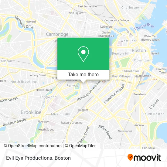
See Evil Eye Productions, Boston, on the map
Public Transit to Evil Eye Productions in Boston
Wondering how to get to Evil Eye Productions in Boston? Moovit helps you find the best way to get to Evil Eye Productions with step-by-step directions from the nearest public transit station.
Moovit provides free maps and live directions to help you navigate through your city. View schedules, routes, timetables, and find out how long does it take to get to Evil Eye Productions in real time.
Looking for the nearest stop or station to Evil Eye Productions? Check out this list of stops closest to your destination: Massachusetts Ave @ Newbury St; Hynes Convention Center - Cambria St @ Boylston St; Boylston St @ Massachusetts Ave; Hynes T Station (To Bumc); Kenmore; Hynes - Commonwealth Ave @ Massachusetts Ave; Hynes Convention Center - Commonwealth Ave @ Massachusetts Ave; Announcement #3 - Airport To Back Bay; Prudential.
Bus: 1, 19, BB, GREEN LINE SHUTTLE, GREEN LINE B SHUTTLE, GREEN LINE C SHUTTLE, 55, 57, 1 BU (CHARLES RIVER-MEDICAL CAMPUS).Train: FITCHBURG, HAVERHILL, NEWBURYPORT/ROCKPORT.Subway: GREEN LINE B, GREEN LINE C, GREEN LINE D, ORANGE LINE, GREEN LINE E.
Want to see if there’s another route that gets you there at an earlier time? Moovit helps you find alternative routes or times. Get directions from and directions to Evil Eye Productions easily from the Moovit App or Website.
We make riding to Evil Eye Productions easy, which is why over 1.7 million users, including users in Boston, trust Moovit as the best app for public transit. You don’t need to download an individual bus app or train app, Moovit is your all-in-one transit app that helps you find the best bus time or train time available.
For information on prices of bus, subway and train, costs and ride fares to Evil Eye Productions, please check the Moovit app.
Use the app to navigate to popular places including to the airport, hospital, stadium, grocery store, mall, coffee shop, school, college, and university.
Evil Eye Productions Address: 20 Hemenway St street in Boston
- Do A Barrell Roll,
- The Boston Conservatory,
- Willow Entertainment,
- Burbank Apartments,
- Boston Conservatory Of Music,
- Boston Conservatory Theater,
- Burbank Apts,
- The Charles Realty,
- Berklee City Music Boston,
- Francine Trester,
- 1120 Rehersal Studio,
- Peet's Coffee,
- Tropical Smoothie Cafe,
- Page Music Lesson Center,
- Massachusetts Historical Society,
- Boston Conservatory at Berklee,
- Fenway - Boston - Boylston St,
- Redi Dispensary,
- Bebop,
- Berklee College of Music - 7 Haviland St
Places Near Evil Eye Productions (Boston)
- Prudential Center, Boston,
- Cheers, Boston,
- Boston Convention & Exhibition Center, Boston,
- Td Garden, Boston,
- Castle Island, Boston,
- Wang Theater, Boston,
- Boston Children's Hospital, Boston,
- Leader Bank Pavilion (Leader Bank Pavillion), Boston,
- Massachusetts General Hospital, Boston,
- Boston Medical Center, Boston,
- Seaport District, Boston,
- Faneuil Hall, Boston,
- House Of Blues, Boston,
- Museum Of Science, Boston,
- Quincy Market, Boston,
- Boston Common, Boston,
- Wilbur Theatre, Boston,
- Mgm Music Hall, Boston,
- Isabella Stewart Gardner Museum, Boston,
- North End, Boston
How to get to popular places in Boston with public transit
Get around Boston by public transit!
Traveling around Boston has never been so easy. See step by step directions as you travel to any attraction, street or major public transit station. View bus and train schedules, arrival times, service alerts and detailed routes on a map, so you know exactly how to get to anywhere in Boston.
When traveling to any destination around Boston use Moovit's Live Directions with Get Off Notifications to know exactly where and how far to walk, how long to wait for your line, and how many stops are left. Moovit will alert you when it's time to get off — no need to constantly re-check whether yours is the next stop.
Wondering how to use public transit in Boston or how to pay for public transit in Boston? Moovit public transit app can help you navigate your way with public transit easily, and at minimum cost. It includes public transit fees, ticket prices, and costs. Looking for a map of Boston public transit lines? Moovit public transit app shows all public transit maps in Boston with all Bus, Train, Subway and Ferry routes and stops on an interactive map.
Boston has 4 transit type(s), including: Bus, Train, Subway and Ferry, operated by several transit agencies, including MBTA, Southeastern Regional Transit Authority, MetroWest Regional Transit Authority, Rhode Island Public Transit Authority, WRTA, Lowell Regional Transit Authority, Merrimack Valley Transit, Montachusett Regional Transit Authority, Cape Cod Regional Transit Authority, Brockton Area Transit Authority, Martha's Vineyard Transit Authority, the WAVE - Nantucket Regional Transit Authority, GATRA, Cape Ann Transportation Authority and Massport