How to get to Expendiduria II by bus?
Click on the bus route to see step by step directions with maps, line arrival times and updated time schedules.
From Parque Coimbra, Área Metropolitana De Madrid Y Corredor Del Henares
50 minFrom Centro Comercial Xanadú, Arroyomolinos
40 minFrom Villaviciosa de Odón, Villaviciosa De Odón
59 minFrom Hospital Universitario De Móstoles., Área Metropolitana De Madrid Y Corredor Del Henares
40 minFrom Hospital Universitario HM Puerta del Sur, Móstoles
40 minFrom Universidad Europea De Madrid, Área Metropolitana De Madrid Y Corredor Del Henares
80 minFrom Parque Finca Liana, Área Metropolitana De Madrid Y Corredor Del Henares
39 minFrom Tanatorio De Móstoles, Área Metropolitana De Madrid Y Corredor Del Henares
68 minFrom Hospital HM Puerta del Sur, Móstoles
55 minFrom Calle Granada 9, Móstoles
30 min
Bus stops near Expendiduria II in Navalcarnero
Bus lines to Expendiduria II in Navalcarnero
- 528, Madrid (Cuatro Vientos) - Navalcarnero,VIEW
- 535, Alcorcón (Alcorcón Central) - Urb. Calypo Fado,VIEW
- 541, Madrid (Plaza Elíptica) - Villamanta - La Torre de E. Hambrán,VIEW
- 545, Madrid (Plaza Elíptica) - Cenicientos - Sotillo de la Adrada,VIEW
- 546, Madrid (Plaza Elíptica) - Rozas de Puerto Real - Casillas,VIEW
- 547, Madrid (Plaza Elíptica) - V. del Prado - Almorox - Aldea en Cabo,VIEW
- 548, Madrid (Plaza Elíptica) - Aldea del Fresno - Calalberche,VIEW
- 531A, Móstoles (Hospital Rey Juan Carlos) - Navalcarnero - Villamantilla,VIEW
- 529H, Móstoles (Hospital Rey Juan Carlos) - Navalcarnero,VIEW
- N505, Madrid (Príncipe Pío) - Navalcarnero - El Álamo,VIEW
- VAC063, 701: Arcicóllar,VIEW
- VAC082, Fuensalida - Alcabón,VIEW
- VAC087, 906: Talavera De La Reina - La Pueblanueva,VIEW
- VAC226, El Casar de Escalona,VIEW
- 1, El Pinar,VIEW
- 530, San Roque - Galileo,VIEW
- 531, Hospital Rey Juan Carlos,VIEW
- 538, Arcángel Gabriel - Av. Mari Martín,VIEW
What are the closest stations to Expendiduria II?
The closest stations to Expendiduria II are:
- Cuesta Del Águila - Jacinto González is 33 meters away, 1 min walk.
- Av. Castilla - Parque San Sebastián is 59 meters away, 1 min walk.
- Buenavista - Ayuntamiento is 513 meters away, 7 min walk.
- Ronda De San Juan - Buenavista is 532 meters away, 8 min walk.
Which bus lines stop near Expendiduria II?
These bus lines stop near Expendiduria II: 528, 529H, 531, 535, 545.
What’s the nearest bus station to Expendiduria II in Navalcarnero?
The nearest bus stations to Expendiduria II in Navalcarnero are Cuesta Del Águila - Jacinto González and Av. Castilla - Parque San Sebastián. The closest one is a 1 min walk away.
What time is the first bus to Expendiduria II in Navalcarnero?
The N505 is the first bus that goes to Expendiduria II in Navalcarnero. It stops nearby at 3:03 AM.
What time is the last bus to Expendiduria II in Navalcarnero?
The N505 is the last bus that goes to Expendiduria II in Navalcarnero. It stops nearby at 1:56 AM.
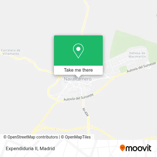
See Expendiduria II, Navalcarnero, on the map
Public Transit to Expendiduria II in Navalcarnero
Wondering how to get to Expendiduria II in Navalcarnero? Moovit helps you find the best way to get to Expendiduria II with step-by-step directions from the nearest public transit station.
Moovit provides free maps and live directions to help you navigate through your city. View schedules, routes, timetables, and find out how long does it take to get to Expendiduria II in real time.
Looking for the nearest stop or station to Expendiduria II? Check out this list of stops closest to your destination: Cuesta Del Águila - Jacinto González; Av. Castilla - Parque San Sebastián; Buenavista - Ayuntamiento; Ronda De San Juan - Buenavista.
Bus: 528, 529H, 531, 535, 545, 541, 546, VAC063, VAC082, VAC087, VAC226, 1, 530, 538.
Want to see if there’s another route that gets you there at an earlier time? Moovit helps you find alternative routes or times. Get directions from and directions to Expendiduria II easily from the Moovit App or Website.
We make riding to Expendiduria II easy, which is why over 1.5 million users, including users in Navalcarnero, trust Moovit as the best app for public transit. You don’t need to download an individual bus app or train app, Moovit is your all-in-one transit app that helps you find the best bus time or train time available.
For information on prices of bus, costs and ride fares to Expendiduria II, please check the Moovit app.
Use the app to navigate to popular places including to the airport, hospital, stadium, grocery store, mall, coffee shop, school, college, and university.
Expendiduria II Address: Calle Real, 13 28600 Navalcarnero street in Navalcarnero
- José Miguel Gaitán González,
- Mercedes Quesada Arroyo,
- La Blasa,
- Autoescuela Alberto,
- Plaza Del Teatro,
- Centro De Salud Navalcarnero,
- Iglesia Parroquial De Nuestra Señora De La Asunción,
- Parking del Teatro,
- Punto Gelatto,
- Teatro Centro,
- Sociedad Agraria de Transformacion SAT4479 Almazara Concepcion,
- César Antonio Uguet de Resayre Garcia Navas,
- Taller de Costura Katy,
- El Búho,
- Amancio Antonio Gonzalez Paz,
- Sabina Leon a,
- Fernandez Rodriguez M. Sonsoles,
- Gesnar Gestion Inmobiliaria,
- Zapateria Yoes,
- Panadería Pastelería José Luis
Places Near Expendiduria II (Navalcarnero)
- Mercadillo de Majadahonda, Majadahonda,
- Plenilunio, Área Metropolitana De Madrid Y Corredor Del Henares,
- Plaza Mayor, Madrid,
- Estadio Wanda Metropolitano, Área Metropolitana De Madrid Y Corredor Del Henares,
- Sala La Riviera, Madrid,
- Rastro De Madrid, Área Metropolitana De Madrid Y Corredor Del Henares,
- Calle de López de Hoyos 169, Madrid,
- Wizink Center, Madrid,
- Hospital Universitario La Paz, Madrid,
- Estacion de Chamartin, Madrid,
- Hospital Universitario Ramón y Cajal, Madrid,
- Centro Comercial La Vaguada, Área Metropolitana De Madrid Y Corredor Del Henares,
- Tres Aguas, Alcorcón,
- Mendez Alvaro, Madrid,
- Palacio De Vistalegre, Área Metropolitana De Madrid Y Corredor Del Henares,
- Centro Comercial La Gavia, Área Metropolitana De Madrid Y Corredor Del Henares,
- Centro Comercial Oasiz Madrid, Área Metropolitana De Madrid Y Corredor Del Henares,
- Hospital Clínico Universitario San Carlos, Madrid,
- Centro Comercial Islazul, Área Metropolitana De Madrid Y Corredor Del Henares,
- Nassica, Área Metropolitana De Madrid Y Corredor Del Henares
How to get to popular places in Madrid with public transit
Get around Navalcarnero by public transit!
Traveling around Navalcarnero has never been so easy. See step by step directions as you travel to any attraction, street or major public transit station. View bus and train schedules, arrival times, service alerts and detailed routes on a map, so you know exactly how to get to anywhere in Navalcarnero.
When traveling to any destination around Navalcarnero use Moovit's Live Directions with Get Off Notifications to know exactly where and how far to walk, how long to wait for your line, and how many stops are left. Moovit will alert you when it's time to get off — no need to constantly re-check whether yours is the next stop.
Wondering how to use public transit in Navalcarnero or how to pay for public transit in Navalcarnero? Moovit public transit app can help you navigate your way with public transit easily, and at minimum cost. It includes public transit fees, ticket prices, and costs. Looking for a map of Navalcarnero public transit lines? Moovit public transit app shows all public transit maps in Navalcarnero with all Bus, Train, Metro and Light Rail routes and stops on an interactive map.
Madrid has 4 transit type(s), including: Bus, Train, Metro and Light Rail, operated by several transit agencies, including Metro de Madrid, Metro Ligero, Tranvía de Parla, Renfe Cercanías - Servicios de Autobús especiales, Renfe Cercanias, Renfe Cercanías, EMT, Interurbanos, Urbanos de Alcalá de Henares, Urbanos de Alcobendas, Urbanos de Alcorcón, Urbanos de Algete, Urbanos de Aranjuez, Urbanos de Arganda del Rey and Urbanos de Arroyomolinos