Directions to Expert Markit (Malden) with public transportation
The following transit lines have routes that pass near Expert Markit
 Bus: 101, 104, 105, 131, 137.
- Train: HAVERHILL, NEWBURYPORT/ROCKPORT, ORANGE LINE.
- Subway: ORANGE LINE.
How to get to Expert Markit by bus?
Click on the bus route to see step by step directions with maps, line arrival times and updated time schedules.
From Laugh Boston, Boston
69 minFrom Boston Harbor Cruises, Boston
61 minFrom Boston Marathon Finish Line, Boston
80 minFrom Landmark Center, Boston
71 minFrom Fairmont Copley Plaza Boston, Boston
78 minFrom Edic Pier, Boston
71 minFrom Sommerville Theatre, Somerville
61 minFrom Boston Temple, Boston
79 minFrom Sweet Cheeks Q, Boston
74 minFrom Matthews Arena, Boston
99 min
How to get to Expert Markit by train?
Click on the train route to see step by step directions with maps, line arrival times and updated time schedules.
How to get to Expert Markit by subway?
Click on the subway route to see step by step directions with maps, line arrival times and updated time schedules.
From Laugh Boston, Boston
51 minFrom Boston Harbor Cruises, Boston
36 minFrom Boston Marathon Finish Line, Boston
39 minFrom Landmark Center, Boston
56 minFrom Fairmont Copley Plaza Boston, Boston
38 minFrom Edic Pier, Boston
60 minFrom Sommerville Theatre, Somerville
54 minFrom Boston Temple, Boston
53 minFrom Sweet Cheeks Q, Boston
60 minFrom Matthews Arena, Boston
36 min
Bus stops near Expert Markit in Malden
Bus lines to Expert Markit in Malden
What are the closest stations to Expert Markit?
The closest stations to Expert Markit are:
- Main St @ Salem St is 294 yards away, 4 min walk.
- Florence St @ Washington St is 340 yards away, 5 min walk.
- Salem St @ Park St is 381 yards away, 5 min walk.
- Washington St @ Clifton St is 612 yards away, 8 min walk.
- Chelsea is 2449 yards away, 31 min walk.
- Oak Grove is 3914 yards away, 46 min walk.
Which bus lines stop near Expert Markit?
These bus lines stop near Expert Markit: 101, 104, 105, 131, 137, 430.
Which train line stops near Expert Markit?
HAVERHILL (#229 | Haverhill)
Which subway line stops near Expert Markit?
ORANGE LINE (Oak Grove)
What’s the nearest bus station to Expert Markit in Malden?
The nearest bus station to Expert Markit in Malden is Main St @ Salem St. It’s a 4 min walk away.
What time is the first subway to Expert Markit in Malden?
The ORANGE LINE is the first subway that goes to Expert Markit in Malden. It stops nearby at 5:15 AM.
What time is the last subway to Expert Markit in Malden?
The ORANGE LINE is the last subway that goes to Expert Markit in Malden. It stops nearby at 1:59 AM.
What time is the first train to Expert Markit in Malden?
The HAVERHILL is the first train that goes to Expert Markit in Malden. It stops nearby at 5:35 AM.
What time is the last train to Expert Markit in Malden?
The NEWBURYPORT/ROCKPORT is the last train that goes to Expert Markit in Malden. It stops nearby at 12:06 AM.
What time is the first bus to Expert Markit in Malden?
The 137 is the first bus that goes to Expert Markit in Malden. It stops nearby at 4:52 AM.
What time is the last bus to Expert Markit in Malden?
The 108 is the last bus that goes to Expert Markit in Malden. It stops nearby at 1:38 AM.
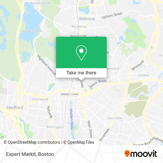
See Expert Markit, Malden, on the map
Public Transit to Expert Markit in Malden
Wondering how to get to Expert Markit in Malden? Moovit helps you find the best way to get to Expert Markit with step-by-step directions from the nearest public transit station.
Moovit provides free maps and live directions to help you navigate through your city. View schedules, routes, timetables, and find out how long does it take to get to Expert Markit in real time.
Looking for the nearest stop or station to Expert Markit? Check out this list of stops closest to your destination: Main St @ Salem St; Florence St @ Washington St; Salem St @ Park St; Washington St @ Clifton St; Chelsea; Oak Grove.
Bus: 101, 104, 105, 131, 137, 430, 99, 106, 108, 411, 132.Train: HAVERHILL, NEWBURYPORT/ROCKPORT, ORANGE LINE.Subway: ORANGE LINE.
Want to see if there’s another route that gets you there at an earlier time? Moovit helps you find alternative routes or times. Get directions from and directions to Expert Markit easily from the Moovit App or Website.
We make riding to Expert Markit easy, which is why over 1.7 million users, including users in Malden, trust Moovit as the best app for public transit. You don’t need to download an individual bus app or train app, Moovit is your all-in-one transit app that helps you find the best bus time or train time available.
For information on prices of bus, subway and train, costs and ride fares to Expert Markit, please check the Moovit app.
Use the app to navigate to popular places including to the airport, hospital, stadium, grocery store, mall, coffee shop, school, college, and university.
Expert Markit Address: 635 Main St street in Malden
- Massachusetts Bar Association,
- Whole Health and Wellness Office,
- Malden Ymca,
- Malden Housing Authority,
- Solla Aesthetics,
- Intentional Wellness Medspa,
- Wellness Institute of Boston,
- Mind Healing Clinic,
- Pawsture Perfect K9,
- Grace and Mercy,
- Kephira Store,
- Coytemore Lea,
- JC Brothers,
- Csi Support and Development,
- Collection di Reeta,
- Main Street Smoke Shop,
- House of Dietrich,
- Pidgeon Co,
- Malden Public Library,
- Blots
Places Near Expert Markit (Malden)
- Faneuil Hall, Boston,
- Mgm Music Hall, Boston,
- Leader Bank Pavilion (Leader Bank Pavillion), Boston,
- Castle Island, Boston,
- Museum Of Science, Boston,
- Prudential Center, Boston,
- Cheers, Boston,
- Td Garden, Boston,
- Isabella Stewart Gardner Museum, Boston,
- Boston Children's Hospital, Boston,
- Boston Medical Center, Boston,
- North End, Boston,
- House Of Blues, Boston,
- Wilbur Theatre, Boston,
- Seaport District, Boston,
- Wang Theater, Boston,
- Boston Convention & Exhibition Center, Boston,
- Massachusetts General Hospital, Boston,
- Quincy Market, Boston,
- Boston Common, Boston
How to get to popular places in Boston with public transit
Get around Malden by public transit!
Traveling around Malden has never been so easy. See step by step directions as you travel to any attraction, street or major public transit station. View bus and train schedules, arrival times, service alerts and detailed routes on a map, so you know exactly how to get to anywhere in Malden.
When traveling to any destination around Malden use Moovit's Live Directions with Get Off Notifications to know exactly where and how far to walk, how long to wait for your line, and how many stops are left. Moovit will alert you when it's time to get off — no need to constantly re-check whether yours is the next stop.
Wondering how to use public transit in Malden or how to pay for public transit in Malden? Moovit public transit app can help you navigate your way with public transit easily, and at minimum cost. It includes public transit fees, ticket prices, and costs. Looking for a map of Malden public transit lines? Moovit public transit app shows all public transit maps in Malden with all Bus, Train, Subway and Ferry routes and stops on an interactive map.
Boston has 4 transit type(s), including: Bus, Train, Subway and Ferry, operated by several transit agencies, including MBTA, Southeastern Regional Transit Authority, MetroWest Regional Transit Authority, Rhode Island Public Transit Authority, WRTA, Lowell Regional Transit Authority, Merrimack Valley Transit, Montachusett Regional Transit Authority, Cape Cod Regional Transit Authority, Brockton Area Transit Authority, Martha's Vineyard Transit Authority, the WAVE - Nantucket Regional Transit Authority, GATRA, Cape Ann Transportation Authority and Massport