How to get to Expleo by bus?
Click on the bus route to see step by step directions with maps, line arrival times and updated time schedules.
From Rihegaon Dam, Paud
55 minFrom International Institute of Information Technology (I2IT | PPCRC), Paud
29 minFrom Sailani Baba Dargah, Wadgaon
81 minFrom Balewadi, Pune & Velhe
48 minFrom MCA International Cricket Stadium, Wadgaon
124 minFrom Moraya Gosavi Ganapati Mandir, Pune & Velhe
59 minFrom Amar Madhuban the Park, Pune & Velhe
48 minFrom Buntara Bhavana, Paud
38 minFrom Jagtap Dairy Chowk, Pune & Velhe
54 minFrom Baner Sadanand Hotel Bus Stop, Paud
35 min
Bus stops near Expleo in Paud
Bus lines to Expleo in Paud
- 124, Aundh Gaon - Neilsoft Company Infosys (Phase 3),VIEW
- 321, Hinjawadi Megapolis Phase 3 - Neilsoft Company Infosys (Phase 3),VIEW
- 373, Neilsoft Company Infosys (Phase 3) - Sangvi Gaon,VIEW
- 375, Neilsoft Company Infosys (Phase 3) - Nigdi,VIEW
- 375C, Maan Depot (Power House Hinjawadi) - Neilsoft Company Infosys (Phase 3),VIEW
- 74, Chinchwadgaon - Paud Shashkiya Vishramgruha,VIEW
- 77, Hinjawadi Maan Phase 3 - Ganpati Matha,VIEW
- 79, Hinjawadi Maan Phase 3 - Deccan Gymkhana,VIEW
- 100, Ma.Na.Pa Bhavan - Hinjawadi Maan Phase 3,VIEW
- 115, Hinjawadi Maan Phase 3 - Pune Station,VIEW
- 208, Bhekrainagar Depot - Hinjawadi Maan Phase 3,VIEW
- 225, Kharadi Gaon - Hinjawadi Maan Phase 3,VIEW
- 306, Dange Chowk - Hinjawadi Megapolis Phase 3,VIEW
- 316, Chinchwadgaon - Katarkhadak,VIEW
- 324, Bhosari Terminal - Hinjawadi Maan Phase 3,VIEW
- 327, Alandi Darshan - Hinjawadi Maan Phase 3,VIEW
- 328, Kesnand Phata Wagholi - Hinjawadi Maan Phase 3,VIEW
- 333, Pune Station - Hinjawadi Maan Phase 3,VIEW
- 345, Hinjawadi Maan Phase 3 - Bhosari Terminal,VIEW
- 372, Nigdi Bhakti Shakti Terminal - Hinjawadi Megapolis Phase 3,VIEW
What are the closest stations to Expleo?
The closest stations to Expleo are:
- Mannara Technologies Pvt.Ltd. is 278 meters away, 4 min walk.
- Tech Mahindra is 1674 meters away, 22 min walk.
Which bus lines stop near Expleo?
These bus lines stop near Expleo: 124, 321, 373, 375.
What’s the nearest bus station to Expleo in Paud?
The nearest bus station to Expleo in Paud is Mannara Technologies Pvt.Ltd.. It’s a 4 min walk away.
What time is the first bus to Expleo in Paud?
The 115 is the first bus that goes to Expleo in Paud. It stops nearby at 4:36 AM.
What time is the last bus to Expleo in Paud?
The 372 is the last bus that goes to Expleo in Paud. It stops nearby at 11:35 PM.
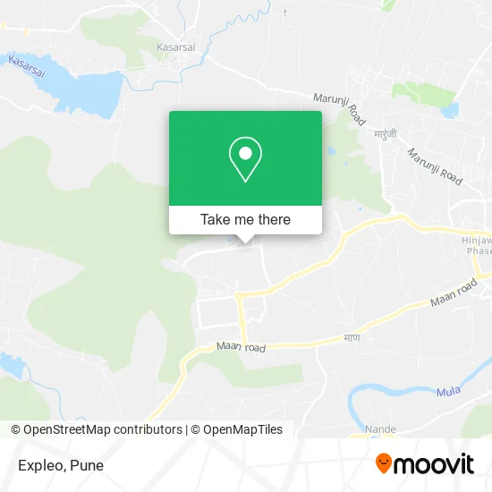
See Expleo, Paud, on the map
Public Transit to Expleo in Paud
Wondering how to get to Expleo in Paud? Moovit helps you find the best way to get to Expleo with step-by-step directions from the nearest public transit station.
Moovit provides free maps and live directions to help you navigate through your city. View schedules, routes, timetables, and find out how long does it take to get to Expleo in real time.
Looking for the nearest stop or station to Expleo? Check out this list of stops closest to your destination: Mannara Technologies Pvt.Ltd.; Tech Mahindra.
Bus: 124, 321, 373, 375, 375C, 74, 77, 79, 100, 115.
Want to see if there’s another route that gets you there at an earlier time? Moovit helps you find alternative routes or times. Get directions from and directions to Expleo easily from the Moovit App or Website.
We make riding to Expleo easy, which is why over 1.5 million users, including users in Paud, trust Moovit as the best app for public transit. You don’t need to download an individual bus app or train app, Moovit is your all-in-one transit app that helps you find the best bus time or train time available.
For information on prices of bus, costs and ride fares to Expleo, please check the Moovit app.
Use the app to navigate to popular places including to the airport, hospital, stadium, grocery store, mall, coffee shop, school, college, and university.
Expleo Address: मुलशी 411057 MH street in Paud
- Cognizant Deccan Campus (CDC),
- KPIT Technologies Ltd.,
- Cognizant CDC,
- EV Charging Station,
- Synechron Technologies,
- International Tech Park,
- Capgemini India,
- Monginis Cake Shop,
- Capgemini, Hinjawadi Phase III,
- Chai Point - Rajiv Gandhi Infotech Park, Hinjawadi,
- Rajiv Gandhi Park,
- Capgemini Employee Relaxation Centre,
- Apollo Pharmacy,
- Melange Garden D,
- Shapoorji Pallonji Joyville Hinjewadi,
- Fusion Towers,
- Cognizant-Quadron Campus,
- Itad,
- Kanifnath Mandir,
- EVnetNL
Places Near Expleo (Paud)
- Dagadusheth Halwai Ganapati Temple, Pune & Velhe,
- Senapati Bapat Road, Pune & Velhe,
- Ion Digital Zone, Pune & Velhe,
- Laxmi Road, Pune & Velhe,
- Sarasbaug, Pune & Velhe,
- Chaturshringi Temple, Pune & Velhe,
- Vishwakarma Institute Of Technology (Vit), Pune & Velhe,
- ISKCON Nvcc Temple, Pune & Velhe,
- ISKCON Pune, Pune & Velhe,
- Pvr Icon - Pavilion Mall, Pune & Velhe,
- Dagdusheth Halwai Ganpati Mandir, Pune & Velhe,
- Pune Okayama Friendship Garden, Pune & Velhe,
- Cognizant Deccan Campus (CDC), Paud,
- Swaminarayan Mandir, Pune & Velhe,
- Fc Road, Pune & Velhe,
- Westend Mall, Pune & Velhe,
- Symbiosis Lavale Bus Stop, Pune & Velhe,
- Raviwar Peth, Pune & Velhe,
- Tulshibaug, Pune & Velhe,
- M G Road, Pune & Velhe
How to get to popular places in Pune with public transit
Get around Paud by public transit!
Traveling around Paud has never been so easy. See step by step directions as you travel to any attraction, street or major public transit station. View bus and train schedules, arrival times, service alerts and detailed routes on a map, so you know exactly how to get to anywhere in Paud.
When traveling to any destination around Paud use Moovit's Live Directions with Get Off Notifications to know exactly where and how far to walk, how long to wait for your line, and how many stops are left. Moovit will alert you when it's time to get off — no need to constantly re-check whether yours is the next stop.
Wondering how to use public transit in Paud or how to pay for public transit in Paud? Moovit public transit app can help you navigate your way with public transit easily, and at minimum cost. It includes public transit fees, ticket prices, and costs. Looking for a map of Paud public transit lines? Moovit public transit app shows all public transit maps in Paud with all Bus, Train and Metro routes and stops on an interactive map.
Pune has 3 transit type(s), including: Bus, Train and Metro, operated by several transit agencies, including Pune Metro (Maha Metro), PMPML, PMPML Night Bus Service (Ratrani) and Central Railways (Indian Railways)