Directions to Extra Space Storage (Malden) with public transportation
The following transit lines have routes that pass near Extra Space Storage
 Bus: 109, 411, 108, 430, 106.
- Train: HAVERHILL, ORANGE LINE, NEWBURYPORT/ROCKPORT.
- Subway: ORANGE LINE.
How to get to Extra Space Storage by bus?
Click on the bus route to see step by step directions with maps, line arrival times and updated time schedules.
From Bebop, Boston
67 minFrom Harvard Business School, Boston
64 minFrom Hyatt Place Boston Seaport District, Boston
57 minFrom Micro Center (Micro Elecronics), Cambridge
67 minFrom Copley House, Boston
83 minFrom Four Seasons Hotel One Dalton, Boston
70 minFrom Schrafft's Center Shuttle, Boston
27 minFrom MBTA Kenmore Station, Boston
70 minFrom One Beacon Street, Boston
34 minFrom Wayfair, Boston
79 min
How to get to Extra Space Storage by train?
Click on the train route to see step by step directions with maps, line arrival times and updated time schedules.
How to get to Extra Space Storage by subway?
Click on the subway route to see step by step directions with maps, line arrival times and updated time schedules.
From Bebop, Boston
72 minFrom Harvard Business School, Boston
88 minFrom Hyatt Place Boston Seaport District, Boston
84 minFrom Micro Center (Micro Elecronics), Cambridge
86 minFrom Copley House, Boston
68 minFrom Four Seasons Hotel One Dalton, Boston
70 minFrom Schrafft's Center Shuttle, Boston
49 minFrom MBTA Kenmore Station, Boston
75 minFrom One Beacon Street, Boston
58 minFrom Wayfair, Boston
68 min
Bus stops near Extra Space Storage in Malden
Train stations near Extra Space Storage in Malden
Bus lines to Extra Space Storage in Malden
What are the closest stations to Extra Space Storage?
The closest stations to Extra Space Storage are:
- Salem St @ Maplewood St is 120 yards away, 2 min walk.
- Eastern Ave @ Broadway is 462 yards away, 6 min walk.
- Oak Grove is 814 yards away, 10 min walk.
- Chelsea is 924 yards away, 14 min walk.
- Lebanon St @ Salem St is 1062 yards away, 13 min walk.
Which bus lines stop near Extra Space Storage?
These bus lines stop near Extra Space Storage: 109, 411.
Which train line stops near Extra Space Storage?
HAVERHILL (#229 | Haverhill)
Which subway line stops near Extra Space Storage?
ORANGE LINE (Oak Grove)
What’s the nearest train station to Extra Space Storage in Malden?
The nearest train station to Extra Space Storage in Malden is Oak Grove. It’s a 10 min walk away.
What’s the nearest bus station to Extra Space Storage in Malden?
The nearest bus station to Extra Space Storage in Malden is Salem St @ Maplewood St. It’s a 2 min walk away.
What time is the first subway to Extra Space Storage in Malden?
The ORANGE LINE is the first subway that goes to Extra Space Storage in Malden. It stops nearby at 5:15 AM.
What time is the last subway to Extra Space Storage in Malden?
The ORANGE LINE is the last subway that goes to Extra Space Storage in Malden. It stops nearby at 1:59 AM.
What time is the first train to Extra Space Storage in Malden?
The HAVERHILL is the first train that goes to Extra Space Storage in Malden. It stops nearby at 5:35 AM.
What time is the last train to Extra Space Storage in Malden?
The NEWBURYPORT/ROCKPORT is the last train that goes to Extra Space Storage in Malden. It stops nearby at 12:06 AM.
What time is the first bus to Extra Space Storage in Malden?
The 109 is the first bus that goes to Extra Space Storage in Malden. It stops nearby at 4:31 AM.
What time is the last bus to Extra Space Storage in Malden?
The 108 is the last bus that goes to Extra Space Storage in Malden. It stops nearby at 1:42 AM.
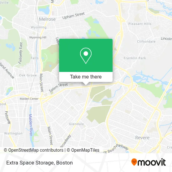
See Extra Space Storage, Malden, on the map
Public Transit to Extra Space Storage in Malden
Wondering how to get to Extra Space Storage in Malden? Moovit helps you find the best way to get to Extra Space Storage with step-by-step directions from the nearest public transit station.
Moovit provides free maps and live directions to help you navigate through your city. View schedules, routes, timetables, and find out how long does it take to get to Extra Space Storage in real time.
Looking for the nearest stop or station to Extra Space Storage? Check out this list of stops closest to your destination: Salem St @ Maplewood St; Eastern Ave @ Broadway; Oak Grove; Chelsea; Lebanon St @ Salem St.
Bus: 109, 411, 108, 430, 106.Train: HAVERHILL, ORANGE LINE, NEWBURYPORT/ROCKPORT.Subway: ORANGE LINE.
Want to see if there’s another route that gets you there at an earlier time? Moovit helps you find alternative routes or times. Get directions from and directions to Extra Space Storage easily from the Moovit App or Website.
We make riding to Extra Space Storage easy, which is why over 1.7 million users, including users in Malden, trust Moovit as the best app for public transit. You don’t need to download an individual bus app or train app, Moovit is your all-in-one transit app that helps you find the best bus time or train time available.
For information on prices of bus, subway and train, costs and ride fares to Extra Space Storage, please check the Moovit app.
Use the app to navigate to popular places including to the airport, hospital, stadium, grocery store, mall, coffee shop, school, college, and university.
Extra Space Storage Address: 960 Eastern Ave street in Malden
- Little Rascal's Day Care Center,
- First Lutheran Church, Malden, Ma,
- Diplo Brand and Services,
- American Concrete CTNG,
- United Printer Aid,
- Club Italia (Abruzzo Club),
- Auto Wholesalers,
- Master Team Barbershop,
- Precision Auto Wor,
- Planet Fitness,
- MGS Professional Painting,
- Paolo D. Parrucchiere,
- Zoe smart,
- Ace Handyman Services Metro Boston Melrose,
- Ormani's Electrology,
- Beylo Events,
- Home Carpet Cleaning,
- Fajita's Mexican Grill,
- D.C.N.E. Totaline Parts and Supplies,
- Maplewood Square
Places Near Extra Space Storage (Malden)
- Td Garden, Boston,
- Isabella Stewart Gardner Museum, Boston,
- Mgm Music Hall, Boston,
- Boston Common, Boston,
- Wang Theater, Boston,
- House Of Blues, Boston,
- Boston Medical Center, Boston,
- Massachusetts General Hospital, Boston,
- North End, Boston,
- Quincy Market, Boston,
- Castle Island, Boston,
- Seaport District, Boston,
- Museum Of Science, Boston,
- Faneuil Hall, Boston,
- Boston Children's Hospital, Boston,
- Cheers, Boston,
- Wilbur Theatre, Boston,
- Boston Convention & Exhibition Center, Boston,
- Prudential Center, Boston,
- Leader Bank Pavilion (Leader Bank Pavillion), Boston
How to get to popular places in Boston with public transit
Get around Malden by public transit!
Traveling around Malden has never been so easy. See step by step directions as you travel to any attraction, street or major public transit station. View bus and train schedules, arrival times, service alerts and detailed routes on a map, so you know exactly how to get to anywhere in Malden.
When traveling to any destination around Malden use Moovit's Live Directions with Get Off Notifications to know exactly where and how far to walk, how long to wait for your line, and how many stops are left. Moovit will alert you when it's time to get off — no need to constantly re-check whether yours is the next stop.
Wondering how to use public transit in Malden or how to pay for public transit in Malden? Moovit public transit app can help you navigate your way with public transit easily, and at minimum cost. It includes public transit fees, ticket prices, and costs. Looking for a map of Malden public transit lines? Moovit public transit app shows all public transit maps in Malden with all Bus, Train, Subway and Ferry routes and stops on an interactive map.
Boston has 4 transit type(s), including: Bus, Train, Subway and Ferry, operated by several transit agencies, including MBTA, Southeastern Regional Transit Authority, MetroWest Regional Transit Authority, Rhode Island Public Transit Authority, WRTA, Lowell Regional Transit Authority, Merrimack Valley Transit, Montachusett Regional Transit Authority, Cape Cod Regional Transit Authority, Brockton Area Transit Authority, Martha's Vineyard Transit Authority, the WAVE - Nantucket Regional Transit Authority, GATRA, Cape Ann Transportation Authority and Massport