How to get to Exxon & Mobil Stations by bus?
Click on the bus route to see step by step directions with maps, line arrival times and updated time schedules.
From Matthews Arena, Boston
88 minFrom Huntington Theatre Company, Boston
88 minFrom Boston Medical Center / Shapiro Center, Boston
68 minFrom Huntington Theatre, Boston
87 minFrom Intercontinental Boston Hotel Boston, Boston
49 minFrom Carson Beach, Boston
95 minFrom Apple Boylston Street, Boston
76 minFrom Public Garden (Boston Public Garden), Boston
44 minFrom Intercontinental Boston, Boston
50 minFrom MGH Shuttle, Boston
46 min
How to get to Exxon & Mobil Stations by train?
Click on the train route to see step by step directions with maps, line arrival times and updated time schedules.
How to get to Exxon & Mobil Stations by subway?
Click on the subway route to see step by step directions with maps, line arrival times and updated time schedules.
From Matthews Arena, Boston
56 minFrom Huntington Theatre Company, Boston
66 minFrom Boston Medical Center / Shapiro Center, Boston
74 minFrom Huntington Theatre, Boston
66 minFrom Intercontinental Boston Hotel Boston, Boston
54 minFrom Carson Beach, Boston
80 minFrom Apple Boylston Street, Boston
65 minFrom Public Garden (Boston Public Garden), Boston
60 minFrom Intercontinental Boston, Boston
55 minFrom MGH Shuttle, Boston
58 min
Bus stops near Exxon & Mobil Stations in Revere
Subway station near Exxon & Mobil Stations in Revere
- Orient Heights, 36 min walk,VIEW
Bus lines to Exxon & Mobil Stations in Revere
What are the closest stations to Exxon & Mobil Stations?
The closest stations to Exxon & Mobil Stations are:
- Central Ave @ School St is 195 yards away, 3 min walk.
- Broadway Opp Elmwood Ave is 211 yards away, 3 min walk.
- 570 Broadway @ Elmwood Ave is 224 yards away, 3 min walk.
- Orient Heights is 3056 yards away, 36 min walk.
Which bus lines stop near Exxon & Mobil Stations?
These bus lines stop near Exxon & Mobil Stations: 110, 116.
Which train line stops near Exxon & Mobil Stations?
NEWBURYPORT/ROCKPORT (#125 | Newburyport)
Which subway line stops near Exxon & Mobil Stations?
BLUE LINE (Wonderland)
What’s the nearest bus station to Exxon & Mobil Stations in Revere?
The nearest bus stations to Exxon & Mobil Stations in Revere are Central Ave @ School St, Broadway Opp Elmwood Ave and 570 Broadway @ Elmwood Ave. The closest one is a 3 min walk away.
What time is the first subway to Exxon & Mobil Stations in Revere?
The BLUE LINE is the first subway that goes to Exxon & Mobil Stations in Revere. It stops nearby at 5:08 AM.
What time is the last subway to Exxon & Mobil Stations in Revere?
The BLUE LINE is the last subway that goes to Exxon & Mobil Stations in Revere. It stops nearby at 2:10 AM.
What time is the first bus to Exxon & Mobil Stations in Revere?
The 116 is the first bus that goes to Exxon & Mobil Stations in Revere. It stops nearby at 4:27 AM.
What time is the last bus to Exxon & Mobil Stations in Revere?
The 116 is the last bus that goes to Exxon & Mobil Stations in Revere. It stops nearby at 2:26 AM.
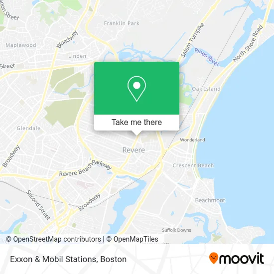
See Exxon & Mobil Stations, Revere, on the map
Public Transit to Exxon & Mobil Stations in Revere
Wondering how to get to Exxon & Mobil Stations in Revere? Moovit helps you find the best way to get to Exxon & Mobil Stations with step-by-step directions from the nearest public transit station.
Moovit provides free maps and live directions to help you navigate through your city. View schedules, routes, timetables, and find out how long does it take to get to Exxon & Mobil Stations in real time.
Looking for the nearest stop or station to Exxon & Mobil Stations? Check out this list of stops closest to your destination: Central Ave @ School St; Broadway Opp Elmwood Ave; 570 Broadway @ Elmwood Ave; Orient Heights.
Bus: 110, 116, 411, 119.Train: NEWBURYPORT/ROCKPORT.Subway: BLUE LINE.
Want to see if there’s another route that gets you there at an earlier time? Moovit helps you find alternative routes or times. Get directions from and directions to Exxon & Mobil Stations easily from the Moovit App or Website.
We make riding to Exxon & Mobil Stations easy, which is why over 1.7 million users, including users in Revere, trust Moovit as the best app for public transit. You don’t need to download an individual bus app or train app, Moovit is your all-in-one transit app that helps you find the best bus time or train time available.
For information on prices of bus, subway and train, costs and ride fares to Exxon & Mobil Stations, please check the Moovit app.
Use the app to navigate to popular places including to the airport, hospital, stadium, grocery store, mall, coffee shop, school, college, and university.
Exxon & Mobil Stations Address: 520 Broadway street in Revere
- Athena Bitcoin Atm,
- Kathe Franco Makeup Hairstyle,
- Total Tax,
- Western Union,
- Variedades Tita,
- Bcm Liquors,
- Penske Truck Rental,
- The Blonde Salon - Revere,
- Fabricios Auto Repair,
- At Juan's Taqueria,
- Karito Studio Salon,
- Rockland Trust Bank,
- La Cantina,
- Buddy's Painting & Carpentry,
- Revere Summer Eats,
- Multiverse Investments And Marketing,
- Northeastern University,
- Fardad Mobed DMD,
- Iglesia Cristiana Citi Mass,
- Moose Club
Places Near Exxon & Mobil Stations (Revere)
- Seaport District, Boston,
- Quincy Market, Boston,
- Isabella Stewart Gardner Museum, Boston,
- Cheers, Boston,
- Boston Medical Center, Boston,
- Castle Island, Boston,
- Wilbur Theatre, Boston,
- Faneuil Hall, Boston,
- Boston Children's Hospital, Boston,
- Mgm Music Hall, Boston,
- Museum Of Science, Boston,
- Leader Bank Pavilion (Leader Bank Pavillion), Boston,
- Prudential Center, Boston,
- Massachusetts General Hospital, Boston,
- Boston Convention & Exhibition Center, Boston,
- Wang Theater, Boston,
- North End, Boston,
- House Of Blues, Boston,
- Td Garden, Boston,
- Boston Common, Boston
How to get to popular places in Boston with public transit
Get around Revere by public transit!
Traveling around Revere has never been so easy. See step by step directions as you travel to any attraction, street or major public transit station. View bus and train schedules, arrival times, service alerts and detailed routes on a map, so you know exactly how to get to anywhere in Revere.
When traveling to any destination around Revere use Moovit's Live Directions with Get Off Notifications to know exactly where and how far to walk, how long to wait for your line, and how many stops are left. Moovit will alert you when it's time to get off — no need to constantly re-check whether yours is the next stop.
Wondering how to use public transit in Revere or how to pay for public transit in Revere? Moovit public transit app can help you navigate your way with public transit easily, and at minimum cost. It includes public transit fees, ticket prices, and costs. Looking for a map of Revere public transit lines? Moovit public transit app shows all public transit maps in Revere with all Bus, Train, Subway and Ferry routes and stops on an interactive map.
Boston has 4 transit type(s), including: Bus, Train, Subway and Ferry, operated by several transit agencies, including MBTA, Southeastern Regional Transit Authority, MetroWest Regional Transit Authority, Rhode Island Public Transit Authority, WRTA, Lowell Regional Transit Authority, Merrimack Valley Transit, Montachusett Regional Transit Authority, Cape Cod Regional Transit Authority, Brockton Area Transit Authority, Martha's Vineyard Transit Authority, the WAVE - Nantucket Regional Transit Authority, GATRA, Cape Ann Transportation Authority and Massport