Directions to Ez Health Care Group (Boston) with public transportation
The following transit lines have routes that pass near Ez Health Care Group
 Bus: 41, 42, 66, SL4, SL5.
- Train: NEEDHAM, PROVIDENCE/STOUGHTON, FRANKLIN/FOXBORO.
- Subway: ORANGE LINE, GREEN LINE E.
How to get to Ez Health Care Group by bus?
Click on the bus route to see step by step directions with maps, line arrival times and updated time schedules.
From Chelsea District Court, Chelsea
86 minFrom Medford Square, Medford
65 minFrom Six Flags New England, Newton
77 minFrom AC Hotel Boston Cambridge, Cambridge
96 minFrom Bunker Hill, Boston
77 minFrom Salem St, Boston
48 minFrom Chevalier Theatre (Chevalier Theater Show Line), Medford
66 minFrom Hyatt Place Medford, Medford
64 minFrom Spaulding Rehabilitation Center, Boston
55 minFrom Belle Isle Lobster & Seafood, Winthrop Town
96 min
How to get to Ez Health Care Group by train?
Click on the train route to see step by step directions with maps, line arrival times and updated time schedules.
How to get to Ez Health Care Group by subway?
Click on the subway route to see step by step directions with maps, line arrival times and updated time schedules.
From Medford Square, Medford
72 minFrom AC Hotel Boston Cambridge, Cambridge
60 minFrom Bunker Hill, Boston
46 minFrom Salem St, Boston
32 minFrom Chevalier Theatre (Chevalier Theater Show Line), Medford
74 minFrom Hyatt Place Medford, Medford
74 minFrom Spaulding Rehabilitation Center, Boston
75 minFrom Belle Isle Lobster & Seafood, Winthrop Town
55 min
Subway stations near Ez Health Care Group in Boston
Bus stops near Ez Health Care Group in Boston
Train station near Ez Health Care Group in Boston
- Ruggles, 5 min walk,VIEW
Bus lines to Ez Health Care Group in Boston
What are the closest stations to Ez Health Care Group?
The closest stations to Ez Health Care Group are:
- Roxbury Crossing is 154 yards away, 2 min walk.
- Washington St @ Guild St is 183 yards away, 3 min walk.
- 42a John Eliot Sq is 232 yards away, 3 min walk.
- Ruggles is 355 yards away, 5 min walk.
- Longwood Medical Area is 763 yards away, 9 min walk.
Which bus lines stop near Ez Health Care Group?
These bus lines stop near Ez Health Care Group: 41, 42, 66, SL4, SL5.
Which train lines stop near Ez Health Care Group?
These train lines stop near Ez Health Care Group: NEEDHAM, PROVIDENCE/STOUGHTON.
Which subway line stops near Ez Health Care Group?
ORANGE LINE (Forest Hills)
What’s the nearest subway station to Ez Health Care Group in Boston?
The nearest subway station to Ez Health Care Group in Boston is Roxbury Crossing. It’s a 2 min walk away.
What’s the nearest train station to Ez Health Care Group in Boston?
The nearest train station to Ez Health Care Group in Boston is Ruggles. It’s a 5 min walk away.
What’s the nearest bus station to Ez Health Care Group in Boston?
The nearest bus stations to Ez Health Care Group in Boston are Washington St @ Guild St and 42a John Eliot Sq. The closest one is a 3 min walk away.
What time is the first subway to Ez Health Care Group in Boston?
The ORANGE LINE is the first subway that goes to Ez Health Care Group in Boston. It stops nearby at 5:20 AM.
What time is the last subway to Ez Health Care Group in Boston?
The GREEN LINE E is the last subway that goes to Ez Health Care Group in Boston. It stops nearby at 2:04 AM.
What time is the first train to Ez Health Care Group in Boston?
The PROVIDENCE/STOUGHTON is the first train that goes to Ez Health Care Group in Boston. It stops nearby at 4:28 AM.
What time is the last train to Ez Health Care Group in Boston?
The PROVIDENCE/STOUGHTON is the last train that goes to Ez Health Care Group in Boston. It stops nearby at 12:34 AM.
What time is the first bus to Ez Health Care Group in Boston?
The 42 is the first bus that goes to Ez Health Care Group in Boston. It stops nearby at 5:01 AM.
What time is the last bus to Ez Health Care Group in Boston?
The 45 is the last bus that goes to Ez Health Care Group in Boston. It stops nearby at 1:05 AM.
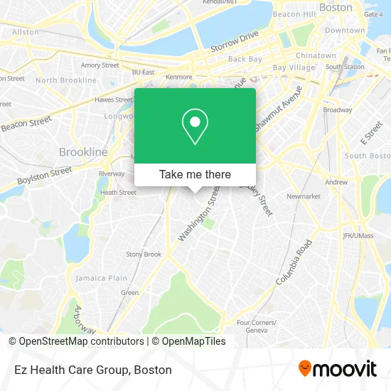
See Ez Health Care Group, Boston, on the map
Public Transit to Ez Health Care Group in Boston
Wondering how to get to Ez Health Care Group in Boston? Moovit helps you find the best way to get to Ez Health Care Group with step-by-step directions from the nearest public transit station.
Moovit provides free maps and live directions to help you navigate through your city. View schedules, routes, timetables, and find out how long does it take to get to Ez Health Care Group in real time.
Looking for the nearest stop or station to Ez Health Care Group? Check out this list of stops closest to your destination: Roxbury Crossing; Washington St @ Guild St; 42a John Eliot Sq; Ruggles; Longwood Medical Area.
Bus: 41, 42, 66, SL4, SL5, 14, 45.Train: NEEDHAM, PROVIDENCE/STOUGHTON, FRANKLIN/FOXBORO.Subway: ORANGE LINE, GREEN LINE E.
Want to see if there’s another route that gets you there at an earlier time? Moovit helps you find alternative routes or times. Get directions from and directions to Ez Health Care Group easily from the Moovit App or Website.
We make riding to Ez Health Care Group easy, which is why over 1.7 million users, including users in Boston, trust Moovit as the best app for public transit. You don’t need to download an individual bus app or train app, Moovit is your all-in-one transit app that helps you find the best bus time or train time available.
For information on prices of bus, subway and train, costs and ride fares to Ez Health Care Group, please check the Moovit app.
Use the app to navigate to popular places including to the airport, hospital, stadium, grocery store, mall, coffee shop, school, college, and university.
Ez Health Care Group Address: 73 Cedar St street in Boston
- The Charles Realty,
- Emmanuel College Notre Dame Campus,
- Best Spiritual Healing in Boston,
- Fort Hill,
- Bartlett Station Condominium Trust,
- Advanced Building Inspectors,
- Thorton Street Urban Farm & Community Gardens,
- 1 Juniper ter Parking,
- Edward Everett Hale House,
- Nuestra Comunidad Development Corporation,
- Live Longer Get Fit,
- District 7 Tavern,
- Roxbury Roots Montessori Inc.,
- Nubian Square,
- Libertyx Bitcoin ATM,
- Boltz Real Estate, Inc.,
- Omega Locksmith,
- Titus Foundation I,
- Black Economic Council of Ma,
- Health Mart Pharmacy
Places Near Ez Health Care Group (Boston)
- House Of Blues, Boston,
- Seaport District, Boston,
- Leader Bank Pavilion (Leader Bank Pavillion), Boston,
- Td Garden, Boston,
- North End, Boston,
- Castle Island, Boston,
- Boston Common, Boston,
- Boston Medical Center, Boston,
- Museum Of Science, Boston,
- Massachusetts General Hospital, Boston,
- Isabella Stewart Gardner Museum, Boston,
- Prudential Center, Boston,
- Wang Theater, Boston,
- Wilbur Theatre, Boston,
- Boston Convention & Exhibition Center, Boston,
- Faneuil Hall, Boston,
- Boston Children's Hospital, Boston,
- Mgm Music Hall, Boston,
- Quincy Market, Boston,
- Cheers, Boston
How to get to popular places in Boston with public transit
Get around Boston by public transit!
Traveling around Boston has never been so easy. See step by step directions as you travel to any attraction, street or major public transit station. View bus and train schedules, arrival times, service alerts and detailed routes on a map, so you know exactly how to get to anywhere in Boston.
When traveling to any destination around Boston use Moovit's Live Directions with Get Off Notifications to know exactly where and how far to walk, how long to wait for your line, and how many stops are left. Moovit will alert you when it's time to get off — no need to constantly re-check whether yours is the next stop.
Wondering how to use public transit in Boston or how to pay for public transit in Boston? Moovit public transit app can help you navigate your way with public transit easily, and at minimum cost. It includes public transit fees, ticket prices, and costs. Looking for a map of Boston public transit lines? Moovit public transit app shows all public transit maps in Boston with all Bus, Train, Subway and Ferry routes and stops on an interactive map.
Boston has 4 transit type(s), including: Bus, Train, Subway and Ferry, operated by several transit agencies, including MBTA, Southeastern Regional Transit Authority, MetroWest Regional Transit Authority, Rhode Island Public Transit Authority, WRTA, Lowell Regional Transit Authority, Merrimack Valley Transit, Montachusett Regional Transit Authority, Cape Cod Regional Transit Authority, Brockton Area Transit Authority, Martha's Vineyard Transit Authority, the WAVE - Nantucket Regional Transit Authority, GATRA, Cape Ann Transportation Authority and Massport