Directions to F3 Clinx (Boston) with public transportation
The following transit lines have routes that pass near F3 Clinx
 Bus: 33.
How to get to F3 Clinx by bus?
Click on the bus route to see step by step directions with maps, line arrival times and updated time schedules.
From South High Community School, Worcester
36 minFrom Registry Of Motor Vehicles (Rmv) Branch Office, Worcester
41 minFrom Polar Park, Worcester
49 minFrom Dcu Center, Worcester
53 minFrom Foxwoods, Worcester
61 minFrom Saint Vincent Hospital at Worcester Medical Center, Worcester
54 minFrom Palladium, Worcester
55 minFrom Worcester, MA, Worcester
43 minFrom St Vincent Hospital TH Medical, Worcester
53 minFrom Walmart Supercenter, Worcester
82 min
Bus stop near F3 Clinx in Boston
- Cumberland Farms, 13 min walk,VIEW
Bus lines to F3 Clinx in Boston
- 33, Central Hub,VIEW
What are the closest stations to F3 Clinx?
The closest stations to F3 Clinx are:
- Cumberland Farms is 1044 yards away, 13 min walk.
Which bus line stops near F3 Clinx?
33 (Central Hub→East Brookfield Courthouse)
What’s the nearest bus station to F3 Clinx in Boston?
The nearest bus station to F3 Clinx in Boston is Cumberland Farms. It’s a 13 min walk away.
What time is the first bus to F3 Clinx in Boston?
The 33 is the first bus that goes to F3 Clinx in Boston. It stops nearby at 5:34 AM.
What time is the last bus to F3 Clinx in Boston?
The 33 is the last bus that goes to F3 Clinx in Boston. It stops nearby at 8:36 PM.
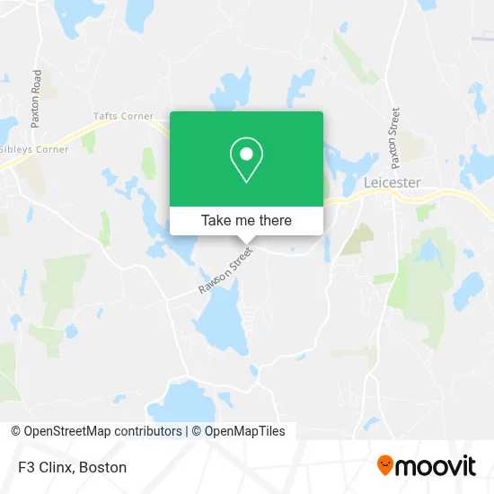
See F3 Clinx, Boston, on the map
Public Transit to F3 Clinx in Boston
Wondering how to get to F3 Clinx in Boston? Moovit helps you find the best way to get to F3 Clinx with step-by-step directions from the nearest public transit station.
Moovit provides free maps and live directions to help you navigate through your city. View schedules, routes, timetables, and find out how long does it take to get to F3 Clinx in real time.
Looking for the nearest stop or station to F3 Clinx? Check out this list of stops closest to your destination: Cumberland Farms.
Bus: 33.
Want to see if there’s another route that gets you there at an earlier time? Moovit helps you find alternative routes or times. Get directions from and directions to F3 Clinx easily from the Moovit App or Website.
We make riding to F3 Clinx easy, which is why over 1.7 million users, including users in Boston, trust Moovit as the best app for public transit. You don’t need to download an individual bus app or train app, Moovit is your all-in-one transit app that helps you find the best bus time or train time available.
For information on prices of bus, costs and ride fares to F3 Clinx, please check the Moovit app.
Use the app to navigate to popular places including to the airport, hospital, stadium, grocery store, mall, coffee shop, school, college, and university.
F3 Clinx Address: 2 Pine Ridge Dr street in Boston
- Lund Boat Parts Finder,
- Smartstyle Family Hair Salon,
- Minute Key,
- Redbox,
- Rugdoctor,
- Corning Clinical Laboratories,
- Walmart Auto Care Centers,
- MoneyGram,
- Blue Rhino,
- Jackson Hewitt Tax Service,
- Ifixandrepair - Leicester,
- Cricket Wireless,
- Eco Atm,
- WESTERN UNION,
- 1199 Main St Parking,
- USPS,
- USPS Collection Box - Po Lobby,
- Leicester, Massachusetts,
- A D T Security Services,
- Leicester Public Library
Places Near F3 Clinx (Boston)
- Quincy Market, Boston,
- Museum Of Science, Boston,
- Cheers, Boston,
- North End, Boston,
- Castle Island, Boston,
- Seaport District, Boston,
- Wilbur Theatre, Boston,
- Td Garden, Boston,
- Mgm Music Hall, Boston,
- Isabella Stewart Gardner Museum, Boston,
- Boston Children's Hospital, Boston,
- Boston Medical Center, Boston,
- Wang Theater, Boston,
- House Of Blues, Boston,
- Prudential Center, Boston,
- Faneuil Hall, Boston,
- Leader Bank Pavilion (Leader Bank Pavillion), Boston,
- Boston Common, Boston,
- Massachusetts General Hospital, Boston,
- Boston Convention & Exhibition Center, Boston
How to get to popular places in Boston with public transit
Get around Boston by public transit!
Traveling around Boston has never been so easy. See step by step directions as you travel to any attraction, street or major public transit station. View bus and train schedules, arrival times, service alerts and detailed routes on a map, so you know exactly how to get to anywhere in Boston.
When traveling to any destination around Boston use Moovit's Live Directions with Get Off Notifications to know exactly where and how far to walk, how long to wait for your line, and how many stops are left. Moovit will alert you when it's time to get off — no need to constantly re-check whether yours is the next stop.
Wondering how to use public transit in Boston or how to pay for public transit in Boston? Moovit public transit app can help you navigate your way with public transit easily, and at minimum cost. It includes public transit fees, ticket prices, and costs. Looking for a map of Boston public transit lines? Moovit public transit app shows all public transit maps in Boston with all Bus, Train, Subway and Ferry routes and stops on an interactive map.
Boston has 4 transit type(s), including: Bus, Train, Subway and Ferry, operated by several transit agencies, including MBTA, Southeastern Regional Transit Authority, MetroWest Regional Transit Authority, Rhode Island Public Transit Authority, WRTA, Lowell Regional Transit Authority, Merrimack Valley Transit, Montachusett Regional Transit Authority, Cape Cod Regional Transit Authority, Brockton Area Transit Authority, Martha's Vineyard Transit Authority, the WAVE - Nantucket Regional Transit Authority, GATRA, Cape Ann Transportation Authority and Massport