Directions to F45 (Cambridge) with public transportation
The following transit lines have routes that pass near F45
 Bus: 1, 66, 71, 96, 74.
- Train: FITCHBURG, FRAMINGHAM/WORCESTER, RED LINE.
- Subway: RED LINE, GREEN LINE D, GREEN LINE E, GREEN LINE B.
How to get to F45 by bus?
Click on the bus route to see step by step directions with maps, line arrival times and updated time schedules.
From VFW Parkway, Boston
59 minFrom Suffolk Downs, Boston
93 minFrom Melrose, MA, Melrose
87 minFrom Seaport District, Boston
58 minFrom The Freedom Trail, Boston
53 minFrom John F. Kennedy Presidential Library And Museum, Boston
72 minFrom Stone Zoo, Stoneham
89 minFrom MBTA Suffolk Downs Station, Boston
97 minFrom Intercontinental Boston, Boston
57 minFrom Residence Inn by Marriott Boston Downtown/South End, Boston
42 min
How to get to F45 by train?
Click on the train route to see step by step directions with maps, line arrival times and updated time schedules.
From VFW Parkway, Boston
105 minFrom Melrose, MA, Melrose
114 minFrom Seaport District, Boston
72 minFrom The Freedom Trail, Boston
58 minFrom John F. Kennedy Presidential Library And Museum, Boston
99 minFrom Intercontinental Boston, Boston
62 minFrom Residence Inn by Marriott Boston Downtown/South End, Boston
80 min
How to get to F45 by subway?
Click on the subway route to see step by step directions with maps, line arrival times and updated time schedules.
From Suffolk Downs, Boston
51 minFrom Seaport District, Boston
37 minFrom The Freedom Trail, Boston
17 minFrom John F. Kennedy Presidential Library And Museum, Boston
50 minFrom MBTA Suffolk Downs Station, Boston
41 minFrom Intercontinental Boston, Boston
25 minFrom Residence Inn by Marriott Boston Downtown/South End, Boston
41 min
Bus stops near F45 in Cambridge
Train station near F45 in Cambridge
- Porter, 14 min walk,VIEW
Bus lines to F45 in Cambridge
- 66, Nubian via Allston - Harvard via Allston,VIEW
- 71, Harvard - Watertown Square,VIEW
- 74, Harvard - Belmont Center,VIEW
- 75, Harvard - Belmont Center,VIEW
- 77, Harvard - Arlington Heights,VIEW
- 78, Harvard - Arlmont Village,VIEW
- 86, Reservoir - Harvard,VIEW
- 96, Harvard - Medford Square,VIEW
- 109, Harvard via Sullivan - Linden Square via Sullivan,VIEW
- RED LINE SHUTTLE, Jfk/Umass (Shuttle),VIEW
- RED LINE SHUTTLE, Alewife (Shuttle),VIEW
- RED LINE SHUTTLE, Harvard (Shuttle),VIEW
- RED LINE SHUTTLE, Alewife (Local Shuttle),VIEW
- 73, Waverley,VIEW
- 68, Kendall/MIT,VIEW
- 69, Harvard,VIEW
- 1, Harvard,VIEW
- RED LINE SHUTTLE, Harvard - Kendall/MIT (Loop),VIEW
- RED LINE SHUTTLE, Harvard - South Station,VIEW
- RED LINE SHUTTLE, Alewife - Harvard via Holyoke Street,VIEW
What are the closest stations to F45?
The closest stations to F45 are:
- Eliot St @ Bennett St is 98 yards away, 2 min walk.
- Harvard - Brattle St @ Palmer St is 138 yards away, 2 min walk.
- Mt Auburn St @ University Rd is 148 yards away, 3 min walk.
- Quincy St @ Harvard St is 201 yards away, 3 min walk.
- Massachusetts Ave @ Bow St is 203 yards away, 3 min walk.
- Massachusetts Ave Opp Holyoke St is 410 yards away, 5 min walk.
- Porter is 1165 yards away, 14 min walk.
- Union Square is 2123 yards away, 26 min walk.
- Babcock Street is 2838 yards away, 34 min walk.
Which bus lines stop near F45?
These bus lines stop near F45: 1, 66, 71, 96.
Which train lines stop near F45?
These train lines stop near F45: FITCHBURG, FRAMINGHAM/WORCESTER.
Which subway line stops near F45?
RED LINE (Alewife)
What’s the nearest subway station to F45 in Cambridge?
The nearest subway station to F45 in Cambridge is Union Square. It’s a 26 min walk away.
What’s the nearest train station to F45 in Cambridge?
The nearest train station to F45 in Cambridge is Porter. It’s a 14 min walk away.
What’s the nearest bus station to F45 in Cambridge?
The nearest bus stations to F45 in Cambridge are Eliot St @ Bennett St and Harvard - Brattle St @ Palmer St. The closest one is a 2 min walk away.
What time is the first subway to F45 in Cambridge?
The GREEN LINE E is the first subway that goes to F45 in Cambridge. It stops nearby at 4:50 AM.
What time is the last subway to F45 in Cambridge?
The GREEN LINE B is the last subway that goes to F45 in Cambridge. It stops nearby at 2:20 AM.
What time is the first train to F45 in Cambridge?
The FITCHBURG is the first train that goes to F45 in Cambridge. It stops nearby at 5:47 AM.
What time is the last train to F45 in Cambridge?
The FITCHBURG is the last train that goes to F45 in Cambridge. It stops nearby at 12:17 AM.
What time is the first bus to F45 in Cambridge?
The 73 is the first bus that goes to F45 in Cambridge. It stops nearby at 4:45 AM.
What time is the last bus to F45 in Cambridge?
The 66 is the last bus that goes to F45 in Cambridge. It stops nearby at 2:36 AM.
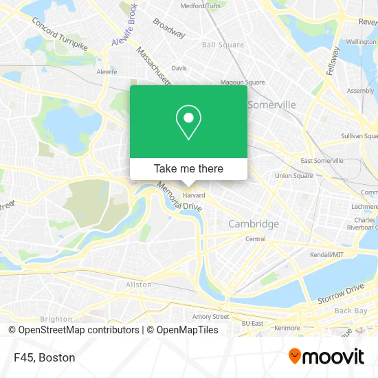
See F45, Cambridge, on the map
Public Transit to F45 in Cambridge
Wondering how to get to F45 in Cambridge? Moovit helps you find the best way to get to F45 with step-by-step directions from the nearest public transit station.
Moovit provides free maps and live directions to help you navigate through your city. View schedules, routes, timetables, and find out how long does it take to get to F45 in real time.
Looking for the nearest stop or station to F45? Check out this list of stops closest to your destination: Eliot St @ Bennett St; Harvard - Brattle St @ Palmer St; Mt Auburn St @ University Rd; Quincy St @ Harvard St; Massachusetts Ave @ Bow St; Massachusetts Ave Opp Holyoke St; Porter; Union Square; Babcock Street.
Bus: 1, 66, 71, 96, 74, 75, 77, RED LINE SHUTTLE, RED LINE SHUTTLE, RED LINE SHUTTLE, RED LINE SHUTTLE, 73.Train: FITCHBURG, FRAMINGHAM/WORCESTER, RED LINE.Subway: RED LINE, GREEN LINE D, GREEN LINE E, GREEN LINE B.
Want to see if there’s another route that gets you there at an earlier time? Moovit helps you find alternative routes or times. Get directions from and directions to F45 easily from the Moovit App or Website.
We make riding to F45 easy, which is why over 1.7 million users, including users in Cambridge, trust Moovit as the best app for public transit. You don’t need to download an individual bus app or train app, Moovit is your all-in-one transit app that helps you find the best bus time or train time available.
For information on prices of bus, subway and train, costs and ride fares to F45, please check the Moovit app.
Use the app to navigate to popular places including to the airport, hospital, stadium, grocery store, mall, coffee shop, school, college, and university.
F45 Address: 20 Brattle St Unit 10 street in Cambridge
- Harvard Square MBTA Station - Red Line & Buses,
- CarGurus,
- Kaplan International Center,
- Magica Italia,
- Tasty Burger,
- El Jefe's Taqueria,
- Anime Zakka,
- Starbucks,
- The Garage,
- La Flamme Barber Shop (Laflamme Barber Shop),
- Brattle St / Harvard Sq,
- Patagonia,
- Plymouth Rock,
- Visionworks,
- Mike's Pastry,
- B.Good,
- Harvard Upper Busway,
- Shake Shack,
- Santander Bank,
- Club Passim
Places Near F45 (Cambridge)
- Td Garden, Boston,
- Isabella Stewart Gardner Museum, Boston,
- Mgm Music Hall, Boston,
- Boston Common, Boston,
- Wang Theater, Boston,
- House Of Blues, Boston,
- Boston Medical Center, Boston,
- Massachusetts General Hospital, Boston,
- North End, Boston,
- Quincy Market, Boston,
- Castle Island, Boston,
- Seaport District, Boston,
- Museum Of Science, Boston,
- Faneuil Hall, Boston,
- Boston Children's Hospital, Boston,
- Cheers, Boston,
- Wilbur Theatre, Boston,
- Boston Convention & Exhibition Center, Boston,
- Prudential Center, Boston,
- Leader Bank Pavilion (Leader Bank Pavillion), Boston
How to get to popular places in Boston with public transit
Get around Cambridge by public transit!
Traveling around Cambridge has never been so easy. See step by step directions as you travel to any attraction, street or major public transit station. View bus and train schedules, arrival times, service alerts and detailed routes on a map, so you know exactly how to get to anywhere in Cambridge.
When traveling to any destination around Cambridge use Moovit's Live Directions with Get Off Notifications to know exactly where and how far to walk, how long to wait for your line, and how many stops are left. Moovit will alert you when it's time to get off — no need to constantly re-check whether yours is the next stop.
Wondering how to use public transit in Cambridge or how to pay for public transit in Cambridge? Moovit public transit app can help you navigate your way with public transit easily, and at minimum cost. It includes public transit fees, ticket prices, and costs. Looking for a map of Cambridge public transit lines? Moovit public transit app shows all public transit maps in Cambridge with all Bus, Train, Subway and Ferry routes and stops on an interactive map.
Boston has 4 transit type(s), including: Bus, Train, Subway and Ferry, operated by several transit agencies, including MBTA, Southeastern Regional Transit Authority, MetroWest Regional Transit Authority, Rhode Island Public Transit Authority, WRTA, Lowell Regional Transit Authority, Merrimack Valley Transit, Montachusett Regional Transit Authority, Cape Cod Regional Transit Authority, Brockton Area Transit Authority, Martha's Vineyard Transit Authority, the WAVE - Nantucket Regional Transit Authority, GATRA, Cape Ann Transportation Authority and Massport