How to get to F.B by bus?
Click on the bus route to see step by step directions with maps, line arrival times and updated time schedules.
From Bilancino Lake, Barberino Di Mugello
221 minFrom Futa Pass, Firenzuola
62 minFrom Borgo San Lorenzo, Borgo San Lorenzo
31 minFrom Pratolino Park, Vaglia
46 minFrom Barberino Outlet, Barberino Di Mugello
240 minFrom Sanctuary of the Madonna del Sasso, Pontassieve
216 minFrom Barberino Di Mugello, Barberino Di Mugello
233 min
Bus lines to F.B in Scarperia
- 302 A, San Piero A Sieve Railway Station,VIEW
- 303 A, San Piero A Sieve Railway Station,VIEW
- 303 B, Scarperia,VIEW
- 303 B, San Piero A Sieve Railway Station,VIEW
- 304 B, Firenzuola Terminal,VIEW
- 304 B, Borgo Kennedy,VIEW
- 305 B, Barberino Via Del Lavoro,VIEW
- 303-1, Scarperia Schools,VIEW
- 305-3, Scarperia,VIEW
- 307 A, Florence Montelungo Hub,VIEW
What are the closest stations to F.B?
The closest stations to F.B are:
- Scarperia Cemetery is 220 meters away, 3 min walk.
- Scarperia is 449 meters away, 6 min walk.
Which bus lines stop near F.B?
These bus lines stop near F.B: 305 B, 307 A.
What’s the nearest bus station to F.B in Scarperia?
The nearest bus station to F.B in Scarperia is Scarperia Cemetery. It’s a 3 min walk away.
What time is the first bus to F.B in Scarperia?
The 307 A is the first bus that goes to F.B in Scarperia. It stops nearby at 5:44 AM.
What time is the last bus to F.B in Scarperia?
The 307 A is the last bus that goes to F.B in Scarperia. It stops nearby at 9:21 PM.
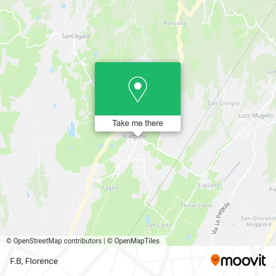
See F.B, Scarperia, on the map
Public Transit to F.B in Scarperia
Wondering how to get to F.B in Scarperia? Moovit helps you find the best way to get to F.B with step-by-step directions from the nearest public transit station.
Moovit provides free maps and live directions to help you navigate through your city. View schedules, routes, timetables, and find out how long does it take to get to F.B in real time.
Looking for the nearest stop or station to F.B? Check out this list of stops closest to your destination: Scarperia Cemetery; Scarperia.
Bus: 305 B, 307 A, 302 A, 303 A, 303 B, 303 B, 304 B, 305-3.
Want to see if there’s another route that gets you there at an earlier time? Moovit helps you find alternative routes or times. Get directions from and directions to F.B easily from the Moovit App or Website.
We make riding to F.B easy, which is why over 1.5 million users, including users in Scarperia, trust Moovit as the best app for public transit. You don’t need to download an individual bus app or train app, Moovit is your all-in-one transit app that helps you find the best bus time or train time available.
For information on prices of bus and train, costs and ride fares to F.B, please check the Moovit app.
Use the app to navigate to popular places including to the airport, hospital, stadium, grocery store, mall, coffee shop, school, college, and university.
F.B Address: Viale Giacomo Matteotti, 50038 Scarperia e San Piero street in Scarperia
- Bi&O Constructions,
- Casalinghiamo,
- Sporting Club Borgo Nuovo,
- Cresci Giuseppe,
- Guidoni by Checchi Rossella,
- Tortello and Porcini Mushroom Festival,
- FGF,
- Fit4you Limited Liability,
- Berti Cutlery by Severino Berti & Co.,
- Gallianinodue by Mengoni M.,
- Vinciguerra Giovanni,
- Olmi Luigi,
- Scricciolo Nursery,
- Mcl. Scarperia,
- Cooperative Work and Mutual Aid Society among Porters,
- 16 San Martino Street,
- Mugello Skating 2002,
- Chapel of the Madonna of the Square,
- Frassine Agritourism,
- Mosca Alessandro
Places Near F.B (Scarperia)
- IKEA Florence, Sesto Fiorentino,
- Campi Bisenzio, Campi Bisenzio,
- OOO, Florence,
- I Gigli, Campi Bisenzio,
- Cascine Park, Florence,
- Artemio Franchi Municipal Stadium, Florence,
- Santa Maria Novella Station, Florence,
- Verdi Theater, Florence,
- Visarno Arena, Florence,
- Field of Mars, Florence,
- Michelangelo Square, Florence,
- Santa Maria Nuova Hospital, Florence,
- Visarno Hippodrome, Florence,
- Mandela Forum (Nelson Mandela Forum), Florence,
- Torregalli Hospital Scandicci *, Scandicci,
- Piero Palagi Hospital Facility-Florence, Florence,
- Nelson Mandela Forum, Florence,
- Asmana, Campi Bisenzio,
- Tobacco Manufacture, Florence,
- Michelangelo Square, Florence
How to get to popular places in Florence with public transit
Get around Scarperia by public transit!
Traveling around Scarperia has never been so easy. See step by step directions as you travel to any attraction, street or major public transit station. View bus and train schedules, arrival times, service alerts and detailed routes on a map, so you know exactly how to get to anywhere in Scarperia.
When traveling to any destination around Scarperia use Moovit's Live Directions with Get Off Notifications to know exactly where and how far to walk, how long to wait for your line, and how many stops are left. Moovit will alert you when it's time to get off — no need to constantly re-check whether yours is the next stop.
Wondering how to use public transit in Scarperia or how to pay for public transit in Scarperia? Moovit public transit app can help you navigate your way with public transit easily, and at minimum cost. It includes public transit fees, ticket prices, and costs. Looking for a map of Scarperia public transit lines? Moovit public transit app shows all public transit maps in Scarperia with all Bus, Train, Light Rail, Ferry and Funicular routes and stops on an interactive map.
Florence has 5 transit type(s), including: Bus, Train, Light Rail, Ferry and Funicular, operated by several transit agencies, including Florence Urban - Tuscan Bus Lines, GEST, Livorno and Province - Tuscan Bus Lines, Arezzo, Florence and Provinces - Tuscan Bus Lines, Prato and Province - Tuscan Bus Lines, Lucca and Province - Tuscan Bus Lines, Massa, Carrara and Province - Tuscan Bus Lines, Pisa and Province - Tuscan Bus Lines, Grosseto, Siena and Provinces - Tuscan Bus Lines, Arezzo, Siena and Provinces - Tuscan Bus Lines, Florence and Province - Tuscan Bus Lines, Pistoia and Province - Tuscan Bus Lines, Siena and Province - Tuscan Bus Lines, Arezzo and Province - Tuscan Bus Lines and Trenitalia
Public transit lines with stations closest to F.B in Scarperia
Bus lines with stations closest to F.B in Scarperia
Scarperia Cemetery
 302 AMonghidoro-Barberino Di Mugello-San Piero A Sieve-Vaglia-Florence
- 303 AGiugnola-Firenzuola-Scarperia-San Piero a Sieve-Florence
- 303 BGiugnola-Firenzuola-Scarperia-San Piero a Sieve-Florence
- 303 BGiugnola-Firenzuola-Scarperia-San Piero a Sieve-Florence
- 304 BMonghidoro-Bruscoli-Firenzuola-San Piero A Sieve-Borgo San Lorenzo