How to get to Fa Williams, Inc by bus?
Click on the bus route to see step by step directions with maps, line arrival times and updated time schedules.
From Boston Tea Party - Ships And Museum, Boston
91 minFrom Emerson Colonial Theatre (Colonial Theater), Boston
57 minFrom Samuel Adams Brewery, Boston
90 minFrom Grill 23 & Bar, Boston
54 minFrom Hyatt Regency Boston, Boston
64 minFrom Newton-Wellesley Hospital, Newton
104 minFrom Melrose, MA, Melrose
127 minFrom Charles/MGH T Stop, Boston
60 minFrom Sam Adams Boston Brewery Tour, Boston
89 minFrom Liberty Mutual, Boston
54 min
How to get to Fa Williams, Inc by train?
Click on the train route to see step by step directions with maps, line arrival times and updated time schedules.
How to get to Fa Williams, Inc by subway?
Click on the subway route to see step by step directions with maps, line arrival times and updated time schedules.
From Boston Tea Party - Ships And Museum, Boston
54 minFrom Emerson Colonial Theatre (Colonial Theater), Boston
49 minFrom Samuel Adams Brewery, Boston
69 minFrom Grill 23 & Bar, Boston
59 minFrom Hyatt Regency Boston, Boston
50 minFrom Newton-Wellesley Hospital, Newton
98 minFrom Charles/MGH T Stop, Boston
42 minFrom Sam Adams Boston Brewery Tour, Boston
69 minFrom Liberty Mutual, Boston
57 min
Bus stops near Fa Williams, Inc in Belmont
Subway station near Fa Williams, Inc in Belmont
- Alewife, 39 min walk,VIEW
Train station near Fa Williams, Inc in Belmont
- Porter, 41 min walk,VIEW
What are the closest stations to Fa Williams, Inc?
The closest stations to Fa Williams, Inc are:
- Brighton St @ Hittinger St is 70 yards away, 2 min walk.
- Concord Ave @ Blanchard Rd is 552 yards away, 7 min walk.
- Concord Ave @ Watson Rd is 638 yards away, 8 min walk.
- Alewife is 3260 yards away, 39 min walk.
- Porter is 3442 yards away, 41 min walk.
Which bus lines stop near Fa Williams, Inc?
These bus lines stop near Fa Williams, Inc: 71, 74, 78.
Which train line stops near Fa Williams, Inc?
FITCHBURG (#413 | Wachusett)
Which subway line stops near Fa Williams, Inc?
RED LINE (Alewife)
What’s the nearest bus station to Fa Williams, Inc in Belmont?
The nearest bus station to Fa Williams, Inc in Belmont is Brighton St @ Hittinger St. It’s a 2 min walk away.
What time is the first subway to Fa Williams, Inc in Belmont?
The RED LINE is the first subway that goes to Fa Williams, Inc in Belmont. It stops nearby at 5:15 AM.
What time is the last subway to Fa Williams, Inc in Belmont?
The RED LINE is the last subway that goes to Fa Williams, Inc in Belmont. It stops nearby at 2:06 AM.
What time is the first train to Fa Williams, Inc in Belmont?
The FITCHBURG is the first train that goes to Fa Williams, Inc in Belmont. It stops nearby at 5:39 AM.
What time is the last train to Fa Williams, Inc in Belmont?
The FITCHBURG is the last train that goes to Fa Williams, Inc in Belmont. It stops nearby at 12:17 AM.
What time is the first bus to Fa Williams, Inc in Belmont?
The 74 is the first bus that goes to Fa Williams, Inc in Belmont. It stops nearby at 5:11 AM.
What time is the last bus to Fa Williams, Inc in Belmont?
The 74 is the last bus that goes to Fa Williams, Inc in Belmont. It stops nearby at 1:24 AM.
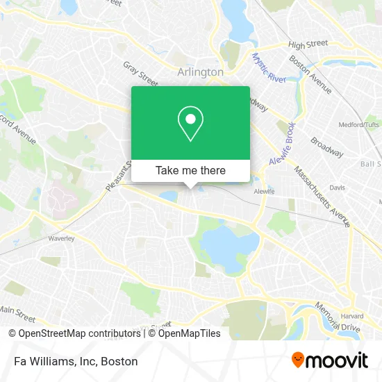
See Fa Williams, Inc, Belmont, on the map
Public Transit to Fa Williams, Inc in Belmont
Wondering how to get to Fa Williams, Inc in Belmont? Moovit helps you find the best way to get to Fa Williams, Inc with step-by-step directions from the nearest public transit station.
Moovit provides free maps and live directions to help you navigate through your city. View schedules, routes, timetables, and find out how long does it take to get to Fa Williams, Inc in real time.
Looking for the nearest stop or station to Fa Williams, Inc? Check out this list of stops closest to your destination: Brighton St @ Hittinger St; Concord Ave @ Blanchard Rd; Concord Ave @ Watson Rd; Alewife; Porter.
Bus: 71, 74, 78, 75.Train: FITCHBURG.Subway: RED LINE.
Want to see if there’s another route that gets you there at an earlier time? Moovit helps you find alternative routes or times. Get directions from and directions to Fa Williams, Inc easily from the Moovit App or Website.
We make riding to Fa Williams, Inc easy, which is why over 1.7 million users, including users in Belmont, trust Moovit as the best app for public transit. You don’t need to download an individual bus app or train app, Moovit is your all-in-one transit app that helps you find the best bus time or train time available.
For information on prices of bus, subway and train, costs and ride fares to Fa Williams, Inc, please check the Moovit app.
Use the app to navigate to popular places including to the airport, hospital, stadium, grocery store, mall, coffee shop, school, college, and university.
Fa Williams, Inc Address: 12 Brighton St street in Belmont
- Allure Aesthetics,
- Styled by Molly,
- Lauras Studio,
- Mukarker Group,
- Comella S - Belmont,
- Single,
- Shishubharati School,
- Its Realty,
- Wingate Electric,
- Logovista,
- Asian Body Works,
- Brighton Street Automotive,
- Trustworthy Auto Glass,
- Frank's Landscaping Company,
- Oak Realty and Service Company,
- C & L Hot Tubs,
- Cambridge Property Development,
- The Squabblin' Goblin,
- FedEx,
- Sico & Walsh Insurance Agency
Places Near Fa Williams, Inc (Belmont)
- North End, Boston,
- House Of Blues, Boston,
- Seaport District, Boston,
- Prudential Center, Boston,
- Castle Island, Boston,
- Td Garden, Boston,
- Massachusetts General Hospital, Boston,
- Cheers, Boston,
- Museum Of Science, Boston,
- Boston Medical Center, Boston,
- Wilbur Theatre, Boston,
- Isabella Stewart Gardner Museum, Boston,
- Leader Bank Pavilion (Leader Bank Pavillion), Boston,
- Boston Common, Boston,
- Boston Children's Hospital, Boston,
- Mgm Music Hall, Boston,
- Faneuil Hall, Boston,
- Wang Theater, Boston,
- Boston Convention & Exhibition Center, Boston,
- Quincy Market, Boston
How to get to popular places in Boston with public transit
Get around Belmont by public transit!
Traveling around Belmont has never been so easy. See step by step directions as you travel to any attraction, street or major public transit station. View bus and train schedules, arrival times, service alerts and detailed routes on a map, so you know exactly how to get to anywhere in Belmont.
When traveling to any destination around Belmont use Moovit's Live Directions with Get Off Notifications to know exactly where and how far to walk, how long to wait for your line, and how many stops are left. Moovit will alert you when it's time to get off — no need to constantly re-check whether yours is the next stop.
Wondering how to use public transit in Belmont or how to pay for public transit in Belmont? Moovit public transit app can help you navigate your way with public transit easily, and at minimum cost. It includes public transit fees, ticket prices, and costs. Looking for a map of Belmont public transit lines? Moovit public transit app shows all public transit maps in Belmont with all Bus, Train, Subway and Ferry routes and stops on an interactive map.
Boston has 4 transit type(s), including: Bus, Train, Subway and Ferry, operated by several transit agencies, including MBTA, Southeastern Regional Transit Authority, MetroWest Regional Transit Authority, Rhode Island Public Transit Authority, WRTA, Lowell Regional Transit Authority, Merrimack Valley Transit, Montachusett Regional Transit Authority, Cape Cod Regional Transit Authority, Brockton Area Transit Authority, Martha's Vineyard Transit Authority, the WAVE - Nantucket Regional Transit Authority, GATRA, Cape Ann Transportation Authority and Massport