Directions to Fabro Scalo with public transportation
The following transit lines have routes that pass near Fabro Scalo
How to get to Fabro Scalo by bus?
Click on the bus route to see step by step directions with maps, line arrival times and updated time schedules.
How to get to Fabro Scalo by train?
Click on the train route to see step by step directions with maps, line arrival times and updated time schedules.
Bus stations near Fabro Scalo
- Fabro Scalo, 3 min walk,
Train stations near Fabro Scalo
- Fabro-Ficulle, 11 min walk,
Bus lines to Fabro Scalo
- E645, ORVIETO - FABRO FS - PERUGIA,
- E646, ORVIETO - FABRO,
What are the closest stations to Fabro Scalo?
The closest stations to Fabro Scalo are:
- Fabro Scalo is 213 meters away, 3 min walk.
- Fabro-Ficulle is 790 meters away, 11 min walk.
Which bus lines stop near Fabro Scalo?
These bus lines stop near Fabro Scalo: E111, E645.
Which train line stops near Fabro Scalo?
RV
What’s the nearest train station to Fabro Scalo?
The nearest train station to Fabro Scalo is Fabro-Ficulle. It’s a 11 min walk away.
What’s the nearest bus stop to Fabro Scalo?
The nearest bus stop to Fabro Scalo is Fabro Scalo. It’s a 3 min walk away.
See Fabro Scalo on the map
Public Transportation to Fabro Scalo
Wondering how to get to Fabro Scalo, Italy? Moovit helps you find the best way to get to Fabro Scalo with step-by-step directions from the nearest public transit station.
Moovit provides free maps and live directions to help you navigate through your city. View schedules, routes, timetables, and find out how long does it take to get to Fabro Scalo in real time.
Looking for the nearest stop or station to Fabro Scalo? Check out this list of stops closest to your destination: Fabro Scalo; Fabro-Ficulle.
Bus: E111, E645, E646.Train: RV, R, R.
Want to see if there’s another route that gets you there at an earlier time? Moovit helps you find alternative routes or times. Get directions from and directions to Fabro Scalo easily from the Moovit App or Website.
We make riding to Fabro Scalo easy, which is why over 1.5 million users, including users in Fabro, trust Moovit as the best app for public transit. You don’t need to download an individual bus app or train app, Moovit is your all-in-one transit app that helps you find the best bus time or train time available.
For information on prices of bus and train, costs and ride fares to Fabro Scalo, please check the Moovit app.
Use the app to navigate to popular places including to the airport, hospital, stadium, grocery store, mall, coffee shop, school, college, and university.
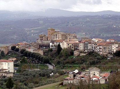
Fabro Scalo Address: Via Pasubio street in Fabro
Attractions near Fabro Scalo
Parco Pubblico,Pista Da Ballo,Piazzetta Del Chiosco,Campo Da Tennis,Festa Contadina,Chiosco,Via Pasubio,Via del Campo Sportivo n. 1,Via Gorizia,Casa Di Quartiere "La Meglio Gioventù",Parcheggio Parco,Sala Polivalente,Albergo il Focolare Smec di Dragoni M.&,Ufficio Postale,Via Papa Giovanni XXIII 13,Ufficio Postale Di Fabro Scalo,Piazzale F. Parri,Parrano Carni,Parcheggio,Grandi Magazzini FioroniHow to get to popular attractions in Fabro with public transit
Stazione di Narni-Amelia, Narni,Perugia Sant'Anna, Perugia,Quasar Village, Corciano,Stazione Terontola-Cortona, Cortona,Tribunale di Perugia, Perugia,Assisi, Assisi,Duomo Di Todi, Todi,Pila, Perugia,Mensa Centrale Adisu, Perugia,Lidl, Perugia,Area di Servizio Terni Nord, Terni,Azienda Ospedaliera Santa Maria, Terni,Marsciano, Marsciano,Ambulatori Ospedale Santa Maria Della Misericordia, Perugia,Borgonovo Entertainment Center, Perugia,Ponte Valleceppi, Perugia,Alla Posta Dei Donini Hotel Perugia, Perugia,Mugnano, Perugia,Piazza Garibaldi, Spoleto,Zona Polymer, TerniGet around Perugia and Umbria by public transit!
Traveling around Perugia and Umbria has never been so easy. See step by step directions as you travel to any attraction, street or major public transit station. View bus and train schedules, arrival times, service alerts and detailed routes on a map, so you know exactly how to get to anywhere in Perugia and Umbria.
When traveling to any destination around Perugia and Umbria use Moovit's Live Directions with Get Off Notifications to know exactly where and how far to walk, how long to wait for your line, and how many stops are left. Moovit will alert you when it's time to get off — no need to constantly re-check whether yours is the next stop.
Wondering how to use public transit in Perugia and Umbria or how to pay for public transit in Perugia and Umbria? Moovit public transit app can help you navigate your way with public transit easily, and at minimum cost. It includes public transit fees, ticket prices, and costs. Looking for a map of Perugia and Umbria public transit lines? Moovit public transit app shows all public transit maps in Perugia and Umbria with all Bus, Train, Metro, Ferry and Funicular routes and stops on an interactive map.
Perugia and Umbria has 5 transit type(s), including: Bus, Train, Metro, Ferry and Funicular, operated by several transit agencies, including Minimetrò S.p.A., Trenitalia, Busitalia - Sita Nord s.r.l., Cooperativa Mobilità Trasporti