How to get to Fair Employment Project by bus?
Click on the bus route to see step by step directions with maps, line arrival times and updated time schedules.
From Bistro du Midi, Boston
53 minFrom Santarpio's Pizza, Boston
89 minFrom Beehive, Boston
62 minFrom Newton Wellesley Hospital Green Building, Newton
100 minFrom L.L.Bean, Boston
92 minFrom The 'Quin House, Boston
50 minFrom 1010 MASS AVE, Boston
63 minFrom Boston Latin School, Boston
60 minFrom 15 Parkman Street, Boston
65 minFrom Haymarket, Boston, Boston
67 min
How to get to Fair Employment Project by train?
Click on the train route to see step by step directions with maps, line arrival times and updated time schedules.
How to get to Fair Employment Project by subway?
Click on the subway route to see step by step directions with maps, line arrival times and updated time schedules.
From Bistro du Midi, Boston
57 minFrom Santarpio's Pizza, Boston
72 minFrom Beehive, Boston
64 minFrom Newton Wellesley Hospital Green Building, Newton
100 minFrom L.L.Bean, Boston
64 minFrom The 'Quin House, Boston
65 minFrom 1010 MASS AVE, Boston
71 minFrom Boston Latin School, Boston
74 minFrom 15 Parkman Street, Boston
50 minFrom Haymarket, Boston, Boston
61 min
Bus stops near Fair Employment Project in Cambridge
Train station near Fair Employment Project in Cambridge
- Belmont, 38 min walk,VIEW
Subway station near Fair Employment Project in Cambridge
- Davis Sq., 49 min walk,VIEW
Bus lines to Fair Employment Project in Cambridge
What are the closest stations to Fair Employment Project?
The closest stations to Fair Employment Project are:
- Concord Ave @ Watson Rd is 85 yards away, 2 min walk.
- Concord Ave @ Smith Pl is 350 yards away, 5 min walk.
- Belmont is 3240 yards away, 38 min walk.
- Davis Sq. is 4191 yards away, 49 min walk.
Which bus lines stop near Fair Employment Project?
These bus lines stop near Fair Employment Project: 71, 74, 78.
Which train line stops near Fair Employment Project?
FITCHBURG (#413 | Wachusett)
Which subway line stops near Fair Employment Project?
RED LINE (Alewife)
What’s the nearest bus station to Fair Employment Project in Cambridge?
The nearest bus station to Fair Employment Project in Cambridge is Concord Ave @ Watson Rd. It’s a 2 min walk away.
What time is the first subway to Fair Employment Project in Cambridge?
The RED LINE is the first subway that goes to Fair Employment Project in Cambridge. It stops nearby at 5:15 AM.
What time is the last subway to Fair Employment Project in Cambridge?
The RED LINE is the last subway that goes to Fair Employment Project in Cambridge. It stops nearby at 2:06 AM.
What time is the first train to Fair Employment Project in Cambridge?
The FITCHBURG is the first train that goes to Fair Employment Project in Cambridge. It stops nearby at 5:39 AM.
What time is the last train to Fair Employment Project in Cambridge?
The FITCHBURG is the last train that goes to Fair Employment Project in Cambridge. It stops nearby at 12:17 AM.
What time is the first bus to Fair Employment Project in Cambridge?
The 74 is the first bus that goes to Fair Employment Project in Cambridge. It stops nearby at 5:11 AM.
What time is the last bus to Fair Employment Project in Cambridge?
The 74 is the last bus that goes to Fair Employment Project in Cambridge. It stops nearby at 1:23 AM.
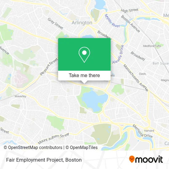
See Fair Employment Project, Cambridge, on the map
Public Transit to Fair Employment Project in Cambridge
Wondering how to get to Fair Employment Project in Cambridge? Moovit helps you find the best way to get to Fair Employment Project with step-by-step directions from the nearest public transit station.
Moovit provides free maps and live directions to help you navigate through your city. View schedules, routes, timetables, and find out how long does it take to get to Fair Employment Project in real time.
Looking for the nearest stop or station to Fair Employment Project? Check out this list of stops closest to your destination: Concord Ave @ Watson Rd; Concord Ave @ Smith Pl; Belmont; Davis Sq..
Bus: 71, 74, 78, 75.Train: FITCHBURG.Subway: RED LINE.
Want to see if there’s another route that gets you there at an earlier time? Moovit helps you find alternative routes or times. Get directions from and directions to Fair Employment Project easily from the Moovit App or Website.
We make riding to Fair Employment Project easy, which is why over 1.7 million users, including users in Cambridge, trust Moovit as the best app for public transit. You don’t need to download an individual bus app or train app, Moovit is your all-in-one transit app that helps you find the best bus time or train time available.
For information on prices of bus, subway and train, costs and ride fares to Fair Employment Project, please check the Moovit app.
Use the app to navigate to popular places including to the airport, hospital, stadium, grocery store, mall, coffee shop, school, college, and university.
Fair Employment Project Address: 777 Concord Ave street in Cambridge
- Herbert Martha MD,
- Higher Synthesis Foundation,
- Zhao Acupuncture,
- Paula Wright Electrolysis,
- Fayerweather Street School,
- DaVita Dialysis Center,
- Mt Auburn HSP SLP DSRDRS Ctr Liberty,
- Dexafit Boston,
- De Bonte Leeuw,
- Peter B Jenney,
- Dr Elizabeth E McKeen, MD,
- Nano Terra,
- Geo Mart,
- Sobuta, Andy, Pt,
- Italian MC Wear,
- Ronald Warren, MD,
- Ent Surgery Associates,
- Rma Policies,
- Joycelyn Datu MD,
- Raj Ferenc Rabbi-Study
Places Near Fair Employment Project (Cambridge)
- Massachusetts General Hospital, Boston,
- Leader Bank Pavilion (Leader Bank Pavillion), Boston,
- Wilbur Theatre, Boston,
- Boston Convention & Exhibition Center, Boston,
- Prudential Center, Boston,
- Isabella Stewart Gardner Museum, Boston,
- Mgm Music Hall, Boston,
- Boston Medical Center, Boston,
- Wang Theater, Boston,
- Boston Children's Hospital, Boston,
- Seaport District, Boston,
- North End, Boston,
- Cheers, Boston,
- Museum Of Science, Boston,
- Quincy Market, Boston,
- Boston Common, Boston,
- House Of Blues, Boston,
- Castle Island, Boston,
- Td Garden, Boston,
- Faneuil Hall, Boston
How to get to popular places in Boston with public transit
Get around Cambridge by public transit!
Traveling around Cambridge has never been so easy. See step by step directions as you travel to any attraction, street or major public transit station. View bus and train schedules, arrival times, service alerts and detailed routes on a map, so you know exactly how to get to anywhere in Cambridge.
When traveling to any destination around Cambridge use Moovit's Live Directions with Get Off Notifications to know exactly where and how far to walk, how long to wait for your line, and how many stops are left. Moovit will alert you when it's time to get off — no need to constantly re-check whether yours is the next stop.
Wondering how to use public transit in Cambridge or how to pay for public transit in Cambridge? Moovit public transit app can help you navigate your way with public transit easily, and at minimum cost. It includes public transit fees, ticket prices, and costs. Looking for a map of Cambridge public transit lines? Moovit public transit app shows all public transit maps in Cambridge with all Bus, Train, Subway and Ferry routes and stops on an interactive map.
Boston has 4 transit type(s), including: Bus, Train, Subway and Ferry, operated by several transit agencies, including MBTA, Southeastern Regional Transit Authority, MetroWest Regional Transit Authority, Rhode Island Public Transit Authority, WRTA, Lowell Regional Transit Authority, Merrimack Valley Transit, Montachusett Regional Transit Authority, Cape Cod Regional Transit Authority, Brockton Area Transit Authority, Martha's Vineyard Transit Authority, the WAVE - Nantucket Regional Transit Authority, GATRA, Cape Ann Transportation Authority and Massport