How to get to Fairfield by bus?
Click on the bus route to see step by step directions with maps, line arrival times and updated time schedules.
From Lawrence, MA, Lawrence
105 minFrom Wilmington, MA, Wilmington
86 minFrom Lowell, MA, Lowell
73 minFrom Target, Lowell
99 minFrom Rockingham Mall Salem New Hampshire, Lawrence
112 minFrom Parque de las ardillas, Lawrence
117 minFrom Middlesex Community College, Lowell
62 minFrom Andover, MA, Andover
142 minFrom Methuen, Methuen Town
128 min
Bus stop near Fairfield in Boston
- North St & International Pl, 6 min walk,VIEW
Bus lines to Fairfield in Boston
- 11, Kennedy Center,VIEW
What are the closest stations to Fairfield?
The closest stations to Fairfield are:
- North St & International Pl is 506 yards away, 6 min walk.
Which bus lines stop near Fairfield?
These bus lines stop near Fairfield: 12, 2.
What’s the nearest bus station to Fairfield in Boston?
The nearest bus station to Fairfield in Boston is North St & International Pl. It’s a 6 min walk away.
What time is the first bus to Fairfield in Boston?
The 11 is the first bus that goes to Fairfield in Boston. It stops nearby at 6:11 AM.
What time is the last bus to Fairfield in Boston?
The 11 is the last bus that goes to Fairfield in Boston. It stops nearby at 4:43 PM.
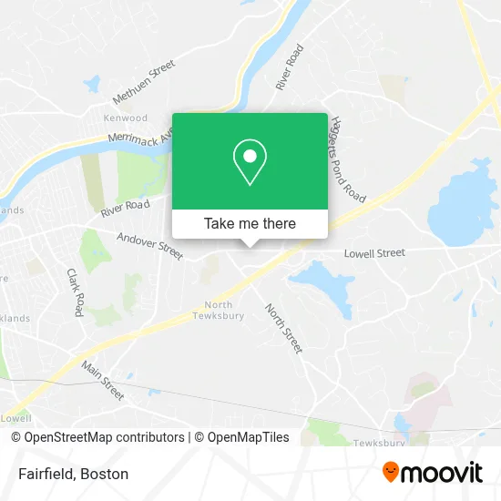
See Fairfield, Boston, on the map
Public Transit to Fairfield in Boston
Wondering how to get to Fairfield in Boston? Moovit helps you find the best way to get to Fairfield with step-by-step directions from the nearest public transit station.
Moovit provides free maps and live directions to help you navigate through your city. View schedules, routes, timetables, and find out how long does it take to get to Fairfield in real time.
Looking for the nearest stop or station to Fairfield? Check out this list of stops closest to your destination: North St & International Pl.
Bus: 12, 2, 11.
Want to see if there’s another route that gets you there at an earlier time? Moovit helps you find alternative routes or times. Get directions from and directions to Fairfield easily from the Moovit App or Website.
We make riding to Fairfield easy, which is why over 1.7 million users, including users in Boston, trust Moovit as the best app for public transit. You don’t need to download an individual bus app or train app, Moovit is your all-in-one transit app that helps you find the best bus time or train time available.
For information on prices of bus and train, costs and ride fares to Fairfield, please check the Moovit app.
Use the app to navigate to popular places including to the airport, hospital, stadium, grocery store, mall, coffee shop, school, college, and university.
Fairfield Address: 1695 Andover St street in Boston
- Grand Residences by Marriott-Boston Tewksbury,
- Done Right Auto Glass,
- ATM,
- Fast Locksmith,
- CIRCLE K,
- Holiday Inn-Tewksbury Andover,
- Thermo Fisher Scientific,
- Massav,
- Stagedge,
- Entrance I-495 N,
- Compass Group USA,
- Libertyx Bitcoin ATM,
- Fletcher Allen Health Care,
- Tewksbury Plumbing 24 7,
- Field Marshall,
- I-495,
- Morgan Home Accents,
- Water Treament Plant,
- Condeventures,
- Pricila Beauty Studio
Places Near Fairfield (Boston)
- Boston Children's Hospital, Boston,
- House Of Blues, Boston,
- Wilbur Theatre, Boston,
- Museum Of Science, Boston,
- Prudential Center, Boston,
- Wang Theater, Boston,
- Boston Convention & Exhibition Center, Boston,
- Cheers, Boston,
- Td Garden, Boston,
- Seaport District, Boston,
- Mgm Music Hall, Boston,
- Faneuil Hall, Boston,
- Quincy Market, Boston,
- Castle Island, Boston,
- Isabella Stewart Gardner Museum, Boston,
- Boston Common, Boston,
- Boston Medical Center, Boston,
- North End, Boston,
- Massachusetts General Hospital, Boston,
- Leader Bank Pavilion (Leader Bank Pavillion), Boston
How to get to popular places in Boston with public transit
Get around Boston by public transit!
Traveling around Boston has never been so easy. See step by step directions as you travel to any attraction, street or major public transit station. View bus and train schedules, arrival times, service alerts and detailed routes on a map, so you know exactly how to get to anywhere in Boston.
When traveling to any destination around Boston use Moovit's Live Directions with Get Off Notifications to know exactly where and how far to walk, how long to wait for your line, and how many stops are left. Moovit will alert you when it's time to get off — no need to constantly re-check whether yours is the next stop.
Wondering how to use public transit in Boston or how to pay for public transit in Boston? Moovit public transit app can help you navigate your way with public transit easily, and at minimum cost. It includes public transit fees, ticket prices, and costs. Looking for a map of Boston public transit lines? Moovit public transit app shows all public transit maps in Boston with all Bus, Train, Subway and Ferry routes and stops on an interactive map.
Boston has 4 transit type(s), including: Bus, Train, Subway and Ferry, operated by several transit agencies, including MBTA, Southeastern Regional Transit Authority, MetroWest Regional Transit Authority, Rhode Island Public Transit Authority, WRTA, Lowell Regional Transit Authority, Merrimack Valley Transit, Montachusett Regional Transit Authority, Cape Cod Regional Transit Authority, Brockton Area Transit Authority, Martha's Vineyard Transit Authority, the WAVE - Nantucket Regional Transit Authority, GATRA, Cape Ann Transportation Authority and Massport